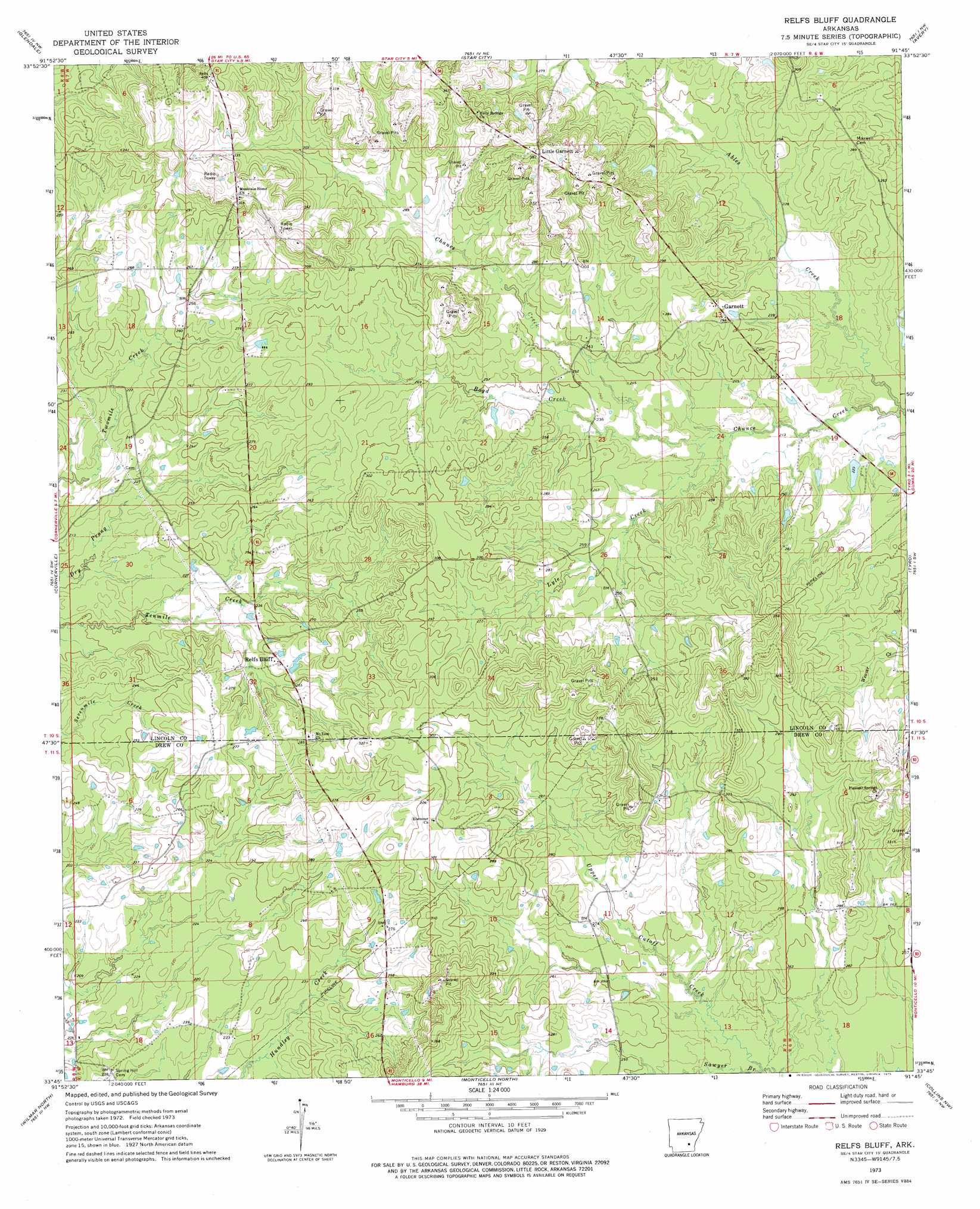
Relfs Bluff Topo Map Arkansas
To zoom in, hover over the map of Relfs Bluff
USGS Topo Quad 33091g7 - 1:24,000 scale
| Topo Map Name: | Relfs Bluff |
| USGS Topo Quad ID: | 33091g7 |
| Print Size: | ca. 21 1/4" wide x 27" high |
| Southeast Coordinates: | 33.75° N latitude / 91.75° W longitude |
| Map Center Coordinates: | 33.8125° N latitude / 91.8125° W longitude |
| U.S. State: | AR |
| Filename: | o33091g7.jpg |
| Download Map JPG Image: | Relfs Bluff topo map 1:24,000 scale |
| Map Type: | Topographic |
| Topo Series: | 7.5´ |
| Map Scale: | 1:24,000 |
| Source of Map Images: | United States Geological Survey (USGS) |
| Alternate Map Versions: |
Relfs Bluff AR 1973, updated 1975 Download PDF Buy paper map Lonoke SE AR 1975, updated 1977 Download PDF Buy paper map Relfs Bluff AR 2011 Download PDF Buy paper map Relfs Bluff AR 2014 Download PDF Buy paper map |
1:24,000 Topo Quads surrounding Relfs Bluff
Faith |
Pinebergen |
Tarry |
Grady |
Cades |
Calmer |
Glendale |
Star City |
Avery |
Gould |
Herbine |
Cornerville |
Relfs Bluff |
Tyro |
Gourd |
Warren Ne |
Wilmar North |
Monticello North |
Collins Nw |
Selma |
Warren |
Wilmar South |
Monticello South |
Cominto |
Collins |
> Back to 33091e1 at 1:100,000 scale
> Back to 33090a1 at 1:250,000 scale
> Back to U.S. Topo Maps home
Relfs Bluff topo map: Gazetteer
Relfs Bluff: Dams
McGraw Pond Dam elevation 71m 232′Relfs Bluff: Populated Places
Garnett elevation 86m 282′Little Garnett elevation 118m 387′
Relfs Bluff elevation 80m 262′
Relfs Bluff: Reservoirs
McGraw Pond elevation 71m 232′Relfs Bluff: Streams
Boyd Creek elevation 70m 229′Chance Creek elevation 64m 209′
Lyle Creek elevation 69m 226′
Sawyer Branch elevation 67m 219′
Relfs Bluff digital topo map on disk
Buy this Relfs Bluff topo map showing relief, roads, GPS coordinates and other geographical features, as a high-resolution digital map file on DVD: