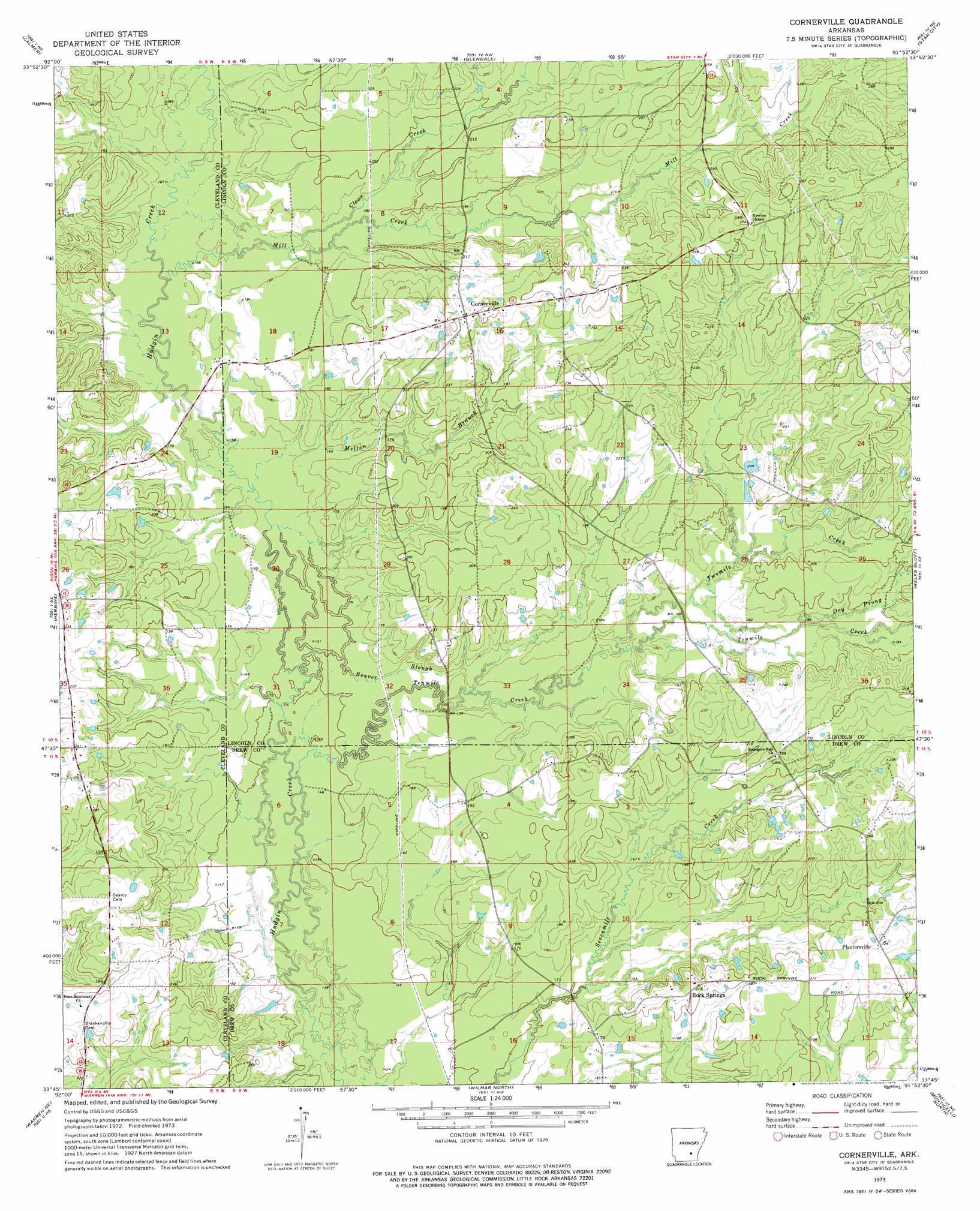
Cornerville Topo Map Arkansas
To zoom in, hover over the map of Cornerville
USGS Topo Quad 33091g8 - 1:24,000 scale
| Topo Map Name: | Cornerville |
| USGS Topo Quad ID: | 33091g8 |
| Print Size: | ca. 21 1/4" wide x 27" high |
| Southeast Coordinates: | 33.75° N latitude / 91.875° W longitude |
| Map Center Coordinates: | 33.8125° N latitude / 91.9375° W longitude |
| U.S. State: | AR |
| Filename: | o33091g8.jpg |
| Download Map JPG Image: | Cornerville topo map 1:24,000 scale |
| Map Type: | Topographic |
| Topo Series: | 7.5´ |
| Map Scale: | 1:24,000 |
| Source of Map Images: | United States Geological Survey (USGS) |
| Alternate Map Versions: |
Cornerville AR 2011 Download PDF Buy paper map Cornerville AR 2014 Download PDF Buy paper map |
1:24,000 Topo Quads surrounding Cornerville
Kedron |
Faith |
Pinebergen |
Tarry |
Grady |
Rison |
Calmer |
Glendale |
Star City |
Avery |
New Edinburg |
Herbine |
Cornerville |
Relfs Bluff |
Tyro |
Mckinney |
Warren Ne |
Wilmar North |
Monticello North |
Collins Nw |
Farmville |
Warren |
Wilmar South |
Monticello South |
Cominto |
> Back to 33091e1 at 1:100,000 scale
> Back to 33090a1 at 1:250,000 scale
> Back to U.S. Topo Maps home
Cornerville topo map: Gazetteer
Cornerville: Populated Places
Annover (historical) elevation 70m 229′Bethel elevation 58m 190′
Cornerville elevation 76m 249′
Plantersville elevation 67m 219′
Rock Springs elevation 63m 206′
Cornerville: Streams
Beaver Slough elevation 48m 157′Browning Creek elevation 54m 177′
Clear Creek elevation 54m 177′
Dry Prong elevation 59m 193′
Melton Branch elevation 50m 164′
Mill Creek elevation 51m 167′
Tenmile Creek elevation 46m 150′
Twomile Creek elevation 55m 180′
Cornerville digital topo map on disk
Buy this Cornerville topo map showing relief, roads, GPS coordinates and other geographical features, as a high-resolution digital map file on DVD: