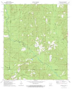
Wesson Sw Topo Map Arkansas
To zoom in, hover over the map of Wesson Sw
USGS Topo Quad 33092a8 - 1:24,000 scale
| Topo Map Name: | Wesson Sw |
| USGS Topo Quad ID: | 33092a8 |
| Print Size: | ca. 21 1/4" wide x 27" high |
| Southeast Coordinates: | 33° N latitude / 92.875° W longitude |
| Map Center Coordinates: | 33.0625° N latitude / 92.9375° W longitude |
| U.S. States: | AR, LA |
| Filename: | o33092a8.jpg |
| Download Map JPG Image: | Wesson Sw topo map 1:24,000 scale |
| Map Type: | Topographic |
| Topo Series: | 7.5´ |
| Map Scale: | 1:24,000 |
| Source of Map Images: | United States Geological Survey (USGS) |
| Alternate Map Versions: |
Wesson SW AR 1971, updated 1973 Download PDF Buy paper map Wesson SW AR 2011 Download PDF Buy paper map Wesson SW AR 2014 Download PDF Buy paper map |
1:24,000 Topo Quads surrounding Wesson Sw
> Back to 33092a1 at 1:100,000 scale
> Back to 33092a1 at 1:250,000 scale
> Back to U.S. Topo Maps home
Wesson Sw topo map: Gazetteer
Wesson Sw: Canals
Lambert Ditch elevation 56m 183′Wesson Sw: Dams
Lewis Lake Dam elevation 49m 160′Wesson Sw: Oilfields
Lick Creek Oil Field elevation 60m 196′Tubal Oil and Gas Field elevation 63m 206′
Wesson Sw: Populated Places
Carnie (historical) elevation 82m 269′Dodge City elevation 63m 206′
New Hope elevation 56m 183′
Tubal elevation 67m 219′
Wesson Sw: Reservoirs
Lewis Lake elevation 49m 160′Wesson Sw: Streams
Adams Branch elevation 42m 137′Black Branch elevation 45m 147′
Black Branch elevation 55m 180′
Blue Branch elevation 51m 167′
Bond Creek elevation 52m 170′
Caney Creek elevation 52m 170′
Clear Creek elevation 46m 150′
Dry Branch elevation 49m 160′
Garner Creek elevation 50m 164′
Jordon Branch elevation 47m 154′
Lemon Creek elevation 51m 167′
Lick Branch elevation 56m 183′
Lick Creek elevation 49m 160′
McCullough Branch elevation 52m 170′
McLendon Branch elevation 52m 170′
Moss Branch elevation 49m 160′
Pigeon Roost Creek elevation 47m 154′
Salem Branch elevation 54m 177′
Spring Branch elevation 53m 173′
West Three Creeks elevation 55m 180′
Wright Branch elevation 43m 141′
Wesson Sw digital topo map on disk
Buy this Wesson Sw topo map showing relief, roads, GPS coordinates and other geographical features, as a high-resolution digital map file on DVD:


