Vick Topo Map Arkansas
To zoom in, hover over the map of Vick
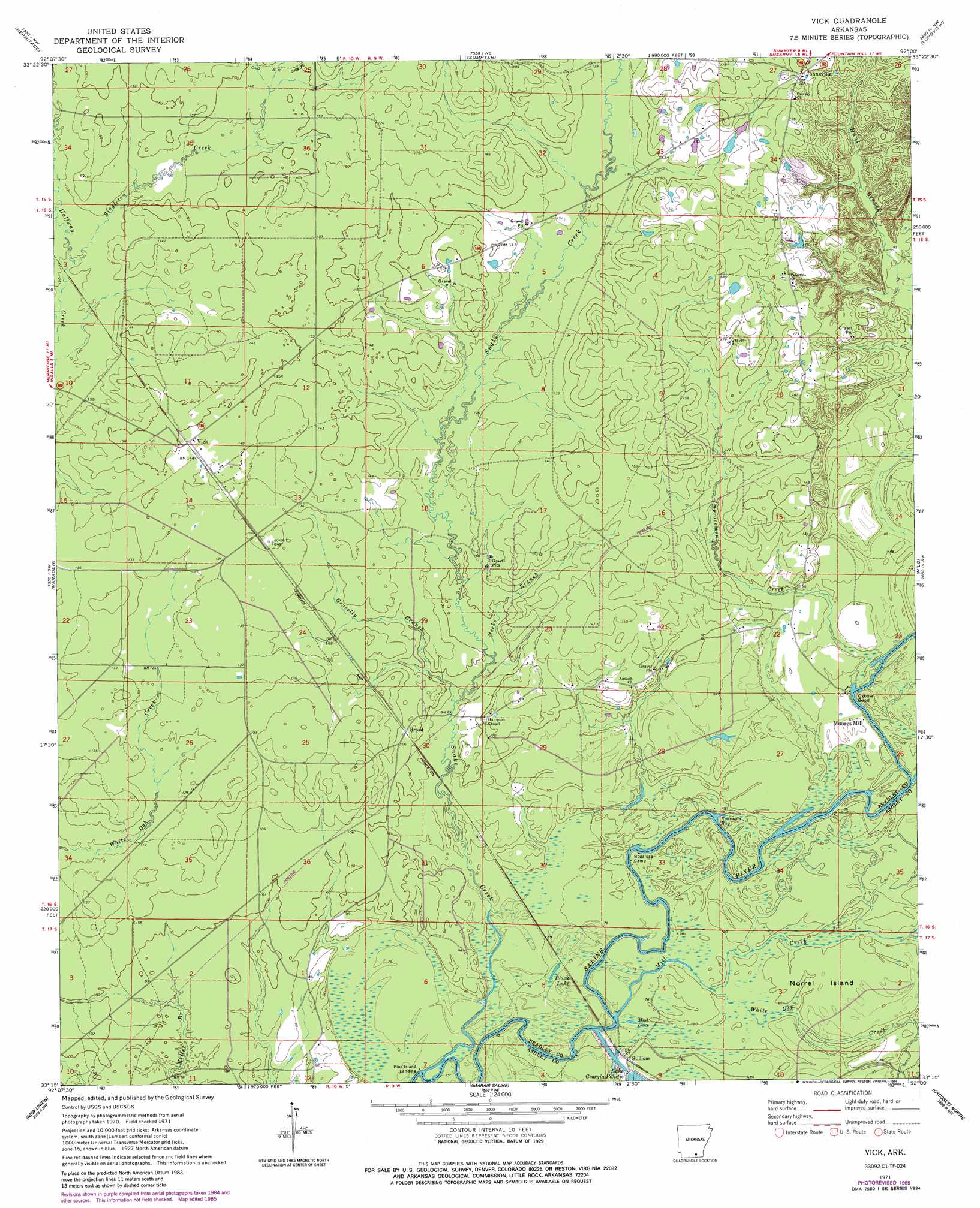
USGS Topo Quad 33092c1 - 1:24,000 scale
| Topo Map Name: | Vick |
| USGS Topo Quad ID: | 33092c1 |
| Print Size: | ca. 21 1/4" wide x 27" high |
| Southeast Coordinates: | 33.25° N latitude / 92° W longitude |
| Map Center Coordinates: | 33.3125° N latitude / 92.0625° W longitude |
| U.S. State: | AR |
| Filename: | o33092c1.jpg |
| Download Map JPG Image: | Vick topo map 1:24,000 scale |
| Map Type: | Topographic |
| Topo Series: | 7.5´ |
| Map Scale: | 1:24,000 |
| Source of Map Images: | United States Geological Survey (USGS) |
| Alternate Map Versions: |
Vick AR 1971, updated 1973 Download PDF Buy paper map Vick AR 1971, updated 1984 Download PDF Buy paper map Vick AR 1971, updated 1986 Download PDF Buy paper map Vick AR 2011 Download PDF Buy paper map Vick AR 2014 Download PDF Buy paper map |
1:24,000 Topo Quads surrounding Vick
Banks |
Farmville |
Warren |
Wilmar South |
Monticello South |
Jersey |
Hermitage |
Sumpter |
Longview |
Ladelle |
Moro Bay |
Marsden |
Vick |
Milo |
Fountain Hill |
New London |
New Union |
Marais Saline |
Crossett North |
Hamburg |
Strong |
Huttig |
Felsenthal Dam |
Crossett South |
Berlin |
> Back to 33092a1 at 1:100,000 scale
> Back to 33092a1 at 1:250,000 scale
> Back to U.S. Topo Maps home
Vick topo map: Gazetteer
Vick: Bays
Robinson Bay elevation 20m 65′Vick: Bends
Oxbow Bend elevation 25m 82′Vick: Flats
Norrel Island elevation 26m 85′Vick: Lakes
Black Lake elevation 24m 78′Lake Georgia Pacific elevation 23m 75′
Mud Lake elevation 24m 78′
Vick: Populated Places
Broad elevation 35m 114′Johnsville elevation 62m 203′
Moores Mill elevation 28m 91′
Pine Island Landing elevation 24m 78′
Stillions elevation 27m 88′
Vick elevation 45m 147′
Wilcox (historical) elevation 28m 91′
Vick: Streams
Gravelly Branch elevation 28m 91′Improvement Creek elevation 27m 88′
Meeks Branch elevation 29m 95′
Mill Creek elevation 24m 78′
Singleton Creek elevation 40m 131′
Snake Creek elevation 23m 75′
Thompson Creek elevation 26m 85′
White Oak Creek elevation 24m 78′
Vick digital topo map on disk
Buy this Vick topo map showing relief, roads, GPS coordinates and other geographical features, as a high-resolution digital map file on DVD: