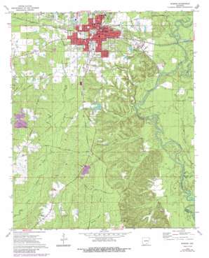
Warren Topo Map Arkansas
To zoom in, hover over the map of Warren
USGS Topo Quad 33092e1 - 1:24,000 scale
| Topo Map Name: | Warren |
| USGS Topo Quad ID: | 33092e1 |
| Print Size: | ca. 21 1/4" wide x 27" high |
| Southeast Coordinates: | 33.5° N latitude / 92° W longitude |
| Map Center Coordinates: | 33.5625° N latitude / 92.0625° W longitude |
| U.S. State: | AR |
| Filename: | o33092e1.jpg |
| Download Map JPG Image: | Warren topo map 1:24,000 scale |
| Map Type: | Topographic |
| Topo Series: | 7.5´ |
| Map Scale: | 1:24,000 |
| Source of Map Images: | United States Geological Survey (USGS) |
| Alternate Map Versions: |
Warren AR 1973, updated 1975 Download PDF Buy paper map Warren AR 1973, updated 1986 Download PDF Buy paper map Warren AR 2011 Download PDF Buy paper map Warren AR 2014 Download PDF Buy paper map |
1:24,000 Topo Quads surrounding Warren
> Back to 33092e1 at 1:100,000 scale
> Back to 33092a1 at 1:250,000 scale
> Back to U.S. Topo Maps home
Warren topo map: Gazetteer
Warren: Airports
Bradley County Memorial Hospital Heliport elevation 59m 193′Warren Municipal Airport elevation 65m 213′
Warren: Crossings
Suttons Ferry (historical) elevation 29m 95′Warren: Dams
Atkins Pond Dam elevation 49m 160′Reeps Lake Dam elevation 40m 131′
Warren Country Club Lake Dam elevation 61m 200′
Warren: Flats
River Island elevation 31m 101′Warren: Guts
Old River elevation 29m 95′Warren: Populated Places
Carmel elevation 75m 246′Cloquet (historical) elevation 73m 239′
Warren elevation 66m 216′
Warren: Reservoirs
Atkins Pond elevation 49m 160′Reeps Lake elevation 40m 131′
Warren Country Club Lake elevation 61m 200′
Warren: Streams
Berry Creek elevation 27m 88′Big Slough elevation 32m 104′
Brooks Creek elevation 35m 114′
Carmichael Creek elevation 28m 91′
Germany Creek elevation 27m 88′
Gin House Slough elevation 34m 111′
Log Slough elevation 34m 111′
Tenmile Creek elevation 27m 88′
Town Branch elevation 26m 85′
Warren digital topo map on disk
Buy this Warren topo map showing relief, roads, GPS coordinates and other geographical features, as a high-resolution digital map file on DVD:


