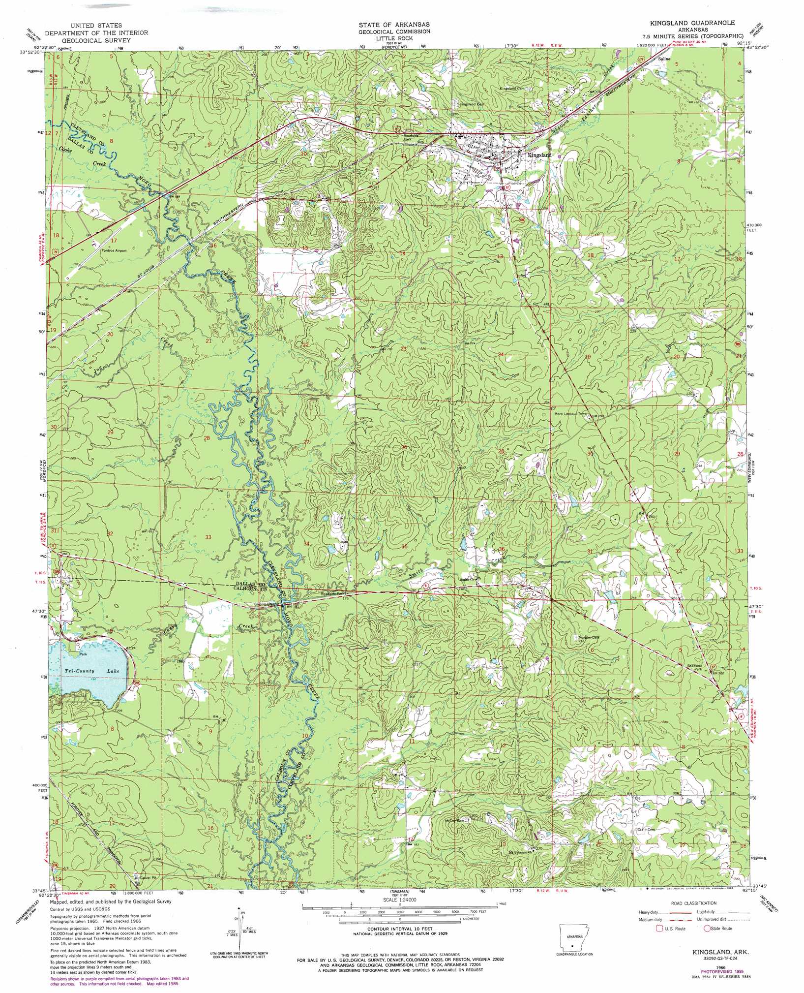
Kingsland Topo Map Arkansas
To zoom in, hover over the map of Kingsland
USGS Topo Quad 33092g3 - 1:24,000 scale
| Topo Map Name: | Kingsland |
| USGS Topo Quad ID: | 33092g3 |
| Print Size: | ca. 21 1/4" wide x 27" high |
| Southeast Coordinates: | 33.75° N latitude / 92.25° W longitude |
| Map Center Coordinates: | 33.8125° N latitude / 92.3125° W longitude |
| U.S. State: | AR |
| Filename: | o33092g3.jpg |
| Download Map JPG Image: | Kingsland topo map 1:24,000 scale |
| Map Type: | Topographic |
| Topo Series: | 7.5´ |
| Map Scale: | 1:24,000 |
| Source of Map Images: | United States Geological Survey (USGS) |
| Alternate Map Versions: |
Kingsland AR 1966, updated 1967 Download PDF Buy paper map Kingsland AR 1966, updated 1986 Download PDF Buy paper map Kingsland AR 2011 Download PDF Buy paper map Kingsland AR 2014 Download PDF Buy paper map |
1:24,000 Topo Quads surrounding Kingsland
Carthage |
Bunn |
Staves |
Kedron |
Faith |
Princeton East |
Ivan |
Fordyce Ne |
Rison |
Calmer |
Hopeville |
Fordyce |
Kingsland |
New Edinburg |
Herbine |
Bearden |
Chambersville |
Tinsman |
Mckinney |
Warren Ne |
Woodberry |
Hampton |
Banks |
Farmville |
Warren |
> Back to 33092e1 at 1:100,000 scale
> Back to 33092a1 at 1:250,000 scale
> Back to U.S. Topo Maps home
Kingsland topo map: Gazetteer
Kingsland: Airports
H L Hopkins Airport elevation 57m 187′Kingsland: Dams
Tri-County Lake Dam elevation 58m 190′Kingsland: Parks
Marks Mill Battleground elevation 80m 262′Kingsland: Populated Places
Draughon (historical) elevation 53m 173′Kingsland elevation 67m 219′
Meek (historical) elevation 58m 190′
Saline elevation 52m 170′
Tipton elevation 81m 265′
Kingsland: Reservoirs
Tri-County Lake elevation 58m 190′Kingsland: Streams
Camp Creek elevation 54m 177′Caney Creek elevation 54m 177′
Cooks Creek elevation 57m 187′
Jug Creek elevation 55m 180′
Smith Creek elevation 53m 173′
Kingsland digital topo map on disk
Buy this Kingsland topo map showing relief, roads, GPS coordinates and other geographical features, as a high-resolution digital map file on DVD: