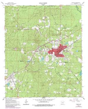
Fordyce Topo Map Arkansas
To zoom in, hover over the map of Fordyce
USGS Topo Quad 33092g4 - 1:24,000 scale
| Topo Map Name: | Fordyce |
| USGS Topo Quad ID: | 33092g4 |
| Print Size: | ca. 21 1/4" wide x 27" high |
| Southeast Coordinates: | 33.75° N latitude / 92.375° W longitude |
| Map Center Coordinates: | 33.8125° N latitude / 92.4375° W longitude |
| U.S. State: | AR |
| Filename: | o33092g4.jpg |
| Download Map JPG Image: | Fordyce topo map 1:24,000 scale |
| Map Type: | Topographic |
| Topo Series: | 7.5´ |
| Map Scale: | 1:24,000 |
| Source of Map Images: | United States Geological Survey (USGS) |
| Alternate Map Versions: |
Fordyce AR 1966, updated 1967 Download PDF Buy paper map Fordyce AR 1966, updated 1986 Download PDF Buy paper map Fordyce AR 2011 Download PDF Buy paper map Fordyce AR 2014 Download PDF Buy paper map |
1:24,000 Topo Quads surrounding Fordyce
> Back to 33092e1 at 1:100,000 scale
> Back to 33092a1 at 1:250,000 scale
> Back to U.S. Topo Maps home
Fordyce topo map: Gazetteer
Fordyce: Airports
Dallas County Hospital Heliport elevation 92m 301′Fordyce: Dams
Jacobs Lake Dam elevation 89m 291′Kervin Lake Dam Number One Dam elevation 81m 265′
Lake Cathay Dam elevation 87m 285′
Lake Lansdale Dam elevation 90m 295′
Fordyce: Parks
Charlotte Street Historic District elevation 79m 259′Fordyce: Populated Places
Beech Grove elevation 85m 278′Bucksnort elevation 93m 305′
Ebenezer elevation 78m 255′
Fordyce elevation 86m 282′
North Fordyce elevation 78m 255′
Thornton elevation 98m 321′
Fordyce: Reservoirs
Jacobs Lake elevation 89m 291′Kervin Lake Number One elevation 81m 265′
Lake Cathay elevation 87m 285′
Lake Lansdale elevation 90m 295′
Fordyce digital topo map on disk
Buy this Fordyce topo map showing relief, roads, GPS coordinates and other geographical features, as a high-resolution digital map file on DVD:


