Calmer Topo Map Arkansas
To zoom in, hover over the map of Calmer
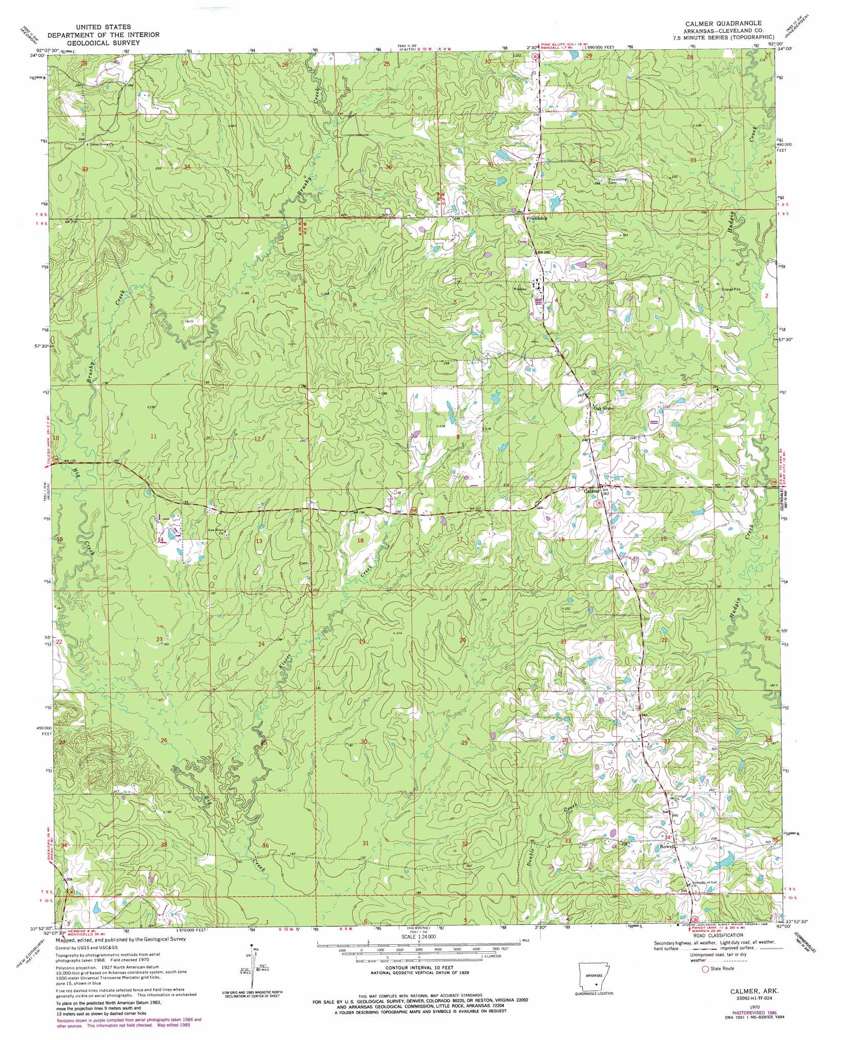
USGS Topo Quad 33092h1 - 1:24,000 scale
| Topo Map Name: | Calmer |
| USGS Topo Quad ID: | 33092h1 |
| Print Size: | ca. 21 1/4" wide x 27" high |
| Southeast Coordinates: | 33.875° N latitude / 92° W longitude |
| Map Center Coordinates: | 33.9375° N latitude / 92.0625° W longitude |
| U.S. State: | AR |
| Filename: | o33092h1.jpg |
| Download Map JPG Image: | Calmer topo map 1:24,000 scale |
| Map Type: | Topographic |
| Topo Series: | 7.5´ |
| Map Scale: | 1:24,000 |
| Source of Map Images: | United States Geological Survey (USGS) |
| Alternate Map Versions: |
Calmer AR 1970, updated 1972 Download PDF Buy paper map Calmer AR 1970, updated 1986 Download PDF Buy paper map Calmer AR 2011 Download PDF Buy paper map Calmer AR 2014 Download PDF Buy paper map |
1:24,000 Topo Quads surrounding Calmer
Grapevine |
Pine Bluff Nw |
Pine Bluff |
Ladd |
Moscow |
Staves |
Kedron |
Faith |
Pinebergen |
Tarry |
Fordyce Ne |
Rison |
Calmer |
Glendale |
Star City |
Kingsland |
New Edinburg |
Herbine |
Cornerville |
Relfs Bluff |
Tinsman |
Mckinney |
Warren Ne |
Wilmar North |
Monticello North |
> Back to 33092e1 at 1:100,000 scale
> Back to 33092a1 at 1:250,000 scale
> Back to U.S. Topo Maps home
Calmer topo map: Gazetteer
Calmer: Dams
Kesterson Lake Dam elevation 69m 226′Calmer: Populated Places
Calmer elevation 78m 255′Friendship elevation 86m 282′
Oak Grove elevation 80m 262′
Rowell elevation 74m 242′
Calmer: Reservoirs
Kesterson Lake elevation 69m 226′Calmer: Streams
Brushy Creek elevation 52m 170′Kissee Creek elevation 48m 157′
Sanders Creek elevation 58m 190′
Calmer digital topo map on disk
Buy this Calmer topo map showing relief, roads, GPS coordinates and other geographical features, as a high-resolution digital map file on DVD: