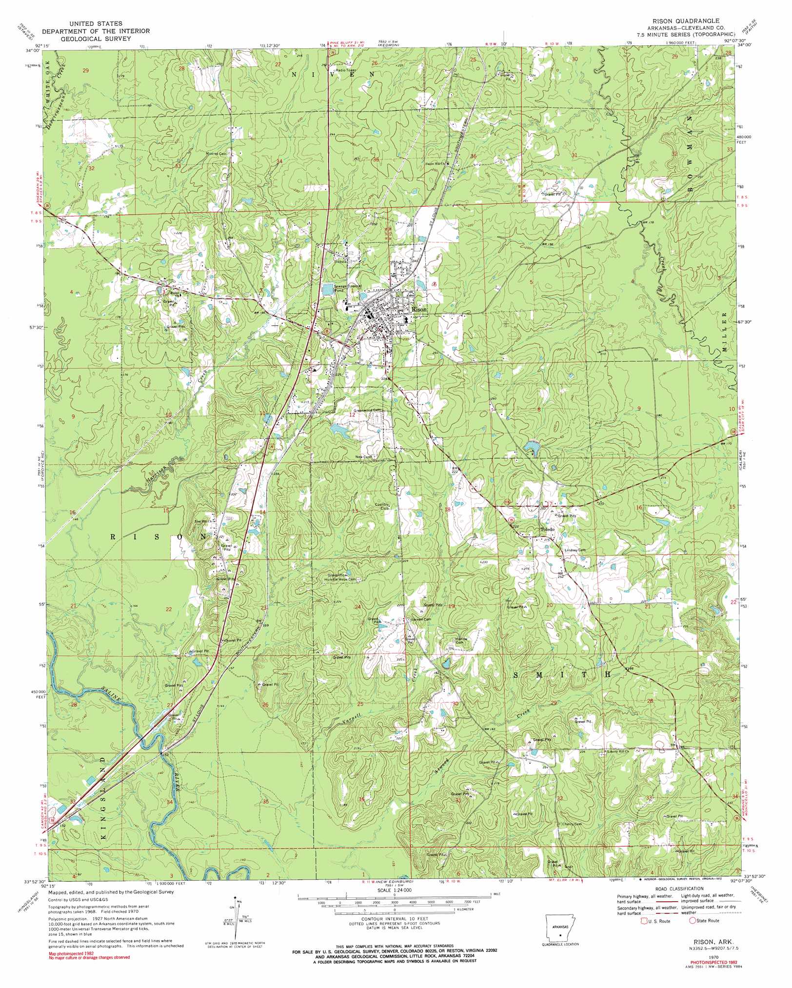
Rison Topo Map Arkansas
To zoom in, hover over the map of Rison
USGS Topo Quad 33092h2 - 1:24,000 scale
| Topo Map Name: | Rison |
| USGS Topo Quad ID: | 33092h2 |
| Print Size: | ca. 21 1/4" wide x 27" high |
| Southeast Coordinates: | 33.875° N latitude / 92.125° W longitude |
| Map Center Coordinates: | 33.9375° N latitude / 92.1875° W longitude |
| U.S. State: | AR |
| Filename: | o33092h2.jpg |
| Download Map JPG Image: | Rison topo map 1:24,000 scale |
| Map Type: | Topographic |
| Topo Series: | 7.5´ |
| Map Scale: | 1:24,000 |
| Source of Map Images: | United States Geological Survey (USGS) |
| Alternate Map Versions: |
Rison AR 1970, updated 1972 Download PDF Buy paper map Rison AR 2011 Download PDF Buy paper map Rison AR 2014 Download PDF Buy paper map |
1:24,000 Topo Quads surrounding Rison
Millerville |
Grapevine |
Pine Bluff Nw |
Pine Bluff |
Ladd |
Bunn |
Staves |
Kedron |
Faith |
Pinebergen |
Ivan |
Fordyce Ne |
Rison |
Calmer |
Glendale |
Fordyce |
Kingsland |
New Edinburg |
Herbine |
Cornerville |
Chambersville |
Tinsman |
Mckinney |
Warren Ne |
Wilmar North |
> Back to 33092e1 at 1:100,000 scale
> Back to 33092a1 at 1:250,000 scale
> Back to U.S. Topo Maps home
Rison topo map: Gazetteer
Rison: Dams
Lake Elrod Dam elevation 77m 252′Van Sadler Lake Dam elevation 66m 216′
Rison: Populated Places
Dwight (historical) elevation 52m 170′Pool (historical) elevation 42m 137′
Radway (historical) elevation 45m 147′
Rison elevation 84m 275′
Toledo elevation 84m 275′
Unionville (historical) elevation 72m 236′
Rison: Reservoirs
Lake Elrod elevation 77m 252′Van Sadler Lake elevation 66m 216′
Rison: Streams
Atwood Creek elevation 43m 141′Harrison Creek elevation 42m 137′
Panther Creek elevation 40m 131′
Rison digital topo map on disk
Buy this Rison topo map showing relief, roads, GPS coordinates and other geographical features, as a high-resolution digital map file on DVD: