Fordyce Ne Topo Map Arkansas
To zoom in, hover over the map of Fordyce Ne
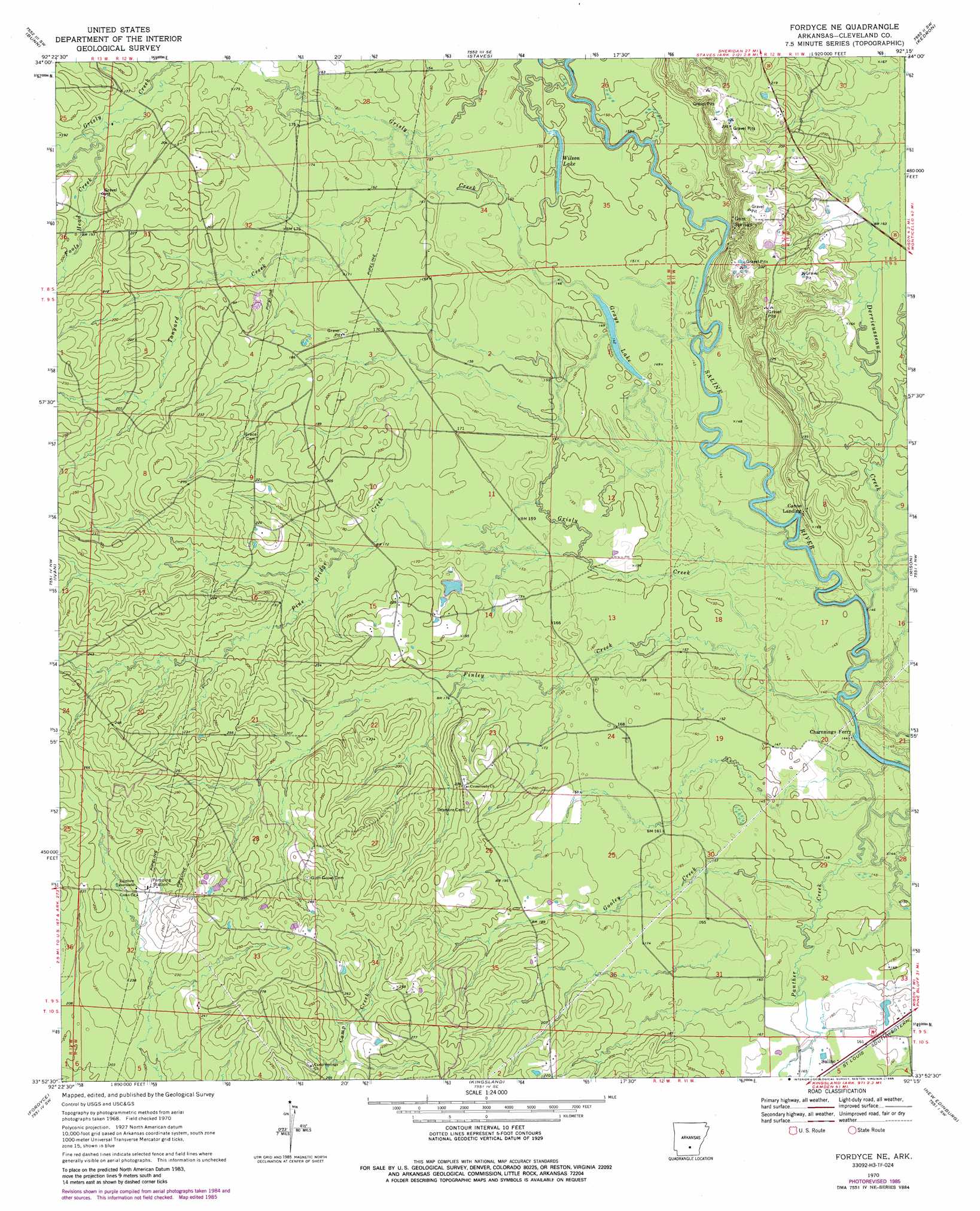
USGS Topo Quad 33092h3 - 1:24,000 scale
| Topo Map Name: | Fordyce Ne |
| USGS Topo Quad ID: | 33092h3 |
| Print Size: | ca. 21 1/4" wide x 27" high |
| Southeast Coordinates: | 33.875° N latitude / 92.25° W longitude |
| Map Center Coordinates: | 33.9375° N latitude / 92.3125° W longitude |
| U.S. State: | AR |
| Filename: | o33092h3.jpg |
| Download Map JPG Image: | Fordyce Ne topo map 1:24,000 scale |
| Map Type: | Topographic |
| Topo Series: | 7.5´ |
| Map Scale: | 1:24,000 |
| Source of Map Images: | United States Geological Survey (USGS) |
| Alternate Map Versions: |
Fordyce NE AR 1970, updated 1972 Download PDF Buy paper map Fordyce NE AR 1970, updated 1985 Download PDF Buy paper map Fordyce NE AR 2011 Download PDF Buy paper map Fordyce NE AR 2014 Download PDF Buy paper map |
1:24,000 Topo Quads surrounding Fordyce Ne
Leola |
Millerville |
Grapevine |
Pine Bluff Nw |
Pine Bluff |
Carthage |
Bunn |
Staves |
Kedron |
Faith |
Princeton East |
Ivan |
Fordyce Ne |
Rison |
Calmer |
Hopeville |
Fordyce |
Kingsland |
New Edinburg |
Herbine |
Bearden |
Chambersville |
Tinsman |
Mckinney |
Warren Ne |
> Back to 33092e1 at 1:100,000 scale
> Back to 33092a1 at 1:250,000 scale
> Back to U.S. Topo Maps home
Fordyce Ne topo map: Gazetteer
Fordyce Ne: Crossings
Charnnings Ferry elevation 44m 144′Fordyce Ne: Dams
Clements Pond Dam elevation 55m 180′Fordyce Ne: Lakes
Grays Lake elevation 46m 150′Wilson Lake elevation 45m 147′
Fordyce Ne: Populated Places
Canoe Landing elevation 54m 177′Gum Springs elevation 57m 187′
Fordyce Ne: Reservoirs
Clements Pond elevation 55m 180′Fordyce Ne: Streams
Derrieusseaux Creek elevation 43m 141′Finley Creek elevation 41m 134′
Fools Head Creek elevation 57m 187′
Gooley Creek elevation 48m 157′
Grisly Creek elevation 44m 144′
Pine Bridge Creek elevation 49m 160′
Tanyard Creek elevation 49m 160′
Fordyce Ne digital topo map on disk
Buy this Fordyce Ne topo map showing relief, roads, GPS coordinates and other geographical features, as a high-resolution digital map file on DVD: