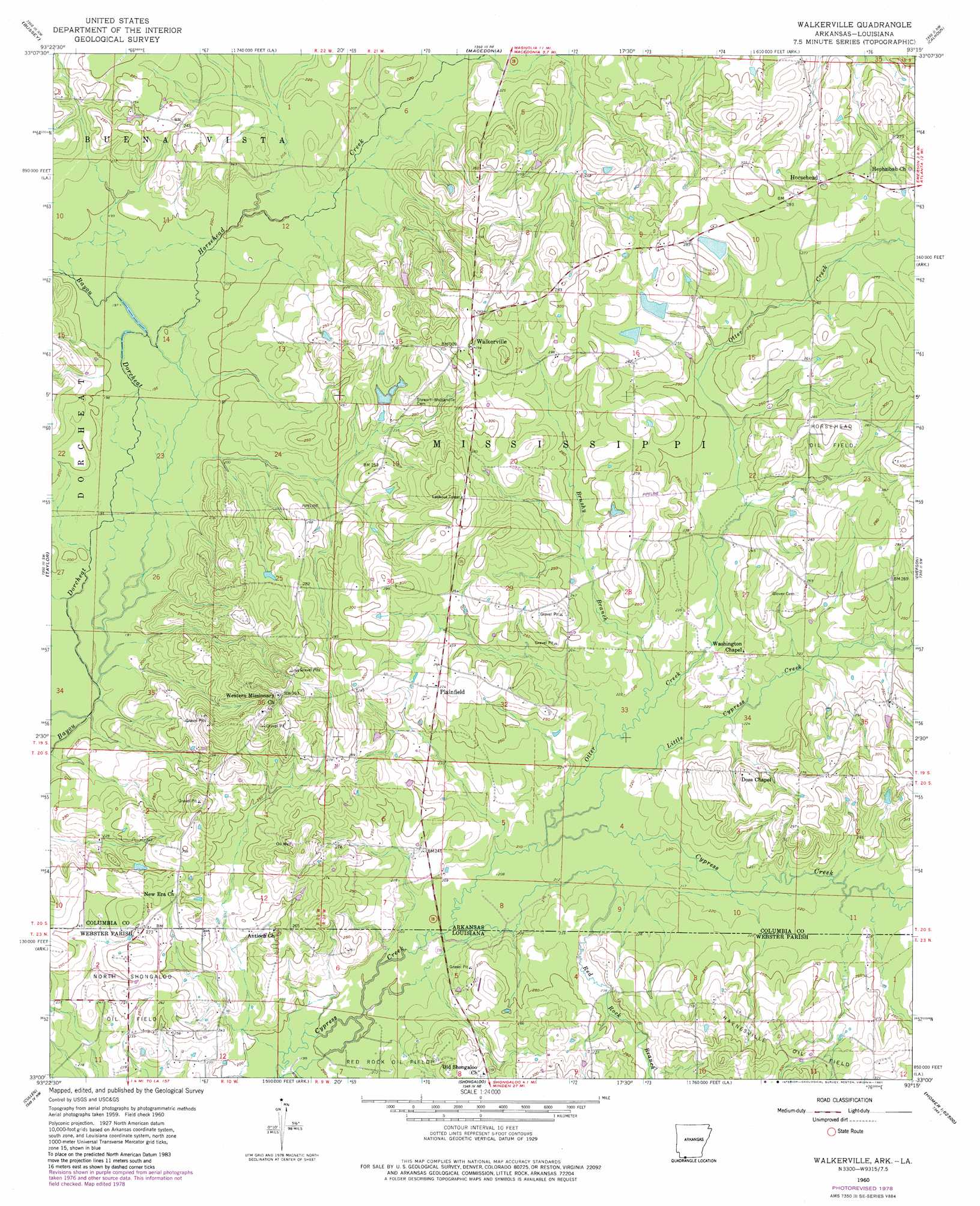
Walkerville Topo Map Arkansas
To zoom in, hover over the map of Walkerville
USGS Topo Quad 33093a3 - 1:24,000 scale
| Topo Map Name: | Walkerville |
| USGS Topo Quad ID: | 33093a3 |
| Print Size: | ca. 21 1/4" wide x 27" high |
| Southeast Coordinates: | 33° N latitude / 93.25° W longitude |
| Map Center Coordinates: | 33.0625° N latitude / 93.3125° W longitude |
| U.S. States: | AR, LA |
| Filename: | o33093a3.jpg |
| Download Map JPG Image: | Walkerville topo map 1:24,000 scale |
| Map Type: | Topographic |
| Topo Series: | 7.5´ |
| Map Scale: | 1:24,000 |
| Source of Map Images: | United States Geological Survey (USGS) |
| Alternate Map Versions: |
Walkerville AR 1960, updated 1961 Download PDF Buy paper map Walkerville AR 1960, updated 1978 Download PDF Buy paper map Walkerville AR 1960, updated 1981 Download PDF Buy paper map Walkerville AR 2011 Download PDF Buy paper map Walkerville AR 2014 Download PDF Buy paper map |
1:24,000 Topo Quads surrounding Walkerville
Lewisville |
Buckner |
Waldo |
Magnolia |
Village |
Bradley Ne |
Bussey |
Macedonia |
Calhoun |
Spotville |
Bradley Se |
Taylor |
Walkerville |
Emerson |
Emerson Se |
Carterville |
Cullen |
Shongaloo |
Haynesville West |
Haynesville East |
Ivan |
Cotton Valley |
Leton |
Blackburn |
Homer |
> Back to 33093a1 at 1:100,000 scale
> Back to 33092a1 at 1:250,000 scale
> Back to U.S. Topo Maps home
Walkerville topo map: Gazetteer
Walkerville: Crossings
Courtneys Ford elevation 56m 183′Lecroys Ford elevation 59m 193′
Walkerville: Dams
Byrd Lake Dam elevation 83m 272′Maloch Lake Dam elevation 87m 285′
Walkerville: Oilfields
North Shongaloo Oil and Gas Field elevation 74m 242′Walkerville: Populated Places
Horsehead elevation 91m 298′Plainfield elevation 83m 272′
Walkerville elevation 91m 298′
Western elevation 107m 351′
Walkerville: Reservoirs
Byrd Lake elevation 83m 272′Maloch Lake elevation 87m 285′
Walkerville: Streams
Brushy Branch elevation 66m 216′Horsehead Creek elevation 59m 193′
Leonard Branch elevation 60m 196′
Little Cypress Creek elevation 64m 209′
Otter Creek elevation 63m 206′
Red Rock Branch elevation 62m 203′
Taylor Branch elevation 61m 200′
White Oak Creek elevation 65m 213′
Walkerville digital topo map on disk
Buy this Walkerville topo map showing relief, roads, GPS coordinates and other geographical features, as a high-resolution digital map file on DVD: