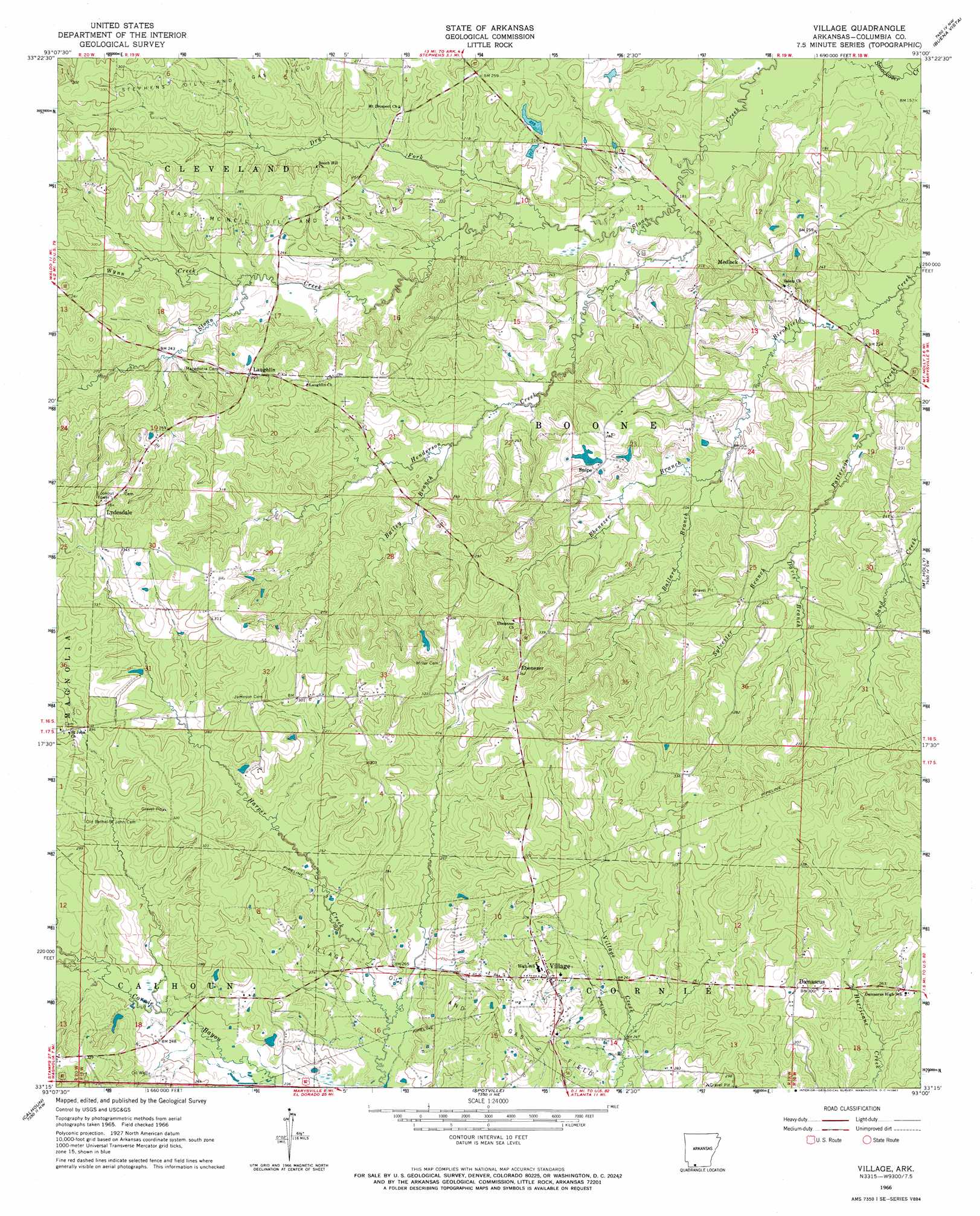
Village Topo Map Arkansas
To zoom in, hover over the map of Village
USGS Topo Quad 33093c1 - 1:24,000 scale
| Topo Map Name: | Village |
| USGS Topo Quad ID: | 33093c1 |
| Print Size: | ca. 21 1/4" wide x 27" high |
| Southeast Coordinates: | 33.25° N latitude / 93° W longitude |
| Map Center Coordinates: | 33.3125° N latitude / 93.0625° W longitude |
| U.S. State: | AR |
| Filename: | o33093c1.jpg |
| Download Map JPG Image: | Village topo map 1:24,000 scale |
| Map Type: | Topographic |
| Topo Series: | 7.5´ |
| Map Scale: | 1:24,000 |
| Source of Map Images: | United States Geological Survey (USGS) |
| Alternate Map Versions: |
Village AR 1966, updated 1967 Download PDF Buy paper map Village AR 2011 Download PDF Buy paper map Village AR 2014 Download PDF Buy paper map |
1:24,000 Topo Quads surrounding Village
Willisville |
Waterloo |
Troy |
Camden Sw |
Camden |
Lamartine |
Magnolia Nw |
Stephens |
Buena Vista |
Louann |
Waldo |
Magnolia |
Village |
Mount Holly |
Lisbon |
Macedonia |
Calhoun |
Spotville |
Marysville |
Newell |
Walkerville |
Emerson |
Emerson Se |
Wesson Sw |
Wesson |
> Back to 33093a1 at 1:100,000 scale
> Back to 33092a1 at 1:250,000 scale
> Back to U.S. Topo Maps home
Village topo map: Gazetteer
Village: Dams
Foster Dam elevation 72m 236′Wilson Lake Dam elevation 77m 252′
Village: Oilfields
East McNeil Oil and Gas Field elevation 80m 262′Village Oil and Gas Field elevation 86m 282′
Warnock Springs Oil and Gas Field elevation 91m 298′
Village: Populated Places
Damascus elevation 91m 298′Ebenezer elevation 104m 341′
Laughlin elevation 91m 298′
Lydesdale elevation 110m 360′
Medlock elevation 80m 262′
Snipe elevation 74m 242′
Village elevation 92m 301′
Village: Post Offices
Village Post Office elevation 96m 314′Village: Reservoirs
Foster Lake elevation 72m 236′Wilson Lake elevation 77m 252′
Village: Streams
Bailey Branch elevation 67m 219′Ballard Branch elevation 62m 203′
Davis Branch elevation 67m 219′
Dry Fork elevation 56m 183′
Ebenezer Branch elevation 62m 203′
Henderson Creek elevation 55m 180′
Patterson Creek elevation 57m 187′
Sylvester Branch elevation 67m 219′
Wynn Creek elevation 69m 226′
Village digital topo map on disk
Buy this Village topo map showing relief, roads, GPS coordinates and other geographical features, as a high-resolution digital map file on DVD: