Fouke Se Topo Map Arkansas
To zoom in, hover over the map of Fouke Se
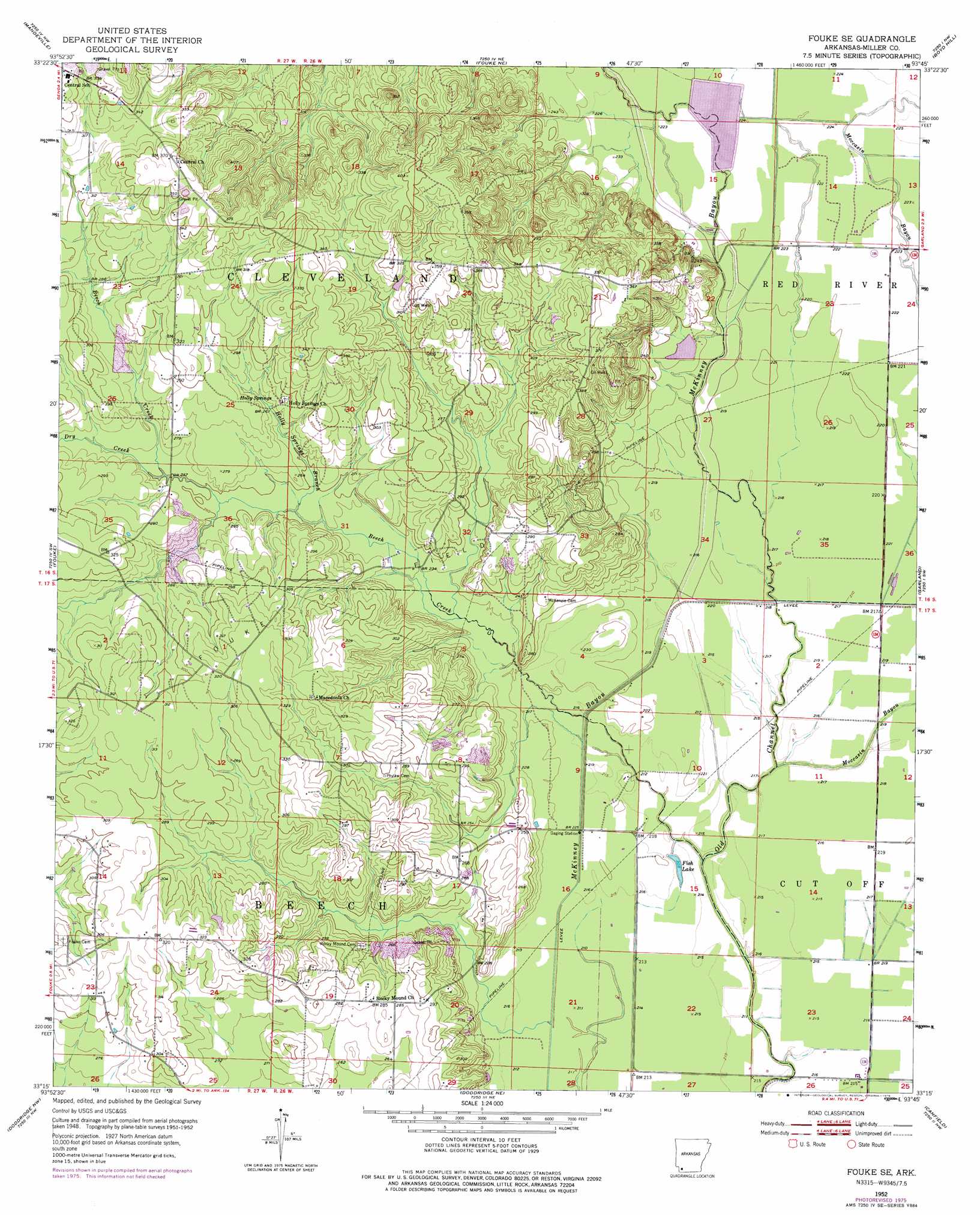
USGS Topo Quad 33093c7 - 1:24,000 scale
| Topo Map Name: | Fouke Se |
| USGS Topo Quad ID: | 33093c7 |
| Print Size: | ca. 21 1/4" wide x 27" high |
| Southeast Coordinates: | 33.25° N latitude / 93.75° W longitude |
| Map Center Coordinates: | 33.3125° N latitude / 93.8125° W longitude |
| U.S. State: | AR |
| Filename: | o33093c7.jpg |
| Download Map JPG Image: | Fouke Se topo map 1:24,000 scale |
| Map Type: | Topographic |
| Topo Series: | 7.5´ |
| Map Scale: | 1:24,000 |
| Source of Map Images: | United States Geological Survey (USGS) |
| Alternate Map Versions: |
Fouke SE AR 1952, updated 1953 Download PDF Buy paper map Fouke SE AR 1952, updated 1957 Download PDF Buy paper map Fouke SE AR 1952, updated 1976 Download PDF Buy paper map Fouke SE AR 2011 Download PDF Buy paper map Fouke SE AR 2014 Download PDF Buy paper map |
1:24,000 Topo Quads surrounding Fouke Se
Ogden |
Homan |
Fulton |
Spring Hill |
Patmos |
Texarkana |
Mandeville |
Fouke Ne |
Boyd Hill |
Old Town |
Domino |
Fouke |
Fouke Se |
Garland |
Lewisville |
Bloomburg |
Doddridge Nw |
Doddridge Ne |
Canfield |
Bradley Ne |
Ravanna |
Doddridge |
Doddridge Se |
Bradley |
Bradley Se |
> Back to 33093a1 at 1:100,000 scale
> Back to 33092a1 at 1:250,000 scale
> Back to U.S. Topo Maps home
Fouke Se topo map: Gazetteer
Fouke Se: Dams
Hensley Lake Dam elevation 72m 236′Fouke Se: Lakes
Fish Lake elevation 63m 206′Fouke Se: Oilfields
Fouke Oil Field elevation 87m 285′Fouke Se: Populated Places
Rocky Mound elevation 88m 288′Fouke Se: Reservoirs
Hensley Lake elevation 72m 236′Fouke Se: Springs
Holly Springs elevation 87m 285′Fouke Se: Streams
Beech Creek elevation 64m 209′Dry Creek elevation 78m 255′
Holly Springs Branch elevation 76m 249′
Moccasin Bayou elevation 65m 213′
Fouke Se digital topo map on disk
Buy this Fouke Se topo map showing relief, roads, GPS coordinates and other geographical features, as a high-resolution digital map file on DVD: