Stephens Topo Map Arkansas
To zoom in, hover over the map of Stephens
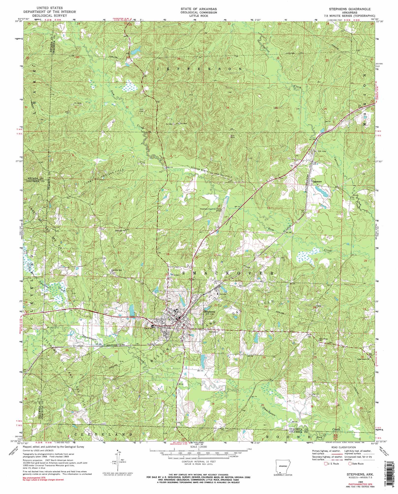
USGS Topo Quad 33093d1 - 1:24,000 scale
| Topo Map Name: | Stephens |
| USGS Topo Quad ID: | 33093d1 |
| Print Size: | ca. 21 1/4" wide x 27" high |
| Southeast Coordinates: | 33.375° N latitude / 93° W longitude |
| Map Center Coordinates: | 33.4375° N latitude / 93.0625° W longitude |
| U.S. State: | AR |
| Filename: | o33093d1.jpg |
| Download Map JPG Image: | Stephens topo map 1:24,000 scale |
| Map Type: | Topographic |
| Topo Series: | 7.5´ |
| Map Scale: | 1:24,000 |
| Source of Map Images: | United States Geological Survey (USGS) |
| Alternate Map Versions: |
Stephens AR 1969, updated 1971 Download PDF Buy paper map Stephens AR 1969, updated 1990 Download PDF Buy paper map Stephens AR 1969, updated 1990 Download PDF Buy paper map Stephens AR 2011 Download PDF Buy paper map Stephens AR 2014 Download PDF Buy paper map |
1:24,000 Topo Quads surrounding Stephens
Laneburg |
Bluff City |
Chidester |
Bragg City |
Harmony Grove |
Willisville |
Waterloo |
Troy |
Camden Sw |
Camden |
Lamartine |
Magnolia Nw |
Stephens |
Buena Vista |
Louann |
Waldo |
Magnolia |
Village |
Mount Holly |
Lisbon |
Macedonia |
Calhoun |
Spotville |
Marysville |
Newell |
> Back to 33093a1 at 1:100,000 scale
> Back to 33092a1 at 1:250,000 scale
> Back to U.S. Topo Maps home
Stephens topo map: Gazetteer
Stephens: Airports
Stephens-Ouachita County Airport elevation 63m 206′Wilson Airport elevation 70m 229′
Stephens: Dams
Brigham Lake Dam elevation 81m 265′Davis Lake Dam elevation 68m 223′
Graysons Dam elevation 74m 242′
Hassics Dam elevation 70m 229′
Stephens: Oilfields
Curry Oil and Gas Field elevation 83m 272′Smart Oil and Gas Field elevation 73m 239′
Stephens Oil and Gas Field elevation 89m 291′
Wesson North Oil and Gas Field elevation 62m 203′
Wesson Oil and Gas Field elevation 63m 206′
Stephens: Populated Places
Ogemaw elevation 64m 209′Stephens elevation 76m 249′
Stephens: Reservoirs
Brigham Lake elevation 81m 265′Davis Lake elevation 68m 223′
Graysons Lake elevation 74m 242′
Hassics Lake elevation 70m 229′
Stephens: Streams
Little Smackover Creek elevation 59m 193′Sloan Creek elevation 49m 160′
Stephens digital topo map on disk
Buy this Stephens topo map showing relief, roads, GPS coordinates and other geographical features, as a high-resolution digital map file on DVD: