Magnolia Nw Topo Map Arkansas
To zoom in, hover over the map of Magnolia Nw
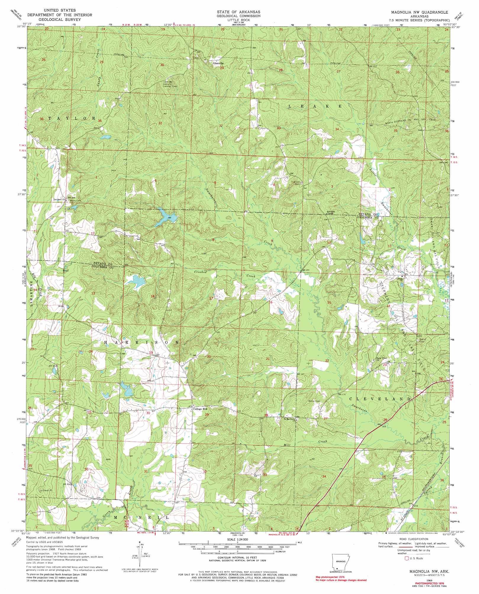
USGS Topo Quad 33093d2 - 1:24,000 scale
| Topo Map Name: | Magnolia Nw |
| USGS Topo Quad ID: | 33093d2 |
| Print Size: | ca. 21 1/4" wide x 27" high |
| Southeast Coordinates: | 33.375° N latitude / 93.125° W longitude |
| Map Center Coordinates: | 33.4375° N latitude / 93.1875° W longitude |
| U.S. State: | AR |
| Filename: | o33093d2.jpg |
| Download Map JPG Image: | Magnolia Nw topo map 1:24,000 scale |
| Map Type: | Topographic |
| Topo Series: | 7.5´ |
| Map Scale: | 1:24,000 |
| Source of Map Images: | United States Geological Survey (USGS) |
| Alternate Map Versions: |
Magnolia NW AR 1969, updated 1971 Download PDF Buy paper map Magnolia NW AR 1969, updated 1980 Download PDF Buy paper map Magnolia NW AR 2011 Download PDF Buy paper map Magnolia NW AR 2014 Download PDF Buy paper map |
1:24,000 Topo Quads surrounding Magnolia Nw
Emmet |
Laneburg |
Bluff City |
Chidester |
Bragg City |
Bodcaw |
Willisville |
Waterloo |
Troy |
Camden Sw |
Falcon |
Lamartine |
Magnolia Nw |
Stephens |
Buena Vista |
Buckner |
Waldo |
Magnolia |
Village |
Mount Holly |
Bussey |
Macedonia |
Calhoun |
Spotville |
Marysville |
> Back to 33093a1 at 1:100,000 scale
> Back to 33092a1 at 1:250,000 scale
> Back to U.S. Topo Maps home
Magnolia Nw topo map: Gazetteer
Magnolia Nw: Dams
Arkansas Noname 62 Dam elevation 89m 291′Fincher Lake Dam elevation 86m 282′
Lake Bradshaw Dam elevation 107m 351′
Magnolia Nw: Oilfields
College Hill Oil and Gas Field elevation 125m 410′North Stephens Oil and Gas Field elevation 103m 337′
Magnolia Nw: Populated Places
College Hill elevation 114m 374′Davidson elevation 120m 393′
Glenville elevation 116m 380′
Milner (historical) elevation 68m 223′
Saint Matthews elevation 94m 308′
Magnolia Nw: Reservoirs
Dupriest Lake elevation 89m 291′Fincher Lake elevation 86m 282′
Lake Bradshaw elevation 107m 351′
Magnolia Nw: Streams
Blake Creek elevation 81m 265′Crooked Creek elevation 69m 226′
Mill Creek elevation 62m 203′
Pretty Branch elevation 65m 213′
Spring Branch elevation 62m 203′
Magnolia Nw digital topo map on disk
Buy this Magnolia Nw topo map showing relief, roads, GPS coordinates and other geographical features, as a high-resolution digital map file on DVD: