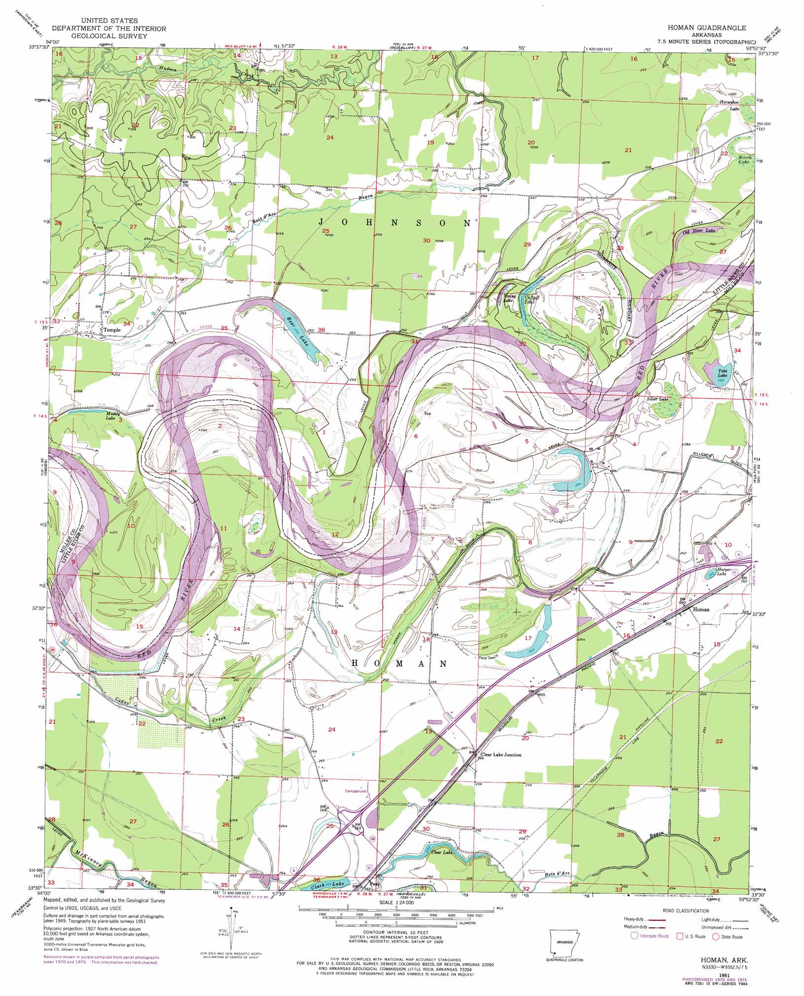
Homan Topo Map Arkansas
To zoom in, hover over the map of Homan
USGS Topo Quad 33093e8 - 1:24,000 scale
| Topo Map Name: | Homan |
| USGS Topo Quad ID: | 33093e8 |
| Print Size: | ca. 21 1/4" wide x 27" high |
| Southeast Coordinates: | 33.5° N latitude / 93.875° W longitude |
| Map Center Coordinates: | 33.5625° N latitude / 93.9375° W longitude |
| U.S. State: | AR |
| Filename: | o33093e8.jpg |
| Download Map JPG Image: | Homan topo map 1:24,000 scale |
| Map Type: | Topographic |
| Topo Series: | 7.5´ |
| Map Scale: | 1:24,000 |
| Source of Map Images: | United States Geological Survey (USGS) |
| Alternate Map Versions: |
Homan AR 1951, updated 1952 Download PDF Buy paper map Homan AR 1951, updated 1968 Download PDF Buy paper map Homan AR 1951, updated 1972 Download PDF Buy paper map Homan AR 1951, updated 1975 Download PDF Buy paper map Homan AR 1951, updated 1976 Download PDF Buy paper map Homan AR 2011 Download PDF Buy paper map Homan AR 2014 Download PDF Buy paper map |
1:24,000 Topo Quads surrounding Homan
Falls Chapel |
Ben Lomond |
Mineral Springs South |
Columbus |
Washington |
Ashdown West |
Ashdown East |
Red Bluff |
Mcnab |
Sheppard |
Barkman |
Ogden |
Homan |
Fulton |
Spring Hill |
Leary |
Texarkana |
Mandeville |
Fouke Ne |
Boyd Hill |
Wright Patman Dam |
Domino |
Fouke |
Fouke Se |
Garland |
> Back to 33093e1 at 1:100,000 scale
> Back to 33092a1 at 1:250,000 scale
> Back to U.S. Topo Maps home
Homan topo map: Gazetteer
Homan: Canals
Gillespie Ditch elevation 79m 259′Homan Ditch elevation 78m 255′
Homan: Crossings
Interchange 7 elevation 88m 288′Homan: Lakes
Bear Lake elevation 77m 252′Clark Lake elevation 79m 259′
Clear Lake elevation 78m 255′
Cut-off Lake elevation 76m 249′
Harper Lake elevation 80m 262′
Muddy Lake elevation 83m 272′
Old River Lake elevation 76m 249′
Tobe Lake elevation 76m 249′
Young Lake elevation 77m 252′
Homan: Populated Places
Clear Lake Junction elevation 79m 259′Homan elevation 82m 269′
Paup elevation 80m 262′
Temple elevation 83m 272′
Homan: Streams
Cedar Creek elevation 79m 259′Homan: Swamps
Brush Lake elevation 78m 255′Horseshoe Lake elevation 80m 262′
Silver Lake elevation 76m 249′
Homan digital topo map on disk
Buy this Homan topo map showing relief, roads, GPS coordinates and other geographical features, as a high-resolution digital map file on DVD: