Bluff City Topo Map Arkansas
To zoom in, hover over the map of Bluff City
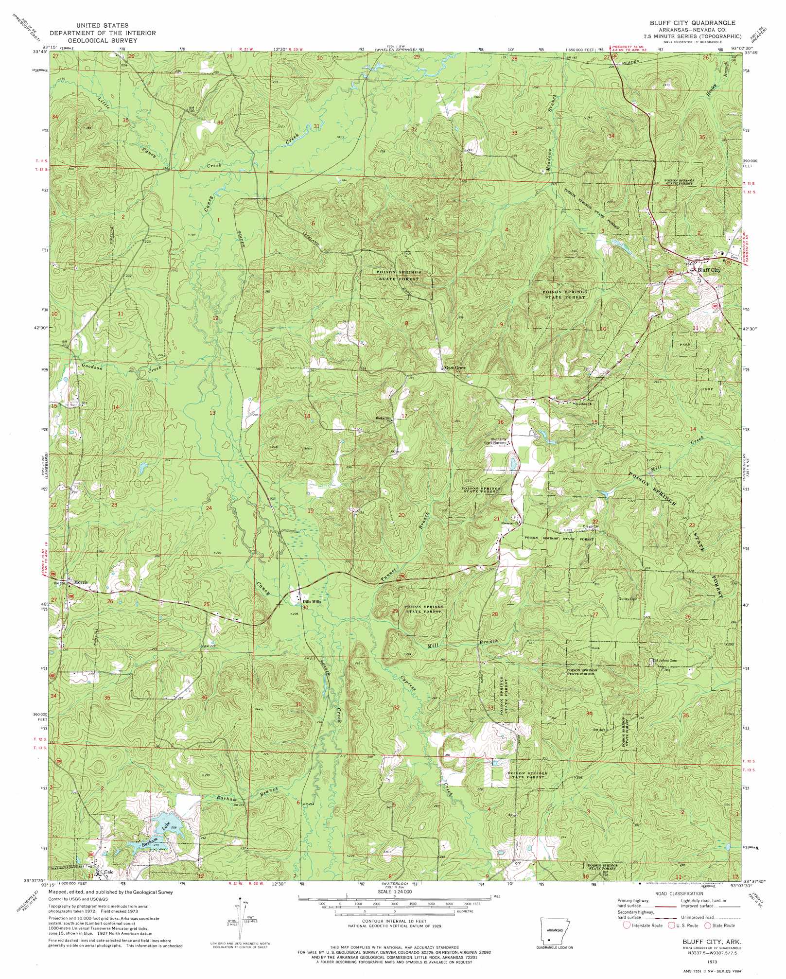
USGS Topo Quad 33093f2 - 1:24,000 scale
| Topo Map Name: | Bluff City |
| USGS Topo Quad ID: | 33093f2 |
| Print Size: | ca. 21 1/4" wide x 27" high |
| Southeast Coordinates: | 33.625° N latitude / 93.125° W longitude |
| Map Center Coordinates: | 33.6875° N latitude / 93.1875° W longitude |
| U.S. State: | AR |
| Filename: | o33093f2.jpg |
| Download Map JPG Image: | Bluff City topo map 1:24,000 scale |
| Map Type: | Topographic |
| Topo Series: | 7.5´ |
| Map Scale: | 1:24,000 |
| Source of Map Images: | United States Geological Survey (USGS) |
| Alternate Map Versions: |
Bluff City AR 1973, updated 1975 Download PDF Buy paper map Bluff City AR 2011 Download PDF Buy paper map Bluff City AR 2014 Download PDF Buy paper map |
1:24,000 Topo Quads surrounding Bluff City
Piney Grove |
Okolona South |
Gurdon |
Curtis |
Sparkman Nw |
Prescott West |
Prescott East |
Whelen Springs |
Reader |
Tates Bluff |
Emmet |
Laneburg |
Bluff City |
Chidester |
Bragg City |
Bodcaw |
Willisville |
Waterloo |
Troy |
Camden Sw |
Falcon |
Lamartine |
Magnolia Nw |
Stephens |
Buena Vista |
> Back to 33093e1 at 1:100,000 scale
> Back to 33092a1 at 1:250,000 scale
> Back to U.S. Topo Maps home
Bluff City topo map: Gazetteer
Bluff City: Dams
Arkansas Noname 68 Dam elevation 107m 351′Barham Lake Number One Dam elevation 84m 275′
Barham Lake Number Two Dam elevation 75m 246′
Bluff City: Populated Places
Bluff City elevation 111m 364′Cale elevation 104m 341′
Dills Mills elevation 66m 216′
Foss (historical) elevation 77m 252′
Gum Grove elevation 115m 377′
Lackland (historical) elevation 78m 255′
Morris elevation 81m 265′
Zama (historical) elevation 109m 357′
Bluff City: Reservoirs
Arkansas Noname 68 Reservoir elevation 107m 351′Barham Lake Number 1 elevation 84m 275′
Barham Lake Number Two elevation 75m 246′
Bluff City: Streams
Barham Branch elevation 66m 216′Cypress Creek elevation 66m 216′
Goodson Creek elevation 60m 196′
Little Caney Creek elevation 57m 187′
Mill Branch elevation 66m 216′
Tunnel Branch elevation 64m 209′
Bluff City digital topo map on disk
Buy this Bluff City topo map showing relief, roads, GPS coordinates and other geographical features, as a high-resolution digital map file on DVD: