Laneburg Topo Map Arkansas
To zoom in, hover over the map of Laneburg
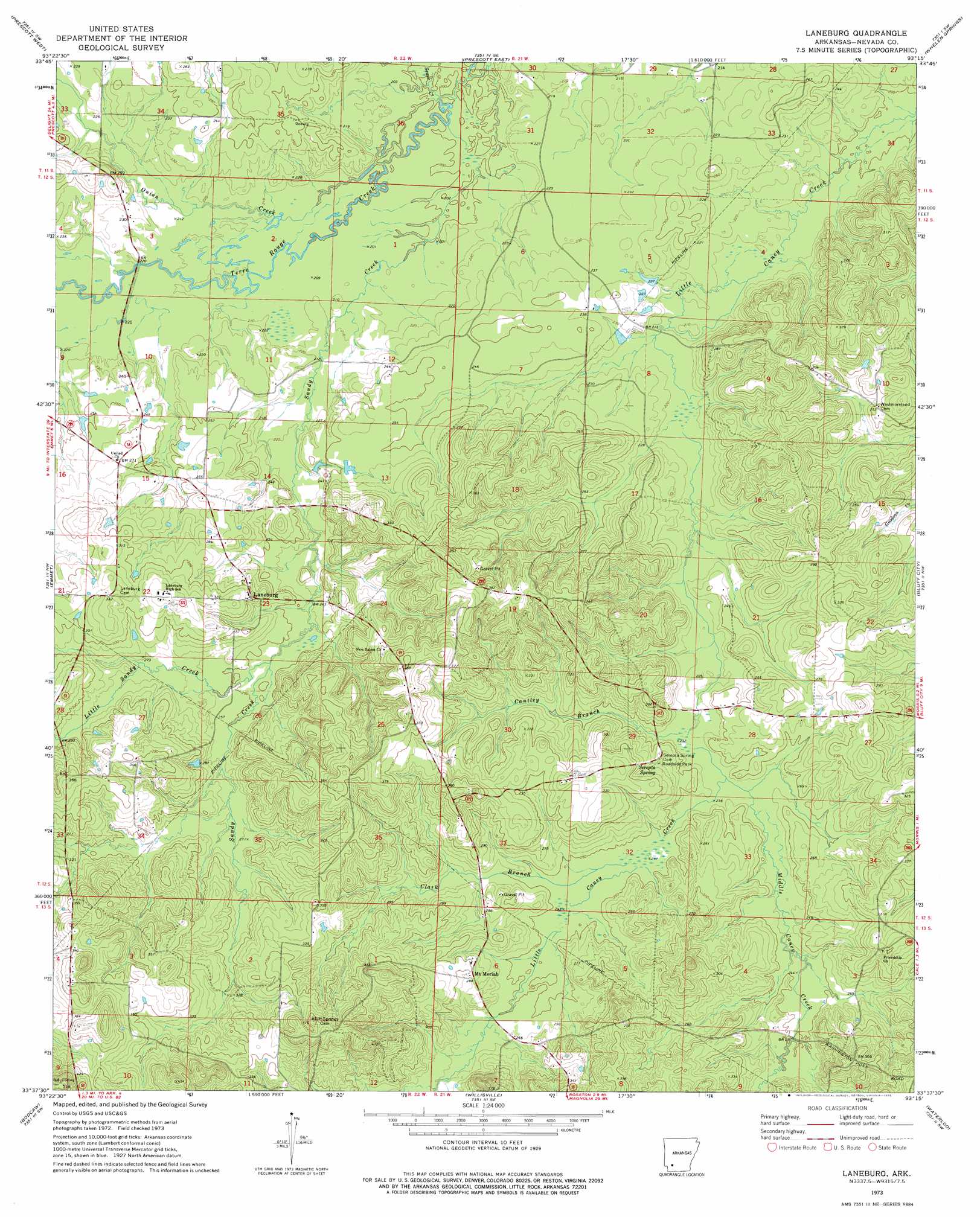
USGS Topo Quad 33093f3 - 1:24,000 scale
| Topo Map Name: | Laneburg |
| USGS Topo Quad ID: | 33093f3 |
| Print Size: | ca. 21 1/4" wide x 27" high |
| Southeast Coordinates: | 33.625° N latitude / 93.25° W longitude |
| Map Center Coordinates: | 33.6875° N latitude / 93.3125° W longitude |
| U.S. State: | AR |
| Filename: | o33093f3.jpg |
| Download Map JPG Image: | Laneburg topo map 1:24,000 scale |
| Map Type: | Topographic |
| Topo Series: | 7.5´ |
| Map Scale: | 1:24,000 |
| Source of Map Images: | United States Geological Survey (USGS) |
| Alternate Map Versions: |
Laneburg AR 1973, updated 1975 Download PDF Buy paper map Laneburg AR 2011 Download PDF Buy paper map Laneburg AR 2014 Download PDF Buy paper map |
1:24,000 Topo Quads surrounding Laneburg
Pisgah |
Piney Grove |
Okolona South |
Gurdon |
Curtis |
Blevins |
Prescott West |
Prescott East |
Whelen Springs |
Reader |
Hope |
Emmet |
Laneburg |
Bluff City |
Chidester |
Patmos |
Bodcaw |
Willisville |
Waterloo |
Troy |
Old Town |
Falcon |
Lamartine |
Magnolia Nw |
Stephens |
> Back to 33093e1 at 1:100,000 scale
> Back to 33092a1 at 1:250,000 scale
> Back to U.S. Topo Maps home
Laneburg topo map: Gazetteer
Laneburg: Populated Places
Laneburg elevation 94m 308′Mount Moriah elevation 90m 295′
New Mount Moriah (historical) elevation 89m 291′
Serepta Springs (historical) elevation 80m 262′
Laneburg: Springs
Serepta Spring elevation 87m 285′Laneburg: Streams
Cantley Branch elevation 73m 239′Clark Branch elevation 77m 252′
Little Sandy Creek elevation 77m 252′
Middle Caney Creek elevation 73m 239′
Onion Creek elevation 62m 203′
Sandy Creek elevation 62m 203′
Sewer Creek elevation 63m 206′
Laneburg digital topo map on disk
Buy this Laneburg topo map showing relief, roads, GPS coordinates and other geographical features, as a high-resolution digital map file on DVD: