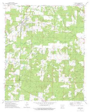
Emmet Topo Map Arkansas
To zoom in, hover over the map of Emmet
USGS Topo Quad 33093f4 - 1:24,000 scale
| Topo Map Name: | Emmet |
| USGS Topo Quad ID: | 33093f4 |
| Print Size: | ca. 21 1/4" wide x 27" high |
| Southeast Coordinates: | 33.625° N latitude / 93.375° W longitude |
| Map Center Coordinates: | 33.6875° N latitude / 93.4375° W longitude |
| U.S. State: | AR |
| Filename: | o33093f4.jpg |
| Download Map JPG Image: | Emmet topo map 1:24,000 scale |
| Map Type: | Topographic |
| Topo Series: | 7.5´ |
| Map Scale: | 1:24,000 |
| Source of Map Images: | United States Geological Survey (USGS) |
| Alternate Map Versions: |
Emmet AR 1973, updated 1975 Download PDF Buy paper map Emmet AR 2011 Download PDF Buy paper map Emmet AR 2014 Download PDF Buy paper map |
1:24,000 Topo Quads surrounding Emmet
> Back to 33093e1 at 1:100,000 scale
> Back to 33092a1 at 1:250,000 scale
> Back to U.S. Topo Maps home
Emmet topo map: Gazetteer
Emmet: Dams
Catfish Pond Dam elevation 89m 291′Rocky Mound Pond Dam elevation 92m 301′
Rolling Hills Pond Dam elevation 92m 301′
Emmet: Populated Places
Centerville elevation 105m 344′Clayton (historical) elevation 120m 393′
Emmet elevation 100m 328′
Harmony elevation 115m 377′
Sutton elevation 121m 396′
Emmet: Reservoirs
Catfish Pond elevation 89m 291′Rocky Mound Pond elevation 92m 301′
Rolling Hills Pond elevation 92m 301′
Emmet: Streams
Bull Branch elevation 74m 242′Garland Creek elevation 83m 272′
Lick Creek elevation 79m 259′
Little Terre Rouge Creek elevation 69m 226′
May Creek elevation 74m 242′
Pate Creek elevation 80m 262′
Pine Creek elevation 73m 239′
Steel Creek elevation 71m 232′
Trammel Creek elevation 71m 232′
Vickers Creek elevation 78m 255′
Whiteside Creek elevation 76m 249′
Emmet digital topo map on disk
Buy this Emmet topo map showing relief, roads, GPS coordinates and other geographical features, as a high-resolution digital map file on DVD:


