Mcnab Topo Map Arkansas
To zoom in, hover over the map of Mcnab
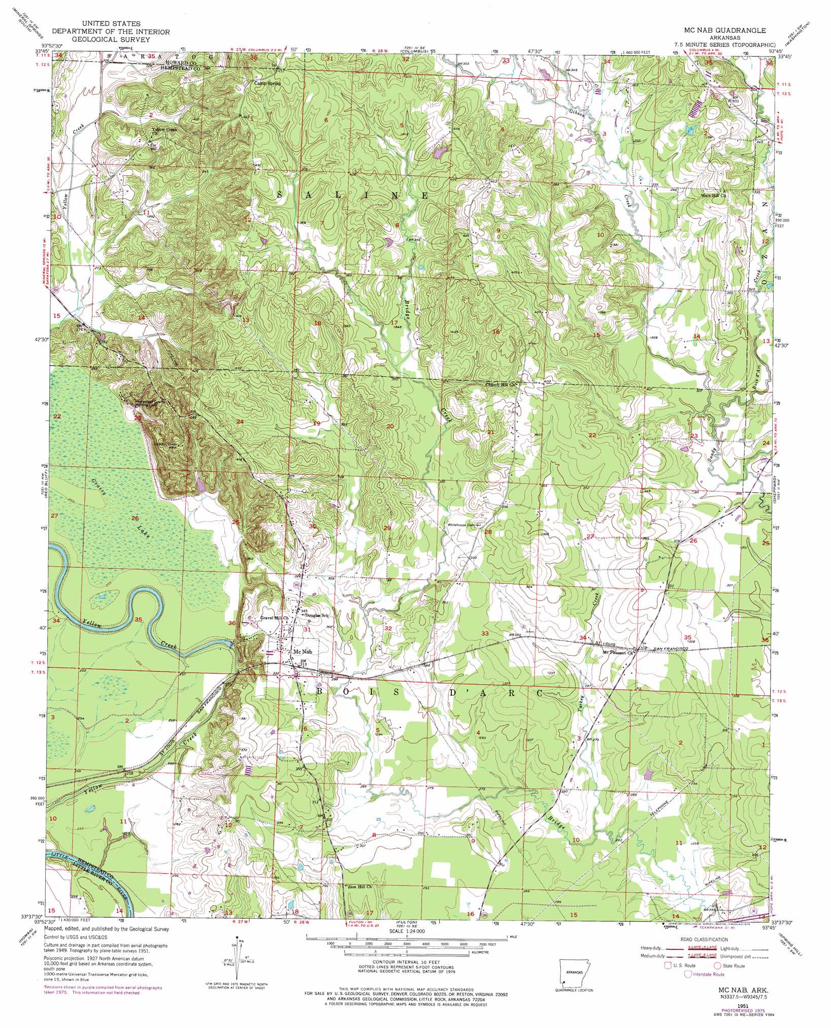
USGS Topo Quad 33093f7 - 1:24,000 scale
| Topo Map Name: | Mcnab |
| USGS Topo Quad ID: | 33093f7 |
| Print Size: | ca. 21 1/4" wide x 27" high |
| Southeast Coordinates: | 33.625° N latitude / 93.75° W longitude |
| Map Center Coordinates: | 33.6875° N latitude / 93.8125° W longitude |
| U.S. State: | AR |
| Filename: | o33093f7.jpg |
| Download Map JPG Image: | Mcnab topo map 1:24,000 scale |
| Map Type: | Topographic |
| Topo Series: | 7.5´ |
| Map Scale: | 1:24,000 |
| Source of Map Images: | United States Geological Survey (USGS) |
| Alternate Map Versions: |
Mc Nab AR 1951, updated 1952 Download PDF Buy paper map Mc Nab AR 1951, updated 1976 Download PDF Buy paper map McNab AR 2011 Download PDF Buy paper map McNab AR 2014 Download PDF Buy paper map |
1:24,000 Topo Quads surrounding Mcnab
Silver Ridge |
Mineral Springs North |
Nashville |
Mccaskill |
Pisgah |
Ben Lomond |
Mineral Springs South |
Columbus |
Washington |
Blevins |
Ashdown East |
Red Bluff |
Mcnab |
Sheppard |
Hope |
Ogden |
Homan |
Fulton |
Spring Hill |
Patmos |
Texarkana |
Mandeville |
Fouke Ne |
Boyd Hill |
Old Town |
> Back to 33093e1 at 1:100,000 scale
> Back to 33092a1 at 1:250,000 scale
> Back to U.S. Topo Maps home
Mcnab topo map: Gazetteer
Mcnab: Populated Places
McNab elevation 98m 321′Thrasher (historical) elevation 98m 321′
Mcnab: Streams
Gibson Creek elevation 94m 308′Little Bridge Creek elevation 97m 318′
Turkey Creek elevation 84m 275′
Mcnab: Swamps
Grassy Lake elevation 84m 275′Mcnab digital topo map on disk
Buy this Mcnab topo map showing relief, roads, GPS coordinates and other geographical features, as a high-resolution digital map file on DVD: