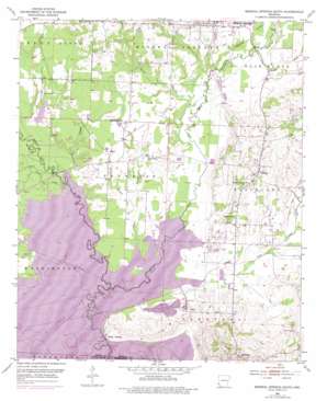
Mineral Springs South Topo Map Arkansas
To zoom in, hover over the map of Mineral Springs South
USGS Topo Quad 33093g8 - 1:24,000 scale
| Topo Map Name: | Mineral Springs South |
| USGS Topo Quad ID: | 33093g8 |
| Print Size: | ca. 21 1/4" wide x 27" high |
| Southeast Coordinates: | 33.75° N latitude / 93.875° W longitude |
| Map Center Coordinates: | 33.8125° N latitude / 93.9375° W longitude |
| U.S. State: | AR |
| Filename: | o33093g8.jpg |
| Download Map JPG Image: | Mineral Springs South topo map 1:24,000 scale |
| Map Type: | Topographic |
| Topo Series: | 7.5´ |
| Map Scale: | 1:24,000 |
| Source of Map Images: | United States Geological Survey (USGS) |
| Alternate Map Versions: |
Mineral Springs South AR 1951, updated 1952 Download PDF Buy paper map Mineral Springs South AR 1951, updated 1973 Download PDF Buy paper map Mineral Springs South AR 1951, updated 1976 Download PDF Buy paper map Mineral Springs South AR 2011 Download PDF Buy paper map Mineral Springs South AR 2014 Download PDF Buy paper map |
1:24,000 Topo Quads surrounding Mineral Springs South
> Back to 33093e1 at 1:100,000 scale
> Back to 33092a1 at 1:250,000 scale
> Back to U.S. Topo Maps home
Mineral Springs South topo map: Gazetteer
Mineral Springs South: Bridges
Saline Landing Bridge (historical) elevation 80m 262′Steel Bridge (historical) elevation 81m 265′
Wood Side Bridge elevation 80m 262′
Mineral Springs South: Dams
Kever Lake Dam elevation 114m 374′Scotty Lake Dam elevation 86m 282′
Mineral Springs South: Levees
Okay Dike elevation 83m 272′Mineral Springs South: Parks
Cottonshed Landing Use Area elevation 85m 278′Okay Dike Use Area elevation 89m 291′
Mineral Springs South: Populated Places
Allbrook elevation 97m 318′Okay elevation 99m 324′
Saratoga elevation 141m 462′
Schaal elevation 94m 308′
Tollette elevation 110m 360′
Mineral Springs South: Post Offices
Saratoga Post Office elevation 140m 459′Mineral Springs South: Reservoirs
Kever Lake elevation 114m 374′Scotty Lake elevation 86m 282′
Mineral Springs South: Ridges
Devils Backbone elevation 124m 406′Mineral Springs South: Streams
Baber Creek elevation 89m 291′Brushy Creek elevation 89m 291′
Dillard Creek elevation 89m 291′
Hosey Branch elevation 83m 272′
Ingram Creek elevation 79m 259′
Mine Creek elevation 79m 259′
Negro Branch elevation 79m 259′
Plum Creek elevation 83m 272′
Schaal Branch elevation 81m 265′
Trent Creek elevation 80m 262′
Mineral Springs South digital topo map on disk
Buy this Mineral Springs South topo map showing relief, roads, GPS coordinates and other geographical features, as a high-resolution digital map file on DVD:


