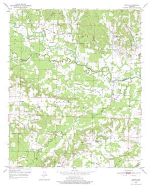
Pisgah Topo Map Arkansas
To zoom in, hover over the map of Pisgah
USGS Topo Quad 33093h5 - 1:24,000 scale
| Topo Map Name: | Pisgah |
| USGS Topo Quad ID: | 33093h5 |
| Print Size: | ca. 21 1/4" wide x 27" high |
| Southeast Coordinates: | 33.875° N latitude / 93.5° W longitude |
| Map Center Coordinates: | 33.9375° N latitude / 93.5625° W longitude |
| U.S. State: | AR |
| Filename: | o33093h5.jpg |
| Download Map JPG Image: | Pisgah topo map 1:24,000 scale |
| Map Type: | Topographic |
| Topo Series: | 7.5´ |
| Map Scale: | 1:24,000 |
| Source of Map Images: | United States Geological Survey (USGS) |
| Alternate Map Versions: |
Pisgah AR 1951, updated 1952 Download PDF Buy paper map Pisgah AR 1951, updated 1975 Download PDF Buy paper map Pisgah AR 2011 Download PDF Buy paper map Pisgah AR 2014 Download PDF Buy paper map |
1:24,000 Topo Quads surrounding Pisgah
> Back to 33093e1 at 1:100,000 scale
> Back to 33092a1 at 1:250,000 scale
> Back to U.S. Topo Maps home
Pisgah topo map: Gazetteer
Pisgah: Bridges
Maxwell Bridge elevation 91m 298′Wallaceburg Bridge (historical) elevation 88m 288′
Pisgah: Cliffs
Bell Bluff elevation 91m 298′Pisgah: Lakes
Horseshoe Lake elevation 82m 269′Pisgah: Populated Places
Billstown elevation 101m 331′Dotson elevation 112m 367′
Dotson Station (historical) elevation 127m 416′
Kilgore (historical) elevation 95m 311′
Pisgah elevation 98m 321′
Wallaceburg elevation 117m 383′
Pisgah: Streams
Baldon Branch elevation 92m 301′Blackland Branch elevation 81m 265′
Blue Branch elevation 88m 288′
Camel Branch elevation 83m 272′
Clear Creek elevation 88m 288′
Collins Bayou elevation 84m 275′
Dry Branch elevation 96m 314′
Hickory Creek elevation 85m 278′
Lick Creek elevation 88m 288′
Marlbrook Creek elevation 105m 344′
Ozan Creek elevation 78m 255′
Saline Creek elevation 82m 269′
Simpsons Creek elevation 82m 269′
Stony Creek elevation 93m 305′
Vaughn Creek elevation 87m 285′
Pisgah digital topo map on disk
Buy this Pisgah topo map showing relief, roads, GPS coordinates and other geographical features, as a high-resolution digital map file on DVD:


