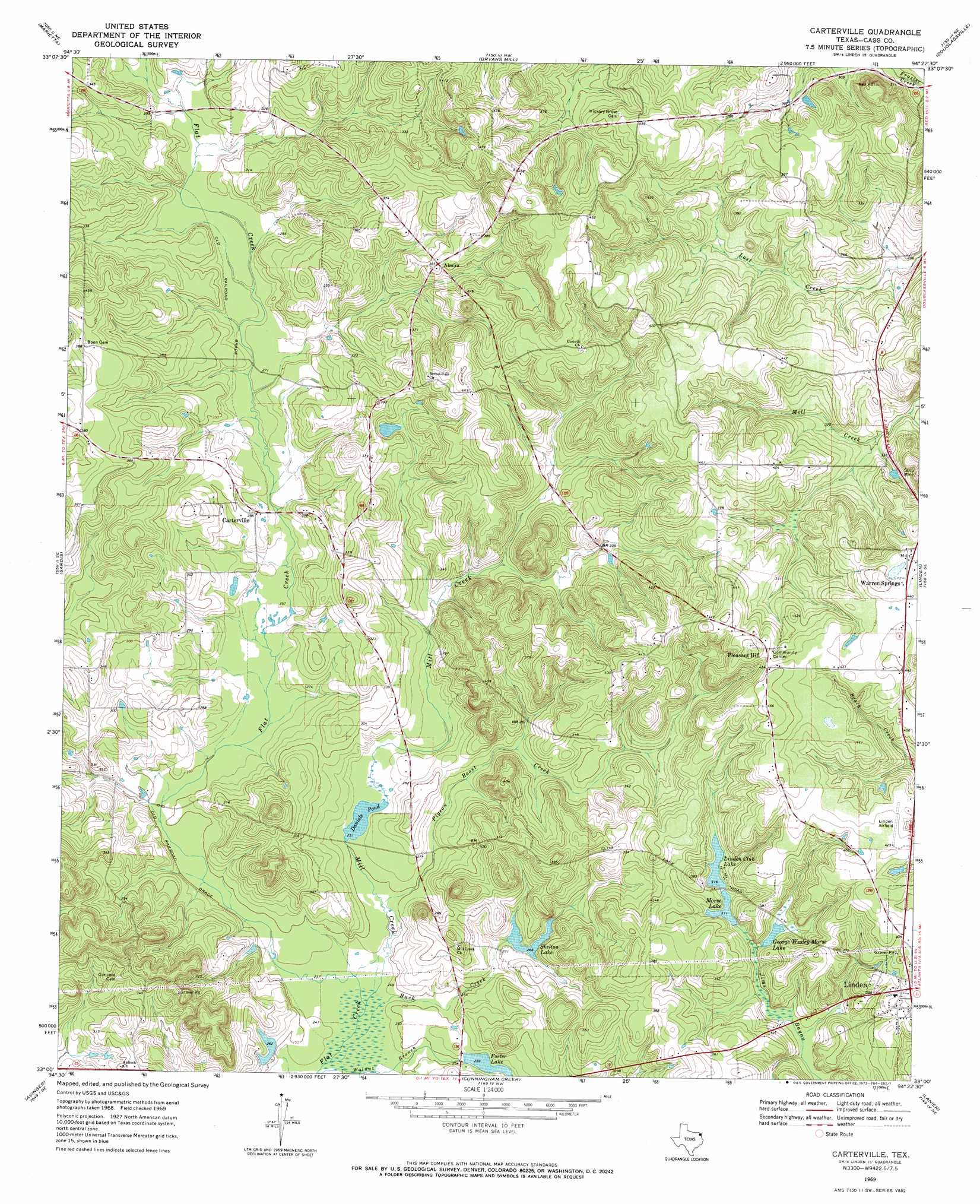
Carterville Topo Map Texas
To zoom in, hover over the map of Carterville
USGS Topo Quad 33094a4 - 1:24,000 scale
| Topo Map Name: | Carterville |
| USGS Topo Quad ID: | 33094a4 |
| Print Size: | ca. 21 1/4" wide x 27" high |
| Southeast Coordinates: | 33° N latitude / 94.375° W longitude |
| Map Center Coordinates: | 33.0625° N latitude / 94.4375° W longitude |
| U.S. State: | TX |
| Filename: | o33094a4.jpg |
| Download Map JPG Image: | Carterville topo map 1:24,000 scale |
| Map Type: | Topographic |
| Topo Series: | 7.5´ |
| Map Scale: | 1:24,000 |
| Source of Map Images: | United States Geological Survey (USGS) |
| Alternate Map Versions: |
Carterville TX 1969, updated 1973 Download PDF Buy paper map Carterville TX 2010 Download PDF Buy paper map Carterville TX 2013 Download PDF Buy paper map Carterville TX 2016 Download PDF Buy paper map |
1:24,000 Topo Quads surrounding Carterville
Dalby Springs |
Bassett |
Corley |
Maud |
Wright Patman Dam |
Naples |
Marietta |
Bryans Mill |
Douglassville |
Atlanta North |
Daingerfield |
Sardis |
Carterville |
Linden |
Atlanta South |
Lone Star |
Avinger |
Cunningham Creek |
Lanier |
Kildare |
Ore City |
Lassater |
Kellyville |
Jefferson |
Smithland |
> Back to 33094a1 at 1:100,000 scale
> Back to 33094a1 at 1:250,000 scale
> Back to U.S. Topo Maps home
Carterville topo map: Gazetteer
Carterville: Airports
Boon-Lovelace Airport elevation 129m 423′Carterville: Dams
Foster Lake Dam elevation 79m 259′Linden Club Dam elevation 100m 328′
Morse Dam elevation 95m 311′
Skelton Lake Dam elevation 82m 269′
Carterville: Lakes
Daniels Pond elevation 76m 249′Carterville: Populated Places
Almira elevation 110m 360′Carterville elevation 86m 282′
Pleasant Hill elevation 133m 436′
Warren Springs elevation 135m 442′
Carterville: Reservoirs
Foster Lake elevation 77m 252′George Wesley Morse Lake elevation 95m 311′
Linden Club Lake elevation 96m 314′
Morse Lake elevation 94m 308′
Skelton Lake elevation 81m 265′
Carterville: Streams
Buck Creek elevation 72m 236′Mill Creek elevation 72m 236′
Pigeon Roost Creek elevation 73m 239′
Walnut Branch elevation 72m 236′
Carterville digital topo map on disk
Buy this Carterville topo map showing relief, roads, GPS coordinates and other geographical features, as a high-resolution digital map file on DVD: