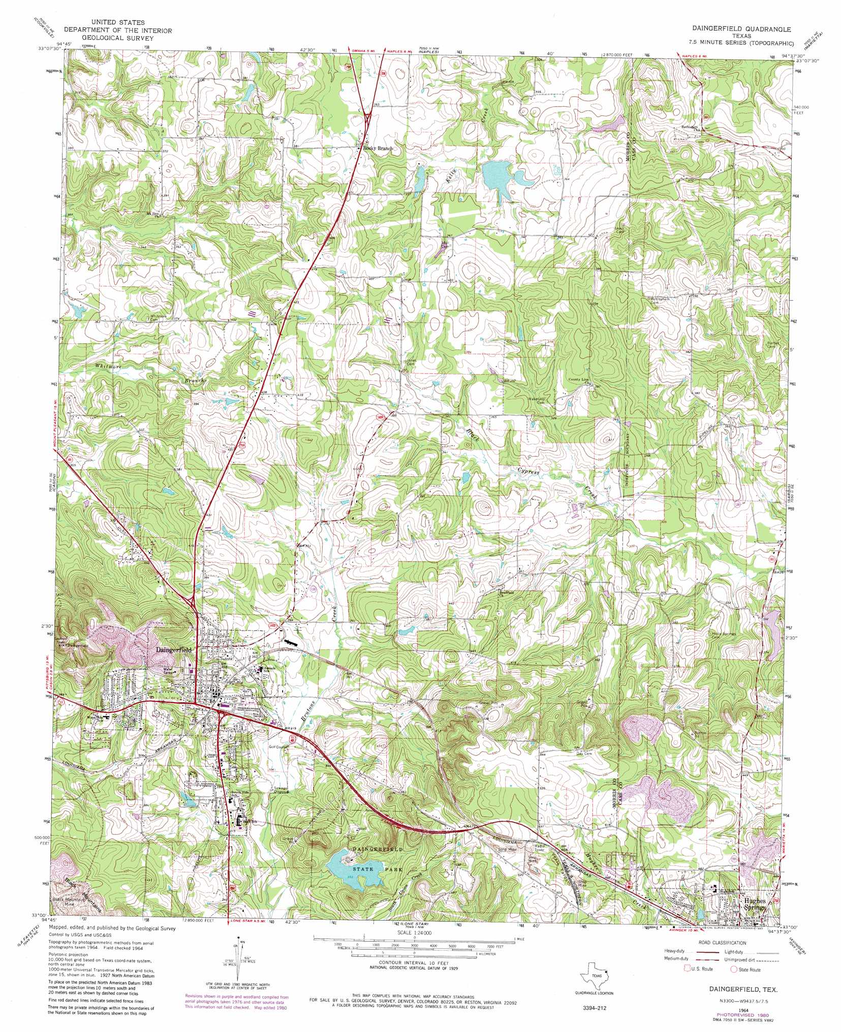
Daingerfield Topo Map Texas
To zoom in, hover over the map of Daingerfield
USGS Topo Quad 33094a6 - 1:24,000 scale
| Topo Map Name: | Daingerfield |
| USGS Topo Quad ID: | 33094a6 |
| Print Size: | ca. 21 1/4" wide x 27" high |
| Southeast Coordinates: | 33° N latitude / 94.625° W longitude |
| Map Center Coordinates: | 33.0625° N latitude / 94.6875° W longitude |
| U.S. State: | TX |
| Filename: | o33094a6.jpg |
| Download Map JPG Image: | Daingerfield topo map 1:24,000 scale |
| Map Type: | Topographic |
| Topo Series: | 7.5´ |
| Map Scale: | 1:24,000 |
| Source of Map Images: | United States Geological Survey (USGS) |
| Alternate Map Versions: |
Daingerfield TX 1964, updated 1967 Download PDF Buy paper map Daingerfield TX 1964, updated 1980 Download PDF Buy paper map Daingerfield TX 2010 Download PDF Buy paper map Daingerfield TX 2013 Download PDF Buy paper map Daingerfield TX 2016 Download PDF Buy paper map |
1:24,000 Topo Quads surrounding Daingerfield
Wilkinson |
Coopers Chapel |
Dalby Springs |
Bassett |
Corley |
Mount Pleasant |
Cookville |
Naples |
Marietta |
Bryans Mill |
Harvard |
Cason |
Daingerfield |
Sardis |
Carterville |
Pittsburg |
Lafayette |
Lone Star |
Avinger |
Cunningham Creek |
Bettie |
Coffeeville |
Ore City |
Lassater |
Kellyville |
> Back to 33094a1 at 1:100,000 scale
> Back to 33094a1 at 1:250,000 scale
> Back to U.S. Topo Maps home
Daingerfield topo map: Gazetteer
Daingerfield: Dams
Daingerfield State Park Dam elevation 109m 357′Florence Dam elevation 87m 285′
Jerome Wolfson Dam elevation 103m 337′
Minor Lake Dam elevation 101m 331′
Daingerfield: Parks
Daingerfield State Park elevation 117m 383′Irvin Park elevation 95m 311′
Daingerfield: Populated Places
Daingerfield elevation 121m 396′Rocky Branch elevation 106m 347′
Daingerfield: Reservoirs
Daingerfield State Park Lake elevation 109m 357′Florence Lake elevation 87m 285′
Jerome Wolfson Lake elevation 103m 337′
Minor Lake elevation 101m 331′
Daingerfield: Springs
Hughes Springs elevation 143m 469′Daingerfield: Trails
Daingerfield State Park Trail elevation 111m 364′Daingerfield digital topo map on disk
Buy this Daingerfield topo map showing relief, roads, GPS coordinates and other geographical features, as a high-resolution digital map file on DVD: