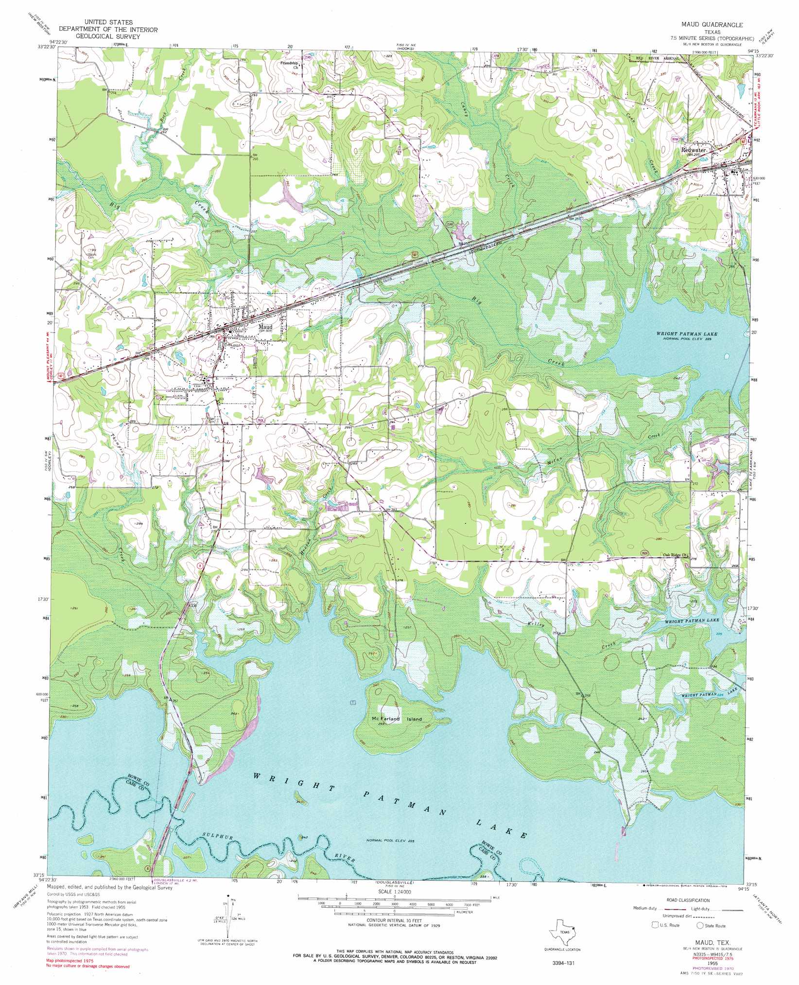
Maud Topo Map Texas
To zoom in, hover over the map of Maud
USGS Topo Quad 33094c3 - 1:24,000 scale
| Topo Map Name: | Maud |
| USGS Topo Quad ID: | 33094c3 |
| Print Size: | ca. 21 1/4" wide x 27" high |
| Southeast Coordinates: | 33.25° N latitude / 94.25° W longitude |
| Map Center Coordinates: | 33.3125° N latitude / 94.3125° W longitude |
| U.S. State: | TX |
| Filename: | o33094c3.jpg |
| Download Map JPG Image: | Maud topo map 1:24,000 scale |
| Map Type: | Topographic |
| Topo Series: | 7.5´ |
| Map Scale: | 1:24,000 |
| Source of Map Images: | United States Geological Survey (USGS) |
| Alternate Map Versions: |
Maud TX 1955, updated 1955 Download PDF Buy paper map Maud TX 1955, updated 1972 Download PDF Buy paper map Maud TX 1955, updated 1978 Download PDF Buy paper map Maud TX 2010 Download PDF Buy paper map Maud TX 2013 Download PDF Buy paper map Maud TX 2016 Download PDF Buy paper map |
1:24,000 Topo Quads surrounding Maud
De Kalb |
Daniels Chapel |
Redbank |
Barkman |
Ogden |
Malta |
New Boston |
Hooks |
Leary |
Texarkana |
Bassett |
Corley |
Maud |
Wright Patman Dam |
Domino |
Marietta |
Bryans Mill |
Douglassville |
Atlanta North |
Bloomburg |
Sardis |
Carterville |
Linden |
Atlanta South |
Ravanna |
> Back to 33094a1 at 1:100,000 scale
> Back to 33094a1 at 1:250,000 scale
> Back to U.S. Topo Maps home
Maud topo map: Gazetteer
Maud: Islands
McFarland Island elevation 77m 252′Maud: Parks
Berry Farm Park elevation 72m 236′Herron Creek Park elevation 86m 282′
Mauldin Lake Park elevation 77m 252′
Maud: Populated Places
Maud elevation 88m 288′Redwater elevation 90m 295′
Maud: Streams
Big Creek elevation 69m 226′Caney Creek elevation 70m 229′
Conn Creek elevation 69m 226′
Herron Creek elevation 70m 229′
Kelley Creek elevation 69m 226′
Milan Creek elevation 69m 226′
Rock Creek elevation 78m 255′
Thompson Creek elevation 69m 226′
Maud digital topo map on disk
Buy this Maud topo map showing relief, roads, GPS coordinates and other geographical features, as a high-resolution digital map file on DVD: