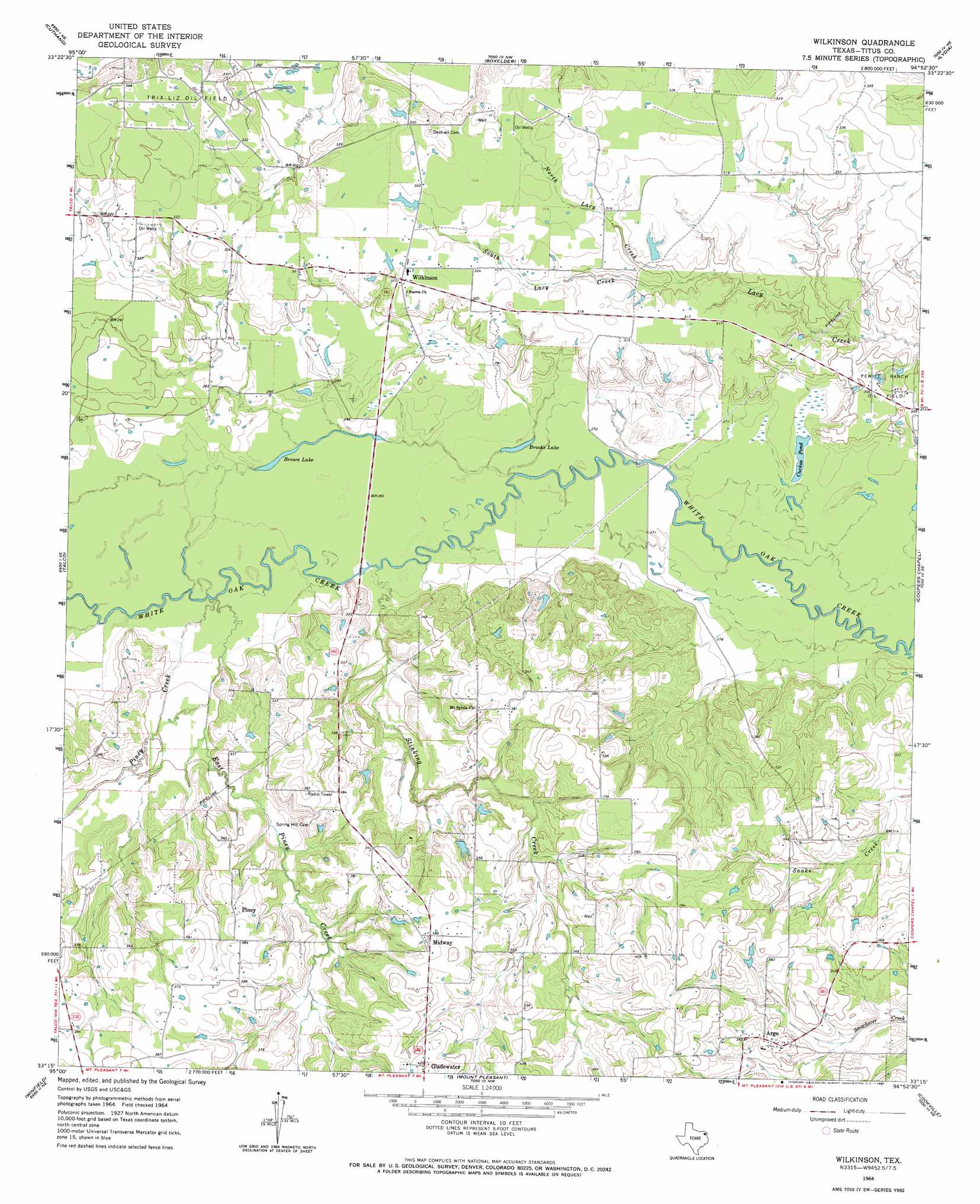
Wilkinson Topo Map Texas
To zoom in, hover over the map of Wilkinson
USGS Topo Quad 33094c8 - 1:24,000 scale
| Topo Map Name: | Wilkinson |
| USGS Topo Quad ID: | 33094c8 |
| Print Size: | ca. 21 1/4" wide x 27" high |
| Southeast Coordinates: | 33.25° N latitude / 94.875° W longitude |
| Map Center Coordinates: | 33.3125° N latitude / 94.9375° W longitude |
| U.S. State: | TX |
| Filename: | o33094c8.jpg |
| Download Map JPG Image: | Wilkinson topo map 1:24,000 scale |
| Map Type: | Topographic |
| Topo Series: | 7.5´ |
| Map Scale: | 1:24,000 |
| Source of Map Images: | United States Geological Survey (USGS) |
| Alternate Map Versions: |
Wilkinson TX 1964, updated 1967 Download PDF Buy paper map Wilkinson TX 2010 Download PDF Buy paper map Wilkinson TX 2013 Download PDF Buy paper map Wilkinson TX 2016 Download PDF Buy paper map |
1:24,000 Topo Quads surrounding Wilkinson
Line Branch |
Clarksville |
Annona |
Avery |
Oak Grove |
Bogata |
Cuthand |
Boxelder |
Lydia |
Hodgson |
Hagansport |
Talco |
Wilkinson |
Coopers Chapel |
Dalby Springs |
Mount Vernon |
Winfield |
Mount Pleasant |
Cookville |
Naples |
New Hope |
Monticello |
Harvard |
Cason |
Daingerfield |
> Back to 33094a1 at 1:100,000 scale
> Back to 33094a1 at 1:250,000 scale
> Back to U.S. Topo Maps home
Wilkinson topo map: Gazetteer
Wilkinson: Lakes
Brooks Lake elevation 82m 269′Brown Lake elevation 84m 275′
Cuckoo Pond elevation 81m 265′
Wilkinson: Oilfields
Trix-Liz Oil Field elevation 106m 347′Wilkinson: Populated Places
Argo elevation 114m 374′Midway elevation 118m 387′
Wilkinson elevation 99m 324′
Wilkinson: Streams
East Piney Creek elevation 85m 278′North Lacy Creek elevation 89m 291′
Piney Creek elevation 85m 278′
South Lacy Creek elevation 89m 291′
Stinking Creek elevation 84m 275′
Wilkinson digital topo map on disk
Buy this Wilkinson topo map showing relief, roads, GPS coordinates and other geographical features, as a high-resolution digital map file on DVD: