Daniels Chapel Topo Map Texas
To zoom in, hover over the map of Daniels Chapel
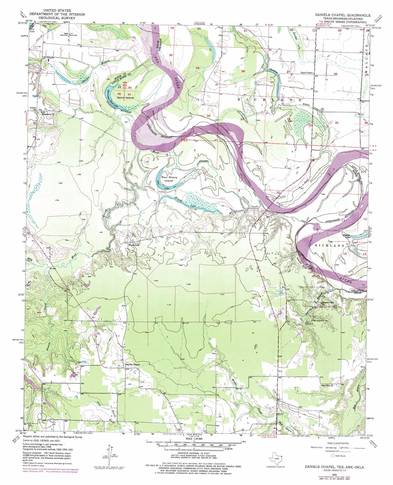
USGS Topo Quad 33094e4 - 1:24,000 scale
| Topo Map Name: | Daniels Chapel |
| USGS Topo Quad ID: | 33094e4 |
| Print Size: | ca. 21 1/4" wide x 27" high |
| Southeast Coordinates: | 33.5° N latitude / 94.375° W longitude |
| Map Center Coordinates: | 33.5625° N latitude / 94.4375° W longitude |
| U.S. States: | TX, AR, OK |
| Filename: | o33094e4.jpg |
| Download Map JPG Image: | Daniels Chapel topo map 1:24,000 scale |
| Map Type: | Topographic |
| Topo Series: | 7.5´ |
| Map Scale: | 1:24,000 |
| Source of Map Images: | United States Geological Survey (USGS) |
| Alternate Map Versions: |
Daniels Chapel TX 1951, updated 1952 Download PDF Buy paper map Daniels Chapel TX 1951, updated 1969 Download PDF Buy paper map Daniels Chapel TX 1951, updated 1971 Download PDF Buy paper map Daniels Chapel TX 1951, updated 1976 Download PDF Buy paper map Daniels Chapel TX 2011 Download PDF Buy paper map Daniels Chapel TX 2013 Download PDF Buy paper map Daniels Chapel TX 2016 Download PDF Buy paper map |
1:24,000 Topo Quads surrounding Daniels Chapel
Haworth |
Bokhoma |
Arkinda |
Winthrop |
Falls Chapel |
De Kalb Nw |
Tom |
Foreman |
Arden |
Ashdown West |
Oak Grove |
De Kalb |
Daniels Chapel |
Redbank |
Barkman |
Hodgson |
Malta |
New Boston |
Hooks |
Leary |
Dalby Springs |
Bassett |
Corley |
Maud |
Wright Patman Dam |
> Back to 33094e1 at 1:100,000 scale
> Back to 33094a1 at 1:250,000 scale
> Back to U.S. Topo Maps home
Daniels Chapel topo map: Gazetteer
Daniels Chapel: Airports
Moser Ranch Airfield elevation 95m 311′Daniels Chapel: Cliffs
Spanish Bluff elevation 104m 341′Daniels Chapel: Guts
Choctaw Bayou elevation 94m 308′Daniels Chapel: Islands
Gano Island elevation 96m 314′Paul Moore Island elevation 91m 298′
Daniels Chapel: Lakes
Brushy Lake elevation 94m 308′Hurricane Bend Lake elevation 92m 301′
New Lake elevation 91m 298′
Daniels Chapel: Populated Places
Spanish Bluff (historical) elevation 100m 328′Woodstock elevation 108m 354′
Daniels Chapel: Streams
Daniels Creek elevation 94m 308′Holly Creek elevation 93m 305′
Hooks Bayou elevation 93m 305′
Mud Creek elevation 91m 298′
Spring Branch elevation 89m 291′
Daniels Chapel digital topo map on disk
Buy this Daniels Chapel topo map showing relief, roads, GPS coordinates and other geographical features, as a high-resolution digital map file on DVD: