Winthrop Topo Map Arkansas
To zoom in, hover over the map of Winthrop
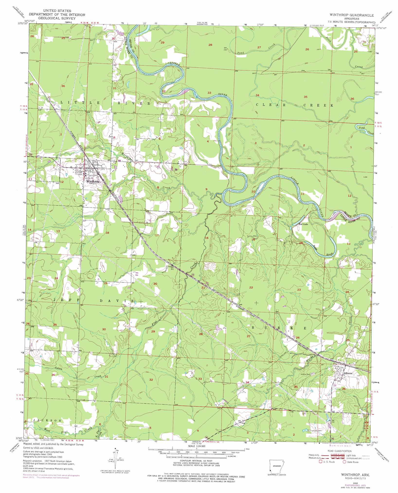
USGS Topo Quad 33094g3 - 1:24,000 scale
| Topo Map Name: | Winthrop |
| USGS Topo Quad ID: | 33094g3 |
| Print Size: | ca. 21 1/4" wide x 27" high |
| Southeast Coordinates: | 33.75° N latitude / 94.25° W longitude |
| Map Center Coordinates: | 33.8125° N latitude / 94.3125° W longitude |
| U.S. State: | AR |
| Filename: | o33094g3.jpg |
| Download Map JPG Image: | Winthrop topo map 1:24,000 scale |
| Map Type: | Topographic |
| Topo Series: | 7.5´ |
| Map Scale: | 1:24,000 |
| Source of Map Images: | United States Geological Survey (USGS) |
| Alternate Map Versions: |
Winthrop AR 1950, updated 1976 Download PDF Buy paper map Winthrop AR 1951, updated 1951 Download PDF Buy paper map Winthrop AR 2011 Download PDF Buy paper map Winthrop AR 2014 Download PDF Buy paper map |
1:24,000 Topo Quads surrounding Winthrop
Eagletown |
Chapel Hill |
De Queen |
Geneva |
Dierks |
Goodwater |
Cerrogordo |
Horatio |
Lockesburg |
Silver Ridge |
Bokhoma |
Arkinda |
Winthrop |
Falls Chapel |
Ben Lomond |
Tom |
Foreman |
Arden |
Ashdown West |
Ashdown East |
De Kalb |
Daniels Chapel |
Redbank |
Barkman |
Ogden |
> Back to 33094e1 at 1:100,000 scale
> Back to 33094a1 at 1:250,000 scale
> Back to U.S. Topo Maps home
Winthrop topo map: Gazetteer
Winthrop: Bars
Cotton Woods Shoals elevation 79m 259′Winthrop: Crossings
Hawkins Ford elevation 79m 259′Winthrop: Lakes
Boggy Slough elevation 82m 269′Red Lake elevation 83m 272′
Winthrop: Populated Places
Alleene elevation 105m 344′Leidygate (historical) elevation 110m 360′
Lippton (historical) elevation 104m 341′
Winthrop elevation 103m 337′
Winthrop: Post Offices
Alleene Post Office elevation 107m 351′Winthrop: Streams
Calton Creek elevation 98m 321′East Flat Creek elevation 104m 341′
Flat Creek elevation 90m 295′
Hurricane Creek elevation 84m 275′
Roberts Branch elevation 88m 288′
West Flat Creek elevation 103m 337′
Winthrop digital topo map on disk
Buy this Winthrop topo map showing relief, roads, GPS coordinates and other geographical features, as a high-resolution digital map file on DVD: