Haworth Topo Map Oklahoma
To zoom in, hover over the map of Haworth
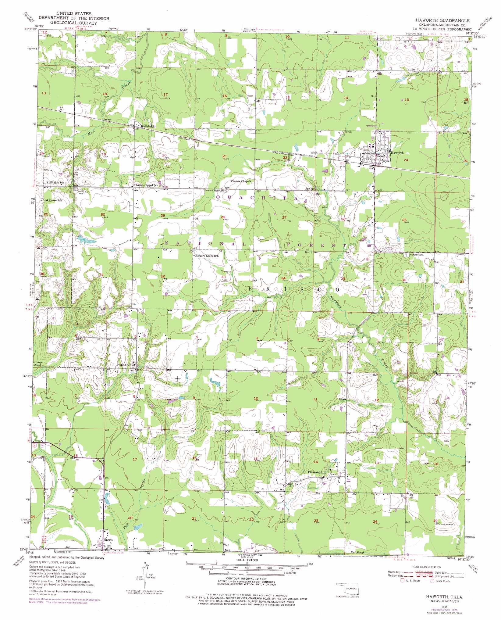
USGS Topo Quad 33094g6 - 1:24,000 scale
| Topo Map Name: | Haworth |
| USGS Topo Quad ID: | 33094g6 |
| Print Size: | ca. 21 1/4" wide x 27" high |
| Southeast Coordinates: | 33.75° N latitude / 94.625° W longitude |
| Map Center Coordinates: | 33.8125° N latitude / 94.6875° W longitude |
| U.S. State: | OK |
| Filename: | o33094g6.jpg |
| Download Map JPG Image: | Haworth topo map 1:24,000 scale |
| Map Type: | Topographic |
| Topo Series: | 7.5´ |
| Map Scale: | 1:24,000 |
| Source of Map Images: | United States Geological Survey (USGS) |
| Alternate Map Versions: |
Haworth OK 1950, updated 1976 Download PDF Buy paper map Haworth OK 1951 Download PDF Buy paper map Haworth OK 2010 Download PDF Buy paper map Haworth OK 2012 Download PDF Buy paper map Haworth OK 2016 Download PDF Buy paper map |
| FStopo: | US Forest Service topo Haworth is available: Download FStopo PDF Download FStopo TIF |
1:24,000 Topo Quads surrounding Haworth
Golden |
Steel Junction |
Broken Bow |
Eagletown |
Chapel Hill |
Garvin |
Idabel |
Shults |
Goodwater |
Cerrogordo |
Acworth |
Idabel Se |
Haworth |
Bokhoma |
Arkinda |
White Rock |
English |
De Kalb Nw |
Tom |
Foreman |
Annona |
Avery |
Oak Grove |
De Kalb |
Daniels Chapel |
> Back to 33094e1 at 1:100,000 scale
> Back to 33094a1 at 1:250,000 scale
> Back to U.S. Topo Maps home
Haworth topo map: Gazetteer
Haworth: Dams
Oknoname 089007 Dam elevation 107m 351′Oknoname 089017 Dam elevation 135m 442′
Water Fall-Gilford Site Number 11 Dam elevation 119m 390′
Haworth: Populated Places
Harris elevation 104m 341′Haworth elevation 122m 400′
Kullituklo elevation 117m 383′
Pleasant Hill elevation 119m 390′
Haworth: Reservoirs
Oknoname 089007 Reservoir elevation 107m 351′Oknoname 089017 Reservoir elevation 135m 442′
Haworth: Summits
Haworth Tower elevation 118m 387′Haworth digital topo map on disk
Buy this Haworth topo map showing relief, roads, GPS coordinates and other geographical features, as a high-resolution digital map file on DVD: