Silver Ridge Topo Map Arkansas
To zoom in, hover over the map of Silver Ridge
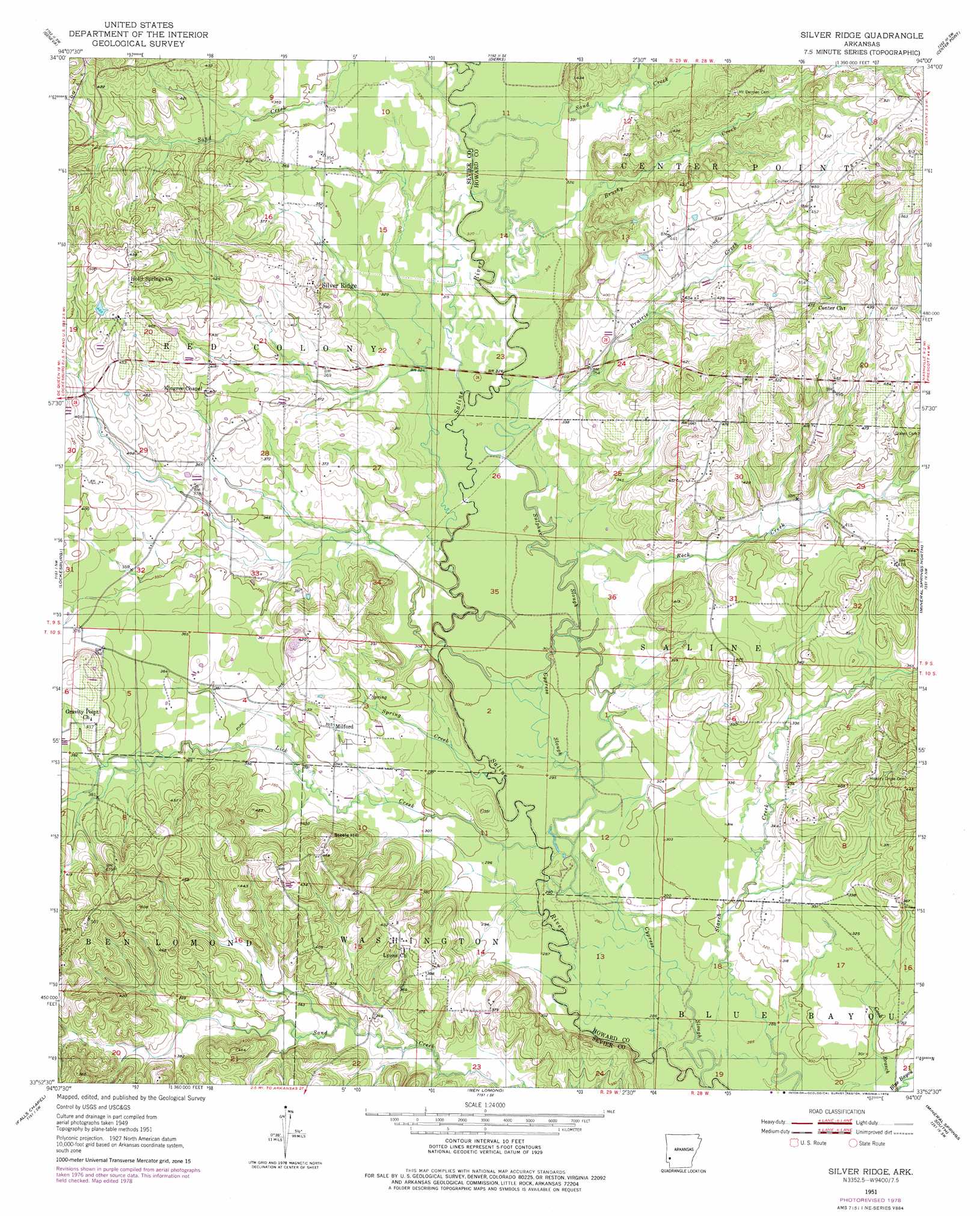
USGS Topo Quad 33094h1 - 1:24,000 scale
| Topo Map Name: | Silver Ridge |
| USGS Topo Quad ID: | 33094h1 |
| Print Size: | ca. 21 1/4" wide x 27" high |
| Southeast Coordinates: | 33.875° N latitude / 94° W longitude |
| Map Center Coordinates: | 33.9375° N latitude / 94.0625° W longitude |
| U.S. State: | AR |
| Filename: | o33094h1.jpg |
| Download Map JPG Image: | Silver Ridge topo map 1:24,000 scale |
| Map Type: | Topographic |
| Topo Series: | 7.5´ |
| Map Scale: | 1:24,000 |
| Source of Map Images: | United States Geological Survey (USGS) |
| Alternate Map Versions: |
Silver Ridge AR 1951, updated 1952 Download PDF Buy paper map Silver Ridge AR 1951, updated 1978 Download PDF Buy paper map Silver Ridge AR 2011 Download PDF Buy paper map Silver Ridge AR 2014 Download PDF Buy paper map |
1:24,000 Topo Quads surrounding Silver Ridge
Gillham |
Gillham Dam |
Dierks Dam |
Newhope |
Center Point Ne |
De Queen |
Geneva |
Dierks |
Center Point |
Nathan |
Horatio |
Lockesburg |
Silver Ridge |
Mineral Springs North |
Nashville |
Winthrop |
Falls Chapel |
Ben Lomond |
Mineral Springs South |
Columbus |
Arden |
Ashdown West |
Ashdown East |
Red Bluff |
Mcnab |
> Back to 33094e1 at 1:100,000 scale
> Back to 33094a1 at 1:250,000 scale
> Back to U.S. Topo Maps home
Silver Ridge topo map: Gazetteer
Silver Ridge: Crossings
Murphy Ford elevation 102m 334′Saltworks Ford elevation 89m 291′
Silver Ridge: Guts
Cypress Slough elevation 87m 285′Silver Ridge: Populated Places
Milford elevation 110m 360′Rosedale (historical) elevation 130m 426′
Silver Ridge: Streams
Brushy Creek elevation 98m 321′Lick Creek elevation 91m 298′
Messer Creek elevation 102m 334′
Prairie Creek elevation 101m 331′
Rock Creek elevation 95m 311′
Sand Creek elevation 102m 334′
Sand Creek elevation 99m 324′
Spring Creek elevation 93m 305′
Sulphur Slough elevation 95m 311′
Silver Ridge: Summits
Steele Hill elevation 134m 439′Silver Ridge digital topo map on disk
Buy this Silver Ridge topo map showing relief, roads, GPS coordinates and other geographical features, as a high-resolution digital map file on DVD: