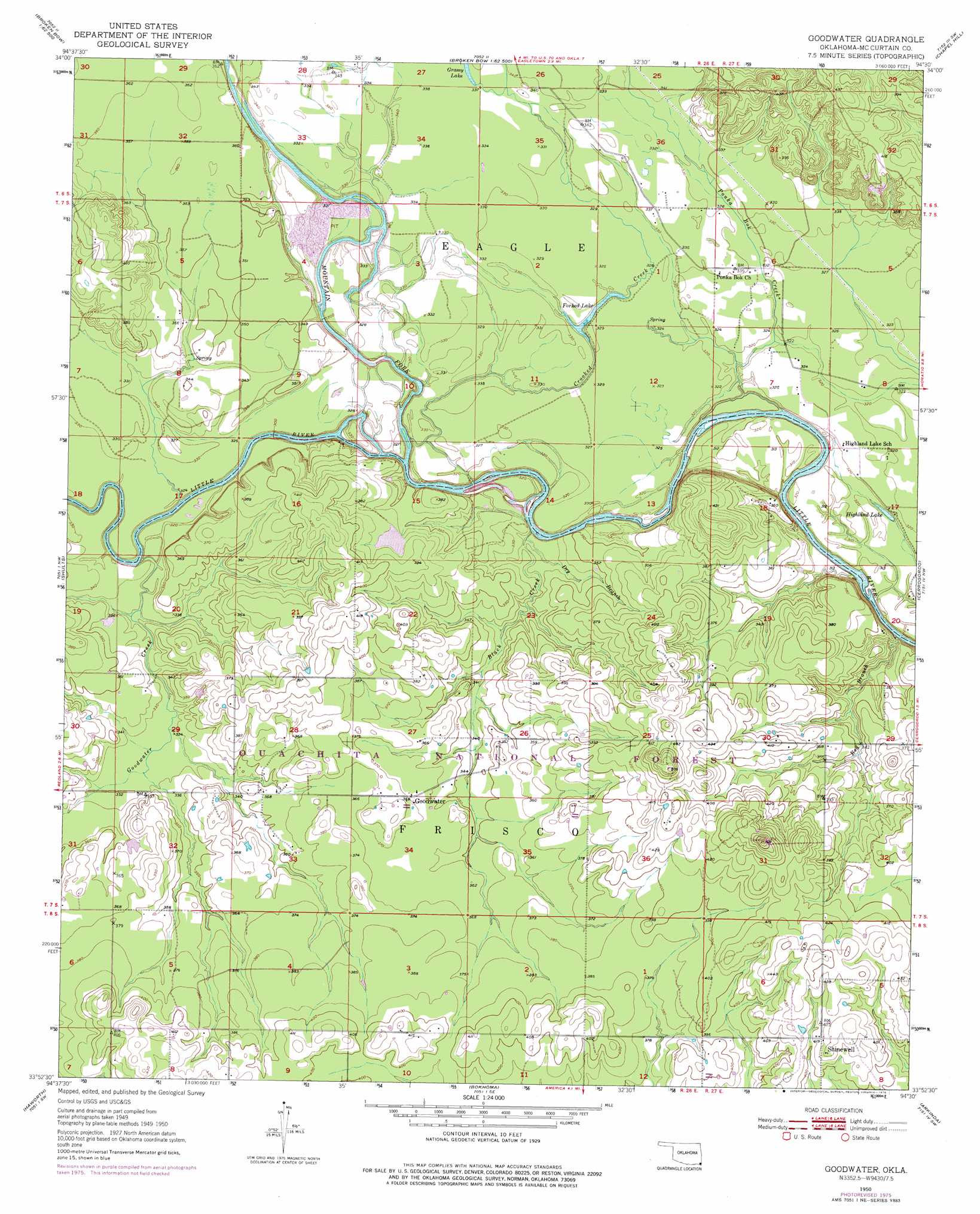
Goodwater Topo Map Oklahoma
To zoom in, hover over the map of Goodwater
USGS Topo Quad 33094h5 - 1:24,000 scale
| Topo Map Name: | Goodwater |
| USGS Topo Quad ID: | 33094h5 |
| Print Size: | ca. 21 1/4" wide x 27" high |
| Southeast Coordinates: | 33.875° N latitude / 94.5° W longitude |
| Map Center Coordinates: | 33.9375° N latitude / 94.5625° W longitude |
| U.S. State: | OK |
| Filename: | o33094h5.jpg |
| Download Map JPG Image: | Goodwater topo map 1:24,000 scale |
| Map Type: | Topographic |
| Topo Series: | 7.5´ |
| Map Scale: | 1:24,000 |
| Source of Map Images: | United States Geological Survey (USGS) |
| Alternate Map Versions: |
Goodwater OK 1950, updated 1976 Download PDF Buy paper map Goodwater OK 1951 Download PDF Buy paper map Goodwater OK 2010 Download PDF Buy paper map Goodwater OK 2012 Download PDF Buy paper map Goodwater OK 2016 Download PDF Buy paper map |
| FStopo: | US Forest Service topo Goodwater is available: Download FStopo PDF Download FStopo TIF |
1:24,000 Topo Quads surrounding Goodwater
Old Glory Mountain |
Stephens Gap |
Toblerville |
De Queen Nw |
Gillham |
Steel Junction |
Broken Bow |
Eagletown |
Chapel Hill |
De Queen |
Idabel |
Shults |
Goodwater |
Cerrogordo |
Horatio |
Idabel Se |
Haworth |
Bokhoma |
Arkinda |
Winthrop |
English |
De Kalb Nw |
Tom |
Foreman |
Arden |
> Back to 33094e1 at 1:100,000 scale
> Back to 33094a1 at 1:250,000 scale
> Back to U.S. Topo Maps home
Goodwater topo map: Gazetteer
Goodwater: Dams
Oknoname 089002 Dam elevation 106m 347′Goodwater: Lakes
Forked Lake elevation 97m 318′Highland Lake elevation 97m 318′
Goodwater: Populated Places
Eagle Town (historical) elevation 101m 331′Goodwater elevation 112m 367′
Shinewell elevation 127m 416′
Goodwater: Reservoirs
Oknoname 089002 Reservoir elevation 106m 347′Goodwater: Streams
Black Creek elevation 89m 291′Crooked Creek elevation 91m 298′
Dry Branch elevation 94m 308′
Goodwater Creek elevation 94m 308′
Mountain Fork elevation 89m 291′
Ponka Bok Creek elevation 90m 295′
Red Branch elevation 90m 295′
Wheeler Branch elevation 103m 337′
Goodwater digital topo map on disk
Buy this Goodwater topo map showing relief, roads, GPS coordinates and other geographical features, as a high-resolution digital map file on DVD: