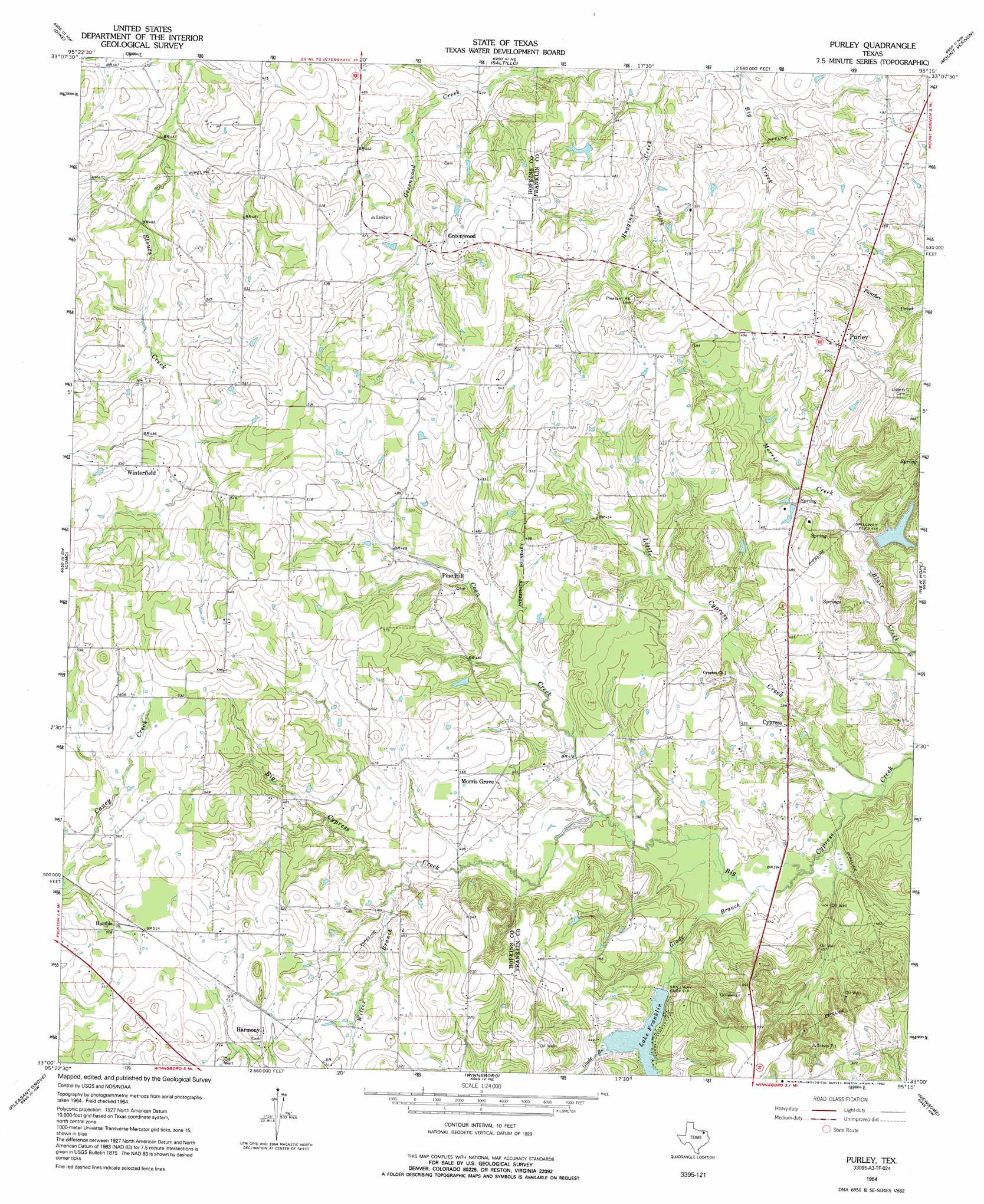
Purley Topo Map Texas
To zoom in, hover over the map of Purley
USGS Topo Quad 33095a3 - 1:24,000 scale
| Topo Map Name: | Purley |
| USGS Topo Quad ID: | 33095a3 |
| Print Size: | ca. 21 1/4" wide x 27" high |
| Southeast Coordinates: | 33° N latitude / 95.25° W longitude |
| Map Center Coordinates: | 33.0625° N latitude / 95.3125° W longitude |
| U.S. State: | TX |
| Filename: | o33095a3.jpg |
| Download Map JPG Image: | Purley topo map 1:24,000 scale |
| Map Type: | Topographic |
| Topo Series: | 7.5´ |
| Map Scale: | 1:24,000 |
| Source of Map Images: | United States Geological Survey (USGS) |
| Alternate Map Versions: |
Purley TX 1964, updated 1968 Download PDF Buy paper map Purley TX 1964, updated 1992 Download PDF Buy paper map Purley TX 2010 Download PDF Buy paper map Purley TX 2013 Download PDF Buy paper map Purley TX 2016 Download PDF Buy paper map |
1:24,000 Topo Quads surrounding Purley
Tira |
Sulphur Bluff |
Mitchell Creek |
Hagansport |
Talco |
Sulphur Springs |
Dike |
Saltillo |
Mount Vernon |
Winfield |
Sulphur Springs Se |
Como |
Purley |
New Hope |
Monticello |
Yantis |
Pleasant Grove |
Winnsboro |
Newsome |
Leesburg |
Calvary |
Quitman |
Cartwright |
Rhonesboro |
Thomas |
> Back to 33095a1 at 1:100,000 scale
> Back to 33094a1 at 1:250,000 scale
> Back to U.S. Topo Maps home
Purley topo map: Gazetteer
Purley: Dams
Lake Franklin Dam elevation 126m 413′Zachry Lake Dam elevation 128m 419′
Purley: Populated Places
Cypress elevation 129m 423′Greenwood elevation 149m 488′
Harmony elevation 159m 521′
Humble elevation 153m 501′
Morris Grove elevation 140m 459′
Pine Hill elevation 140m 459′
Purley elevation 160m 524′
Winterfield elevation 162m 531′
Purley: Reservoirs
Lake Franklin elevation 127m 416′Zachry Lake elevation 128m 419′
Purley: Streams
Blair Creek elevation 118m 387′Coon Creek elevation 121m 396′
Glade Branch elevation 118m 387′
Little Cypress Creek elevation 116m 380′
Morris Creek elevation 122m 400′
Wilcox Branch elevation 131m 429′
Purley digital topo map on disk
Buy this Purley topo map showing relief, roads, GPS coordinates and other geographical features, as a high-resolution digital map file on DVD: