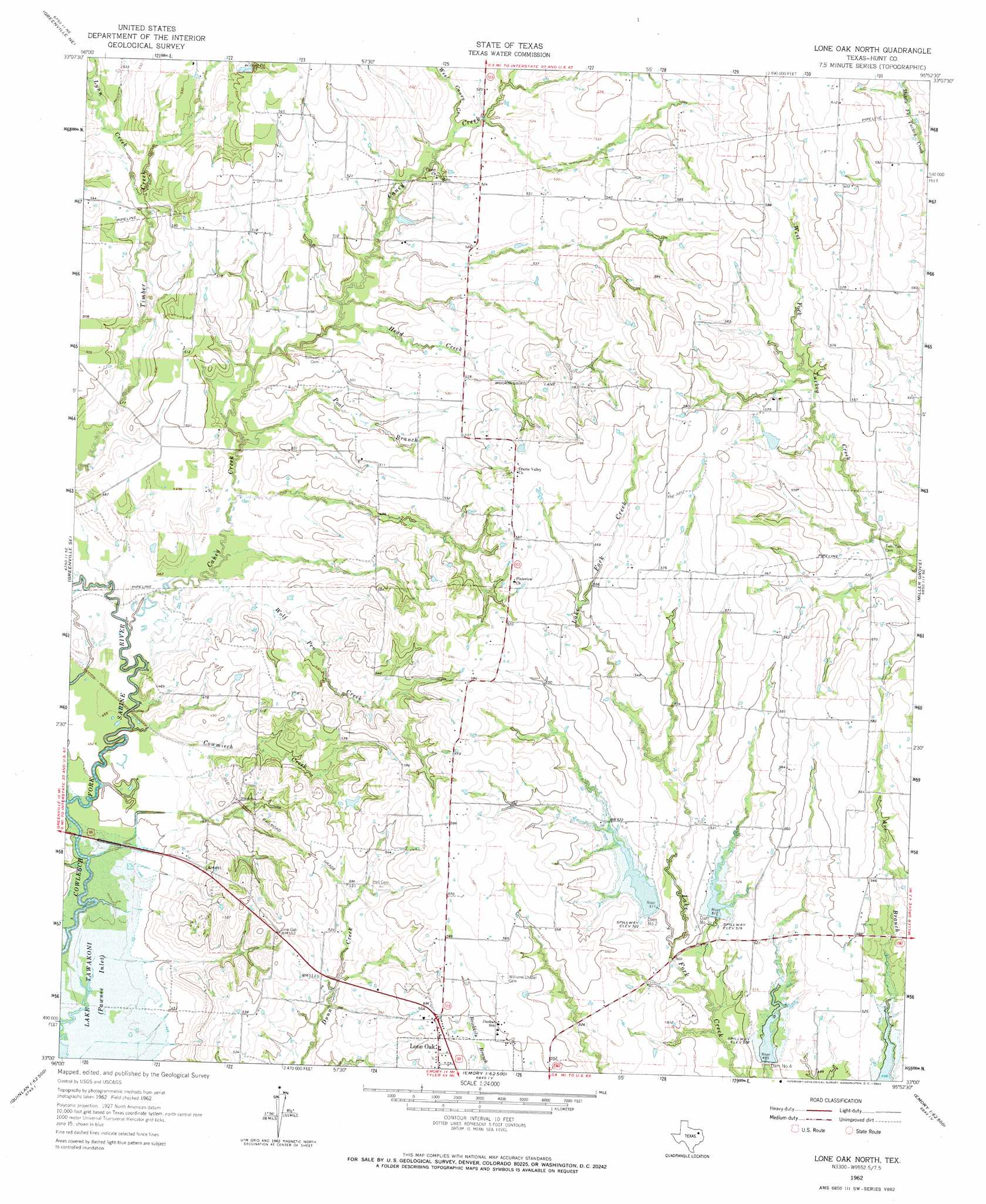
Lone Oak North Topo Map Texas
To zoom in, hover over the map of Lone Oak North
USGS Topo Quad 33095a8 - 1:24,000 scale
| Topo Map Name: | Lone Oak North |
| USGS Topo Quad ID: | 33095a8 |
| Print Size: | ca. 21 1/4" wide x 27" high |
| Southeast Coordinates: | 33° N latitude / 95.875° W longitude |
| Map Center Coordinates: | 33.0625° N latitude / 95.9375° W longitude |
| U.S. State: | TX |
| Filename: | o33095a8.jpg |
| Download Map JPG Image: | Lone Oak North topo map 1:24,000 scale |
| Map Type: | Topographic |
| Topo Series: | 7.5´ |
| Map Scale: | 1:24,000 |
| Source of Map Images: | United States Geological Survey (USGS) |
| Alternate Map Versions: |
Lone Oak North TX 1962, updated 1965 Download PDF Buy paper map Lone Oak North TX 2010 Download PDF Buy paper map Lone Oak North TX 2013 Download PDF Buy paper map Lone Oak North TX 2016 Download PDF Buy paper map |
1:24,000 Topo Quads surrounding Lone Oak North
Celeste |
Wolfe City |
Commerce North |
Klondike |
Cooper South |
Greenville Nw |
Greenville Ne |
Commerce South |
Cumby |
Gafford Chapel |
Greenville Sw |
Greenville Se |
Lone Oak North |
Miller Grove |
Brashear |
Quinlan |
West Tawakoni |
Lone Oak South |
Emory North |
Arbala |
Poetry |
Ables Springs |
Iron Bridge Dam |
Emory South |
Alba |
> Back to 33095a1 at 1:100,000 scale
> Back to 33094a1 at 1:250,000 scale
> Back to U.S. Topo Maps home
Lone Oak North topo map: Gazetteer
Lone Oak North: Airports
Glenmar Airport elevation 164m 538′Wolf Run Airport elevation 172m 564′
Lone Oak North: Dams
Dam Number 2 elevation 158m 518′Dam Number 3 elevation 156m 511′
Dam Number 4 elevation 152m 498′
Soil Conservation Service Site 1 Dam elevation 156m 511′
Soil Conservation Service Site 10a Dam elevation 159m 521′
Soil Conservation Service Site 2 Dam elevation 158m 518′
Soil Conservation Service Site 3 Dam elevation 158m 518′
Soil Conservation Service Site 4 Dam elevation 150m 492′
Lone Oak North: Reservoirs
Soil Conservation Service Site 1 Reservoir elevation 156m 511′Soil Conservation Service Site 10a Reservoir elevation 159m 521′
Soil Conservation Service Site 2 Reservoir elevation 158m 518′
Soil Conservation Service Site 3 Reservoir elevation 158m 518′
Soil Conservation Service Site 4 Reservoir elevation 150m 492′
Lone Oak North: Streams
Caney Creek elevation 136m 446′Cowmiech Creek elevation 134m 439′
Head Creek elevation 145m 475′
Lynn Creek elevation 152m 498′
Pool Branch elevation 141m 462′
Watson Branch elevation 151m 495′
West Caney Creek elevation 151m 495′
Wolf Pen Creek elevation 140m 459′
Lone Oak North digital topo map on disk
Buy this Lone Oak North topo map showing relief, roads, GPS coordinates and other geographical features, as a high-resolution digital map file on DVD: