Mount Vernon Topo Map Texas
To zoom in, hover over the map of Mount Vernon
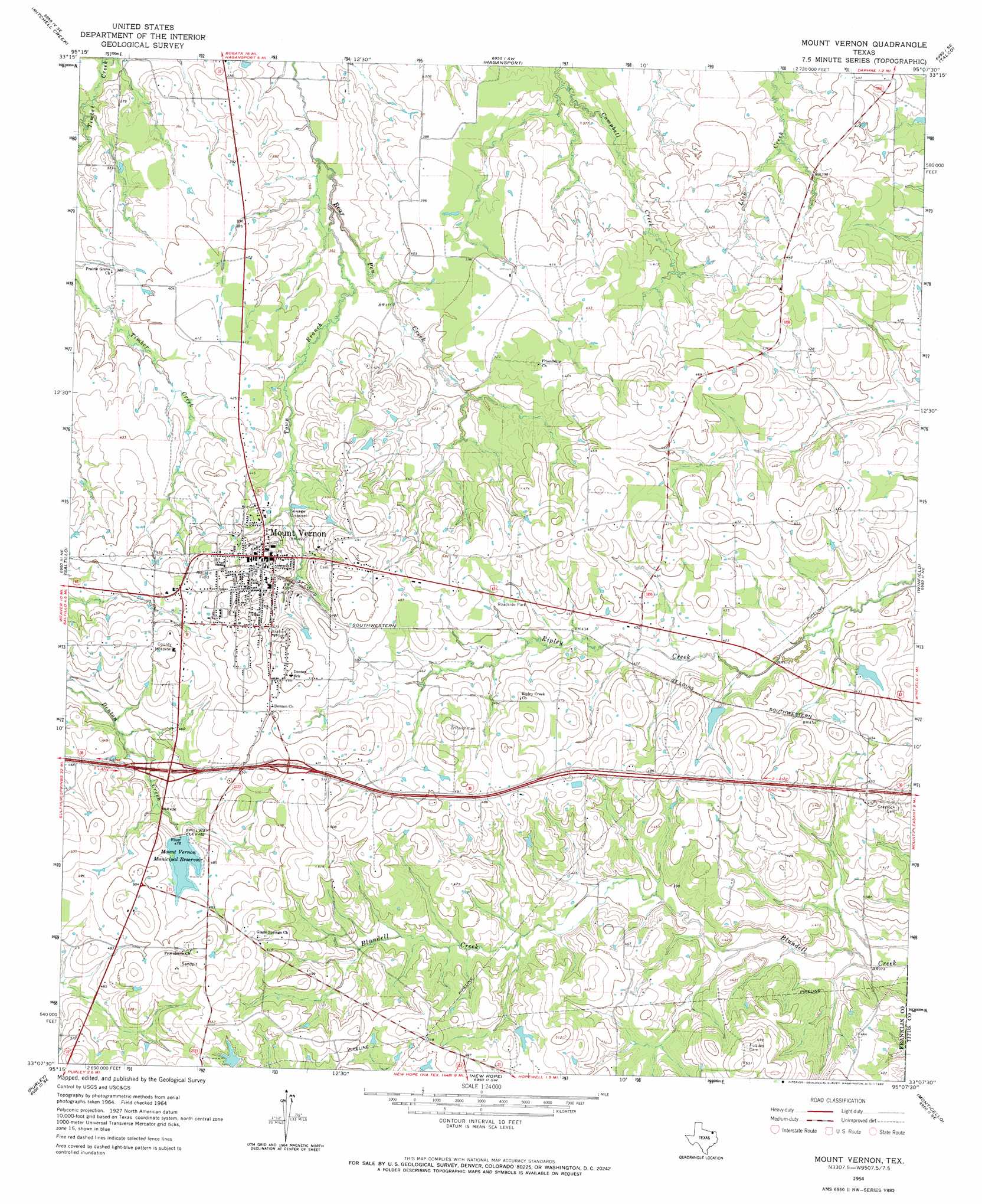
USGS Topo Quad 33095b2 - 1:24,000 scale
| Topo Map Name: | Mount Vernon |
| USGS Topo Quad ID: | 33095b2 |
| Print Size: | ca. 21 1/4" wide x 27" high |
| Southeast Coordinates: | 33.125° N latitude / 95.125° W longitude |
| Map Center Coordinates: | 33.1875° N latitude / 95.1875° W longitude |
| U.S. State: | TX |
| Filename: | o33095b2.jpg |
| Download Map JPG Image: | Mount Vernon topo map 1:24,000 scale |
| Map Type: | Topographic |
| Topo Series: | 7.5´ |
| Map Scale: | 1:24,000 |
| Source of Map Images: | United States Geological Survey (USGS) |
| Alternate Map Versions: |
Mount Vernon TX 1964, updated 1967 Download PDF Buy paper map Mount Vernon TX 2010 Download PDF Buy paper map Mount Vernon TX 2013 Download PDF Buy paper map Mount Vernon TX 2016 Download PDF Buy paper map |
1:24,000 Topo Quads surrounding Mount Vernon
Minter |
Cunningham |
Bogata |
Cuthand |
Boxelder |
Sulphur Bluff |
Mitchell Creek |
Hagansport |
Talco |
Wilkinson |
Dike |
Saltillo |
Mount Vernon |
Winfield |
Mount Pleasant |
Como |
Purley |
New Hope |
Monticello |
Harvard |
Pleasant Grove |
Winnsboro |
Newsome |
Leesburg |
Pittsburg |
> Back to 33095a1 at 1:100,000 scale
> Back to 33094a1 at 1:250,000 scale
> Back to U.S. Topo Maps home
Mount Vernon topo map: Gazetteer
Mount Vernon: Airports
Franklin County Airport elevation 123m 403′Mount Vernon Medical Center Heliport elevation 153m 501′
Mount Vernon: Dams
Carpenter Lake Dam elevation 144m 472′Deal Lake Dam elevation 133m 436′
Edwards Lake Dam elevation 154m 505′
Lake Ione Dam elevation 126m 413′
Mount Vernon City Dam elevation 147m 482′
Mount Vernon: Populated Places
Mount Vernon elevation 150m 492′Mount Vernon: Reservoirs
Carpenter Lake elevation 144m 472′Deal Lake elevation 133m 436′
Edwards Lake elevation 154m 505′
Lake Ione elevation 126m 413′
Mount Vernon Municipal Reservoir elevation 147m 482′
Mount Vernon: Streams
Town Branch elevation 110m 360′Mount Vernon digital topo map on disk
Buy this Mount Vernon topo map showing relief, roads, GPS coordinates and other geographical features, as a high-resolution digital map file on DVD: