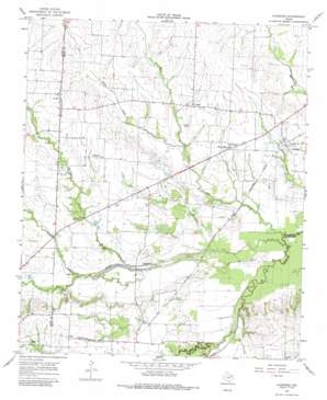
Klondike Topo Map Texas
To zoom in, hover over the map of Klondike
USGS Topo Quad 33095c7 - 1:24,000 scale
| Topo Map Name: | Klondike |
| USGS Topo Quad ID: | 33095c7 |
| Print Size: | ca. 21 1/4" wide x 27" high |
| Southeast Coordinates: | 33.25° N latitude / 95.75° W longitude |
| Map Center Coordinates: | 33.3125° N latitude / 95.8125° W longitude |
| U.S. State: | TX |
| Filename: | o33095c7.jpg |
| Download Map JPG Image: | Klondike topo map 1:24,000 scale |
| Map Type: | Topographic |
| Topo Series: | 7.5´ |
| Map Scale: | 1:24,000 |
| Source of Map Images: | United States Geological Survey (USGS) |
| Alternate Map Versions: |
Klondike TX 1964, updated 1968 Download PDF Buy paper map Klondike TX 1964, updated 1985 Download PDF Buy paper map Klondike TX 2010 Download PDF Buy paper map Klondike TX 2013 Download PDF Buy paper map Klondike TX 2016 Download PDF Buy paper map |
1:24,000 Topo Quads surrounding Klondike
> Back to 33095a1 at 1:100,000 scale
> Back to 33094a1 at 1:250,000 scale
> Back to U.S. Topo Maps home
Klondike topo map: Gazetteer
Klondike: Populated Places
Gough elevation 148m 485′Horton elevation 147m 482′
Klondike elevation 144m 472′
Needmore elevation 157m 515′
West Delta elevation 146m 479′
Yowell elevation 162m 531′
Klondike: Streams
Barnett Creek elevation 135m 442′East Fork Jernigan Creek elevation 137m 449′
Jernigan Creek elevation 128m 419′
Middle Sulphur River elevation 128m 419′
Pecan Creek elevation 136m 446′
West Fork Jernigan Creek elevation 137m 449′
Klondike digital topo map on disk
Buy this Klondike topo map showing relief, roads, GPS coordinates and other geographical features, as a high-resolution digital map file on DVD:


