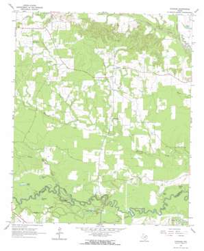
Cuthand Topo Map Texas
To zoom in, hover over the map of Cuthand
USGS Topo Quad 33095d1 - 1:24,000 scale
| Topo Map Name: | Cuthand |
| USGS Topo Quad ID: | 33095d1 |
| Print Size: | ca. 21 1/4" wide x 27" high |
| Southeast Coordinates: | 33.375° N latitude / 95° W longitude |
| Map Center Coordinates: | 33.4375° N latitude / 95.0625° W longitude |
| U.S. State: | TX |
| Filename: | o33095d1.jpg |
| Download Map JPG Image: | Cuthand topo map 1:24,000 scale |
| Map Type: | Topographic |
| Topo Series: | 7.5´ |
| Map Scale: | 1:24,000 |
| Source of Map Images: | United States Geological Survey (USGS) |
| Alternate Map Versions: |
Cuthand TX 1964, updated 1967 Download PDF Buy paper map Cuthand TX 2010 Download PDF Buy paper map Cuthand TX 2013 Download PDF Buy paper map Cuthand TX 2016 Download PDF Buy paper map |
1:24,000 Topo Quads surrounding Cuthand
> Back to 33095a1 at 1:100,000 scale
> Back to 33094a1 at 1:250,000 scale
> Back to U.S. Topo Maps home
Cuthand topo map: Gazetteer
Cuthand: Dams
Barnard Lake Dam elevation 109m 357′Blackmon Farms Reservoir Number 3 Dam elevation 98m 321′
Cuthand: Guts
Cottonwood Slough elevation 88m 288′Sanders Slough elevation 91m 298′
Cuthand: Lakes
Brushy Lake elevation 87m 285′Cheetwood Lake elevation 86m 282′
Elbow Lake elevation 88m 288′
Farmers Lake elevation 93m 305′
Horseshoe Lake elevation 93m 305′
Stout Lake elevation 92m 301′
Timber Lake elevation 91m 298′
Turner Lake elevation 92m 301′
Cuthand: Populated Places
Cuthand elevation 118m 387′Pine Branch elevation 119m 390′
Cuthand: Reservoirs
Barnard Draw Lake elevation 109m 357′Blackmon Farms Reservoir Number 3 elevation 98m 321′
Cuthand: Streams
Langford Creek elevation 88m 288′Little Mustang Creek elevation 86m 282′
Pickett Creek elevation 90m 295′
Pine Branch elevation 98m 321′
Ringo Creek elevation 94m 308′
Cuthand digital topo map on disk
Buy this Cuthand topo map showing relief, roads, GPS coordinates and other geographical features, as a high-resolution digital map file on DVD:


