Petty Topo Map Texas
To zoom in, hover over the map of Petty
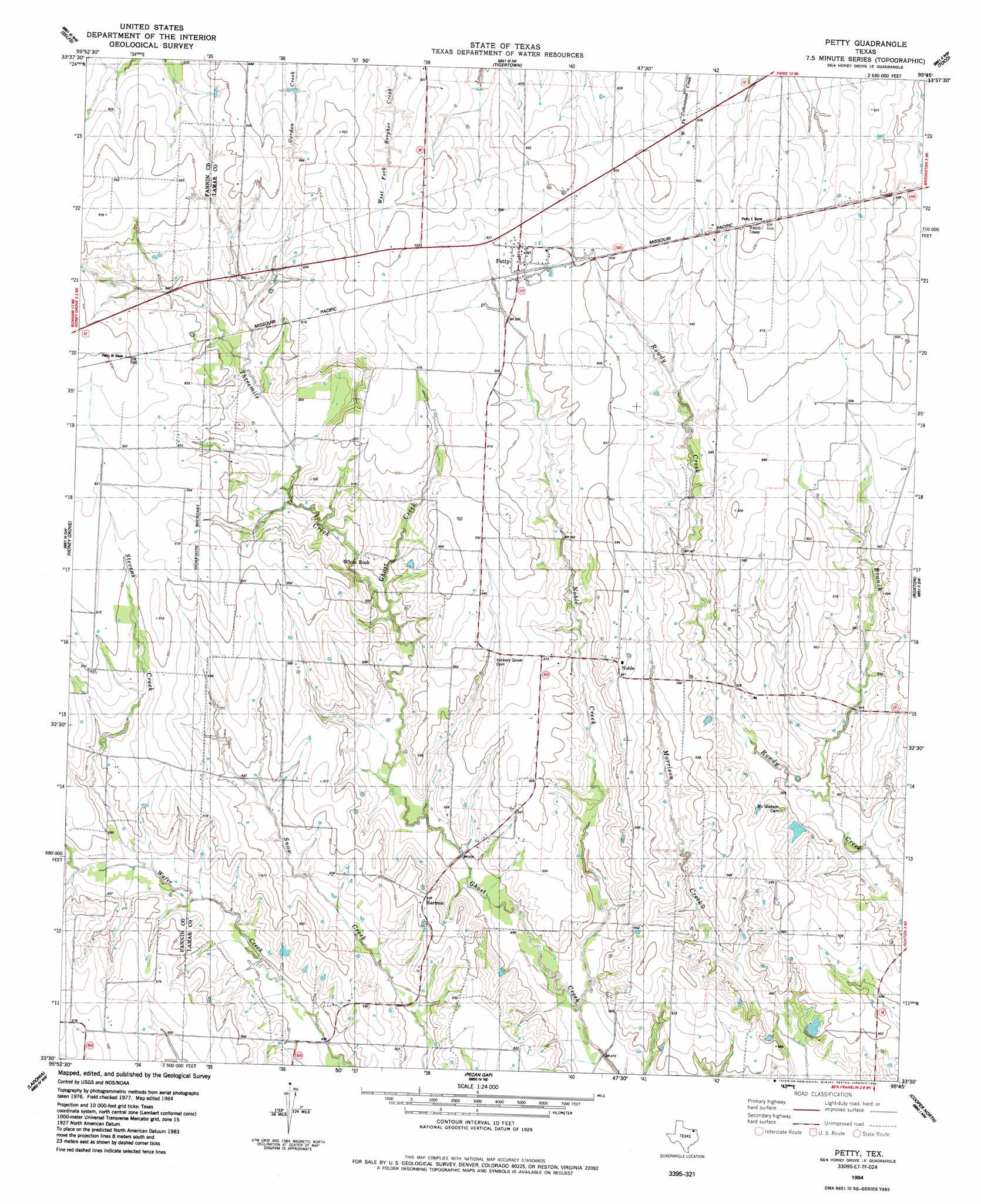
USGS Topo Quad 33095e7 - 1:24,000 scale
| Topo Map Name: | Petty |
| USGS Topo Quad ID: | 33095e7 |
| Print Size: | ca. 21 1/4" wide x 27" high |
| Southeast Coordinates: | 33.5° N latitude / 95.75° W longitude |
| Map Center Coordinates: | 33.5625° N latitude / 95.8125° W longitude |
| U.S. State: | TX |
| Filename: | o33095e7.jpg |
| Download Map JPG Image: | Petty topo map 1:24,000 scale |
| Map Type: | Topographic |
| Topo Series: | 7.5´ |
| Map Scale: | 1:24,000 |
| Source of Map Images: | United States Geological Survey (USGS) |
| Alternate Map Versions: |
Petty TX 1984, updated 1985 Download PDF Buy paper map Petty TX 2010 Download PDF Buy paper map Petty TX 2012 Download PDF Buy paper map Petty TX 2016 Download PDF Buy paper map |
1:24,000 Topo Quads surrounding Petty
Telephone |
Monkstown |
Direct |
Pat Mayse Lake West |
Pat Mayse Lake East |
Lamasco |
Selfs |
Tigertown |
Toco |
Paris |
Dodd City |
Honey Grove |
Petty |
Roxton |
Biardstown |
Gober |
Ladonia |
Pecan Gap |
Cooper North |
Charleston |
Wolfe City |
Commerce North |
Klondike |
Cooper South |
Tira |
> Back to 33095e1 at 1:100,000 scale
> Back to 33094a1 at 1:250,000 scale
> Back to U.S. Topo Maps home
Petty topo map: Gazetteer
Petty: Dams
Grogens Lake Dam elevation 144m 472′Petty: Populated Places
Harmon elevation 168m 551′Noble elevation 180m 590′
Petty elevation 188m 616′
White Rock elevation 173m 567′
Petty: Reservoirs
Grogens Lake elevation 144m 472′Petty: Streams
Noble Creek elevation 142m 465′North Branch Rowdy Creek elevation 149m 488′
Stevens Creek elevation 159m 521′
Threemile Creek elevation 162m 531′
Petty digital topo map on disk
Buy this Petty topo map showing relief, roads, GPS coordinates and other geographical features, as a high-resolution digital map file on DVD: