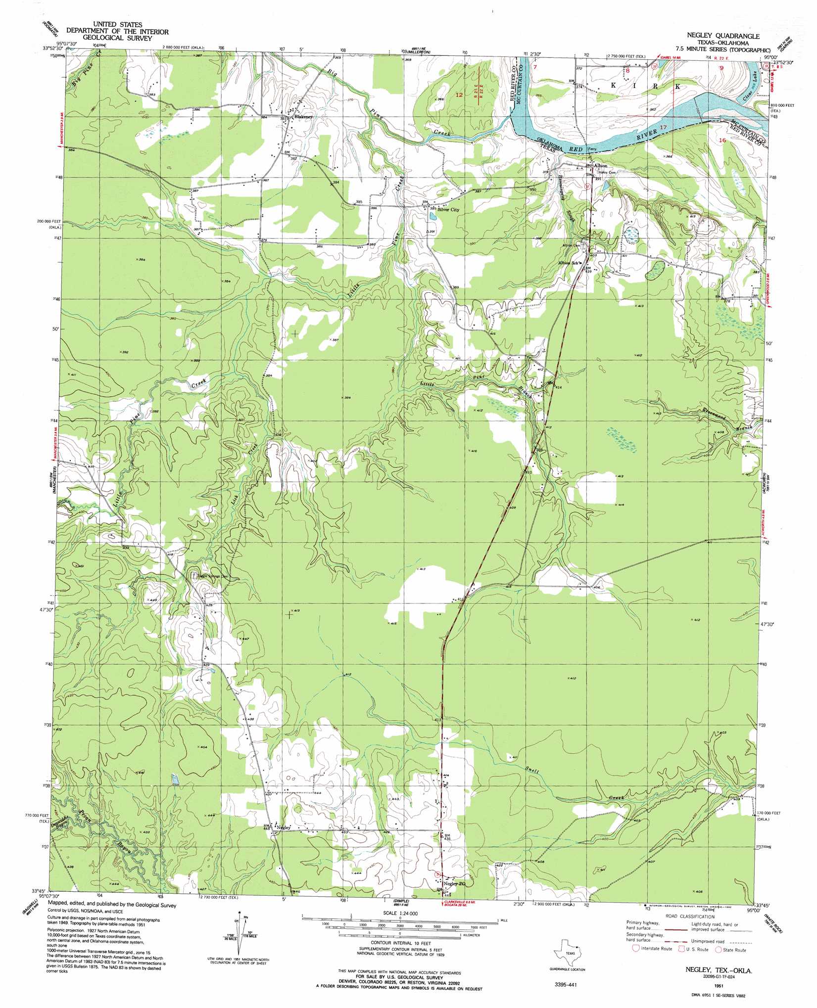
Negley Topo Map Texas
To zoom in, hover over the map of Negley
USGS Topo Quad 33095g1 - 1:24,000 scale
| Topo Map Name: | Negley |
| USGS Topo Quad ID: | 33095g1 |
| Print Size: | ca. 21 1/4" wide x 27" high |
| Southeast Coordinates: | 33.75° N latitude / 95° W longitude |
| Map Center Coordinates: | 33.8125° N latitude / 95.0625° W longitude |
| U.S. States: | TX, OK |
| Filename: | o33095g1.jpg |
| Download Map JPG Image: | Negley topo map 1:24,000 scale |
| Map Type: | Topographic |
| Topo Series: | 7.5´ |
| Map Scale: | 1:24,000 |
| Source of Map Images: | United States Geological Survey (USGS) |
| Alternate Map Versions: |
Negley TX 1951, updated 1952 Download PDF Buy paper map Negley TX 1951, updated 1958 Download PDF Buy paper map Negley TX 1951, updated 1992 Download PDF Buy paper map Negley TX 2010 Download PDF Buy paper map Negley TX 2013 Download PDF Buy paper map Negley TX 2016 Download PDF Buy paper map |
1:24,000 Topo Quads surrounding Negley
Fort Towson |
Swink |
Wright City |
Golden |
Steel Junction |
Frogville |
Kiomatia |
Millerton |
Garvin |
Idabel |
Woodland |
Manchester |
Negley |
Acworth |
Idabel Se |
Detroit |
Bagwell |
Dimple |
White Rock |
English |
Deport |
Line Branch |
Clarksville |
Annona |
Avery |
> Back to 33095e1 at 1:100,000 scale
> Back to 33094a1 at 1:250,000 scale
> Back to U.S. Topo Maps home
Negley topo map: Gazetteer
Negley: Dams
Igo Dam Number 2 elevation 116m 380′Negley: Populated Places
Albion elevation 117m 383′Blakeney elevation 116m 380′
Negley elevation 137m 449′
Silver City elevation 117m 383′
Negley: Post Offices
Negley Post Office elevation 137m 449′Negley: Reservoirs
Igo Lake Number 2 elevation 116m 380′Negley: Streams
Big Pine Creek elevation 111m 364′Denwiddie Bayou elevation 125m 410′
Hemmingway Slough elevation 109m 357′
Lick Creek elevation 113m 370′
Little Pine Branch elevation 110m 360′
Little Pine Creek elevation 113m 370′
Negley digital topo map on disk
Buy this Negley topo map showing relief, roads, GPS coordinates and other geographical features, as a high-resolution digital map file on DVD: