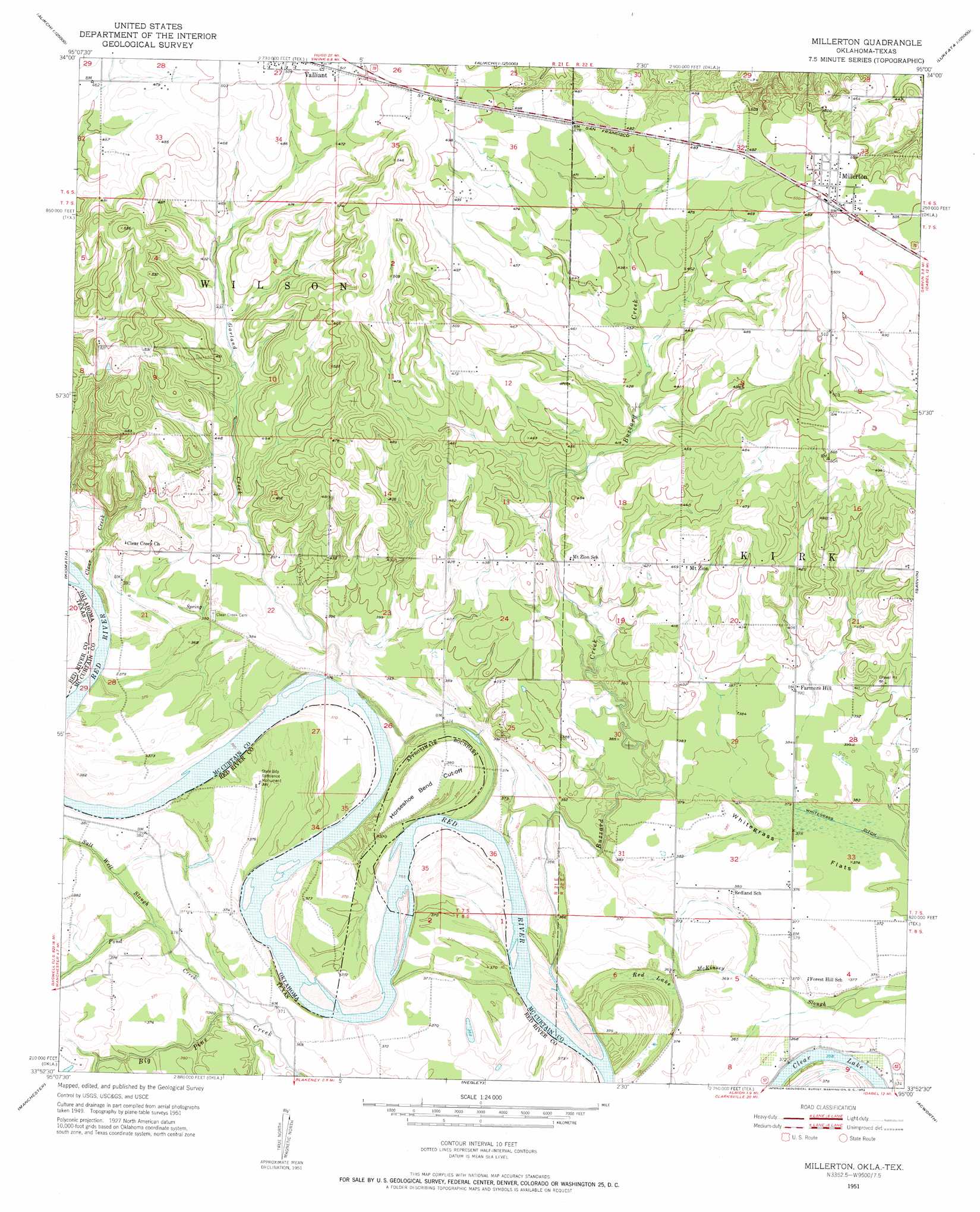
Millerton Topo Map Oklahoma
To zoom in, hover over the map of Millerton
USGS Topo Quad 33095h1 - 1:24,000 scale
| Topo Map Name: | Millerton |
| USGS Topo Quad ID: | 33095h1 |
| Print Size: | ca. 21 1/4" wide x 27" high |
| Southeast Coordinates: | 33.875° N latitude / 95° W longitude |
| Map Center Coordinates: | 33.9375° N latitude / 95.0625° W longitude |
| U.S. States: | OK, TX |
| Filename: | o33095h1.jpg |
| Download Map JPG Image: | Millerton topo map 1:24,000 scale |
| Map Type: | Topographic |
| Topo Series: | 7.5´ |
| Map Scale: | 1:24,000 |
| Source of Map Images: | United States Geological Survey (USGS) |
| Alternate Map Versions: |
Millerton OK 1951, updated 1952 Download PDF Buy paper map Millerton OK 2010 Download PDF Buy paper map Millerton OK 2012 Download PDF Buy paper map Millerton OK 2016 Download PDF Buy paper map |
1:24,000 Topo Quads surrounding Millerton
Spencerville |
Sobol |
Alikchi |
Bear Mountain |
Old Glory Mountain |
Fort Towson |
Swink |
Wright City |
Golden |
Steel Junction |
Frogville |
Kiomatia |
Millerton |
Garvin |
Idabel |
Woodland |
Manchester |
Negley |
Acworth |
Idabel Se |
Detroit |
Bagwell |
Dimple |
White Rock |
English |
> Back to 33095e1 at 1:100,000 scale
> Back to 33094a1 at 1:250,000 scale
> Back to U.S. Topo Maps home
Millerton topo map: Gazetteer
Millerton: Bends
Horseshoe Bend Cutoff elevation 114m 374′Millerton: Canals
Whitegrass Ditch elevation 114m 374′Millerton: Dams
Whitegrass Waterhole Creeks Site 2 Dam elevation 130m 426′Whitegrass Waterhole Creeks Site 4 Dam elevation 115m 377′
Whitegrass-Waterhole Creeks Site 1 Dam elevation 122m 400′
Whitegrass-Waterhole Creeks Site 3 Dam elevation 123m 403′
Millerton: Flats
Whitegrass Flats elevation 114m 374′Millerton: Lakes
Clear Lake elevation 109m 357′Millerton: Populated Places
Farmers Hill elevation 120m 393′Millerton elevation 154m 505′
Mount Zion elevation 143m 469′
Millerton: Reservoirs
Whitegrass-Waterhole Creeks Site 1 Reservoir elevation 122m 400′Whitegrass-Waterhole Creeks Site 2 Reservoir elevation 130m 426′
Whitegrass-Waterhole Creeks Site 3 Reservoir elevation 123m 403′
Whitegrass-Waterhole Creeks Site 4 Reservoir elevation 115m 377′
Millerton: Streams
Buzzard Creek elevation 109m 357′Clear Creek elevation 109m 357′
Garland Creek elevation 109m 357′
Pond Creek elevation 110m 360′
Salt Well Slough elevation 111m 364′
Millerton: Swamps
Red Lake elevation 110m 360′Millerton digital topo map on disk
Buy this Millerton topo map showing relief, roads, GPS coordinates and other geographical features, as a high-resolution digital map file on DVD: