Josephine Topo Map Texas
To zoom in, hover over the map of Josephine
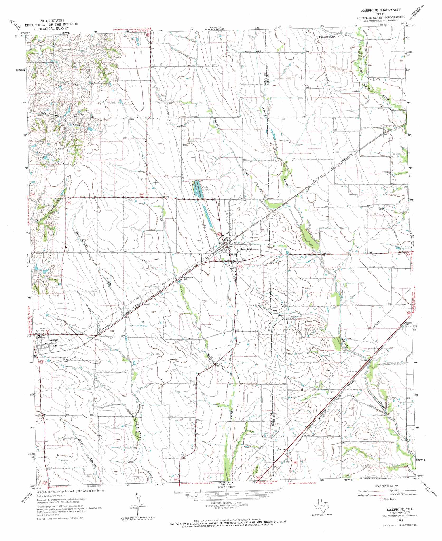
USGS Topo Quad 33096a3 - 1:24,000 scale
| Topo Map Name: | Josephine |
| USGS Topo Quad ID: | 33096a3 |
| Print Size: | ca. 21 1/4" wide x 27" high |
| Southeast Coordinates: | 33° N latitude / 96.25° W longitude |
| Map Center Coordinates: | 33.0625° N latitude / 96.3125° W longitude |
| U.S. State: | TX |
| Filename: | o33096a3.jpg |
| Download Map JPG Image: | Josephine topo map 1:24,000 scale |
| Map Type: | Topographic |
| Topo Series: | 7.5´ |
| Map Scale: | 1:24,000 |
| Source of Map Images: | United States Geological Survey (USGS) |
| Alternate Map Versions: |
Josephine TX 1963, updated 1965 Download PDF Buy paper map Josephine TX 1963, updated 1985 Download PDF Buy paper map Josephine TX 2010 Download PDF Buy paper map Josephine TX 2013 Download PDF Buy paper map Josephine TX 2016 Download PDF Buy paper map |
1:24,000 Topo Quads surrounding Josephine
Anna |
Blue Ridge |
Pike |
Celeste |
Wolfe City |
Mckinney East |
Culleoka |
Farmersville |
Greenville Nw |
Greenville Ne |
Wylie |
Lavon |
Josephine |
Greenville Sw |
Greenville Se |
Rowlett |
Rockwall |
Royse City |
Quinlan |
West Tawakoni |
Mesquite |
Forney North |
Terrell North |
Poetry |
Ables Springs |
> Back to 33096a1 at 1:100,000 scale
> Back to 33096a1 at 1:250,000 scale
> Back to U.S. Topo Maps home
Josephine topo map: Gazetteer
Josephine: Dams
Soil Conservation Service Site 85a Dam elevation 167m 547′Soil Conservation Service Site 85b Dam elevation 174m 570′
Josephine: Populated Places
Burrow elevation 178m 583′Josephine elevation 177m 580′
Nevada elevation 196m 643′
Pleasant Valley elevation 174m 570′
Josephine: Reservoirs
Cooks Lake elevation 183m 600′Soil Conservation Service Site 85a Reservoir elevation 167m 547′
Soil Conservation Service Site 85b Reservoir elevation 174m 570′
Josephine: Streams
Cowskin Creek elevation 162m 531′Payne Creek elevation 152m 498′
Josephine digital topo map on disk
Buy this Josephine topo map showing relief, roads, GPS coordinates and other geographical features, as a high-resolution digital map file on DVD: