Greenville Nw Topo Map Texas
To zoom in, hover over the map of Greenville Nw
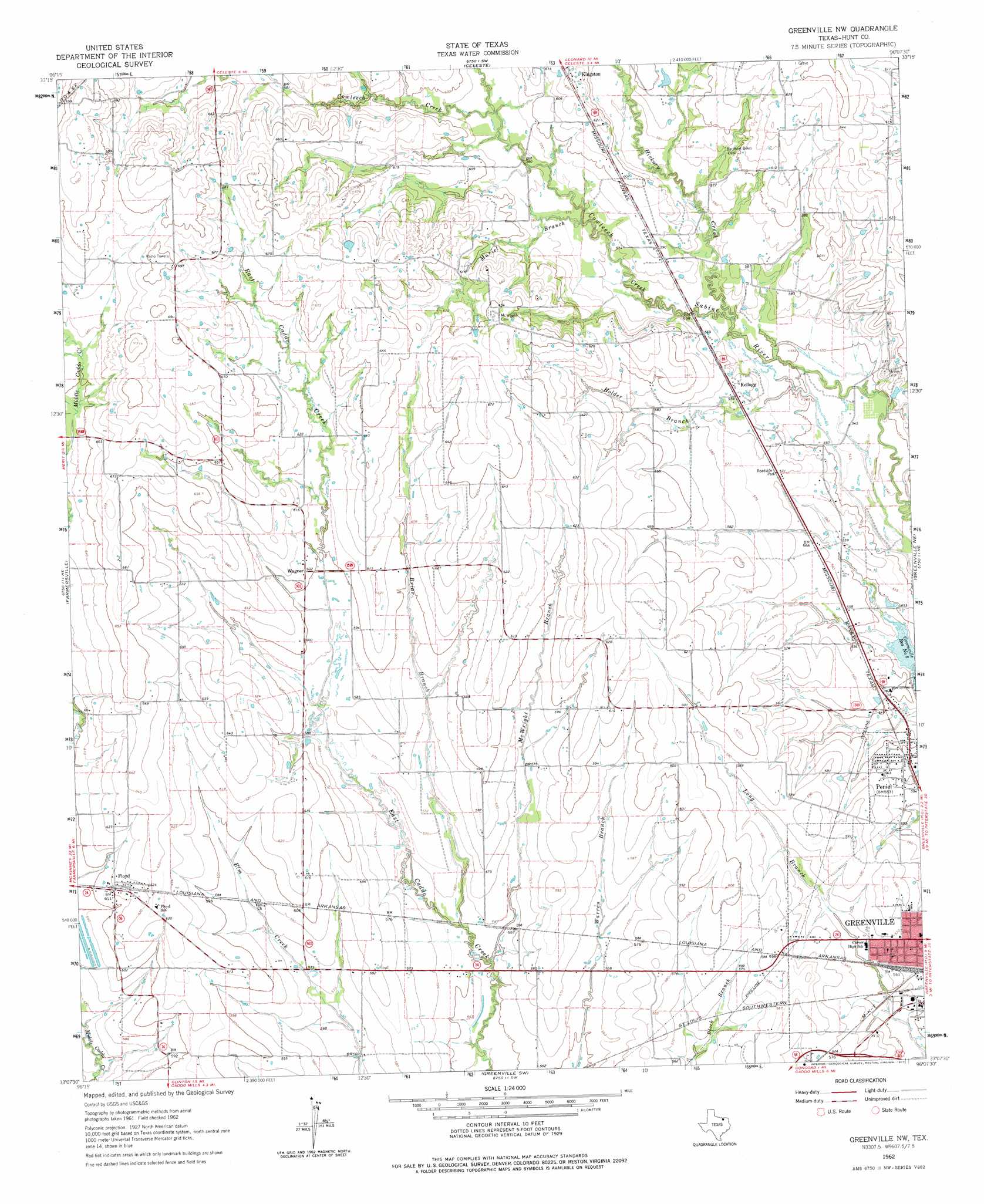
USGS Topo Quad 33096b2 - 1:24,000 scale
| Topo Map Name: | Greenville Nw |
| USGS Topo Quad ID: | 33096b2 |
| Print Size: | ca. 21 1/4" wide x 27" high |
| Southeast Coordinates: | 33.125° N latitude / 96.125° W longitude |
| Map Center Coordinates: | 33.1875° N latitude / 96.1875° W longitude |
| U.S. State: | TX |
| Filename: | o33096b2.jpg |
| Download Map JPG Image: | Greenville Nw topo map 1:24,000 scale |
| Map Type: | Topographic |
| Topo Series: | 7.5´ |
| Map Scale: | 1:24,000 |
| Source of Map Images: | United States Geological Survey (USGS) |
| Alternate Map Versions: |
Greenville NW TX 1962, updated 1964 Download PDF Buy paper map Greenville NW TX 1962, updated 1977 Download PDF Buy paper map Greenville NW TX 2010 Download PDF Buy paper map Greenville NW TX 2013 Download PDF Buy paper map Greenville NW TX 2016 Download PDF Buy paper map |
1:24,000 Topo Quads surrounding Greenville Nw
Pilot Grove |
Trenton |
Leonard |
Gober |
Ladonia |
Blue Ridge |
Pike |
Celeste |
Wolfe City |
Commerce North |
Culleoka |
Farmersville |
Greenville Nw |
Greenville Ne |
Commerce South |
Lavon |
Josephine |
Greenville Sw |
Greenville Se |
Lone Oak North |
Rockwall |
Royse City |
Quinlan |
West Tawakoni |
Lone Oak South |
> Back to 33096a1 at 1:100,000 scale
> Back to 33096a1 at 1:250,000 scale
> Back to U.S. Topo Maps home
Greenville Nw topo map: Gazetteer
Greenville Nw: Airports
Flyers Field elevation 192m 629′Greenville Nw: Parks
Carver Park elevation 170m 557′Greenville Nw: Populated Places
Floyd elevation 186m 610′Kellogg elevation 176m 577′
Peniel elevation 168m 551′
Wagner elevation 184m 603′
Greenville Nw: Streams
Briar Branch elevation 168m 551′Cowleech Creek elevation 177m 580′
Hickory Creek elevation 168m 551′
Holder Branch elevation 168m 551′
McWright Branch elevation 165m 541′
Muriel Branch elevation 173m 567′
Greenville Nw digital topo map on disk
Buy this Greenville Nw topo map showing relief, roads, GPS coordinates and other geographical features, as a high-resolution digital map file on DVD: