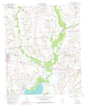
Culleoka Topo Map Texas
To zoom in, hover over the map of Culleoka
USGS Topo Quad 33096b4 - 1:24,000 scale
| Topo Map Name: | Culleoka |
| USGS Topo Quad ID: | 33096b4 |
| Print Size: | ca. 21 1/4" wide x 27" high |
| Southeast Coordinates: | 33.125° N latitude / 96.375° W longitude |
| Map Center Coordinates: | 33.1875° N latitude / 96.4375° W longitude |
| U.S. State: | TX |
| Filename: | o33096b4.jpg |
| Download Map JPG Image: | Culleoka topo map 1:24,000 scale |
| Map Type: | Topographic |
| Topo Series: | 7.5´ |
| Map Scale: | 1:24,000 |
| Source of Map Images: | United States Geological Survey (USGS) |
| Alternate Map Versions: |
Culleoka TX 1960, updated 1962 Download PDF Buy paper map Culleoka TX 1960, updated 1969 Download PDF Buy paper map Culleoka TX 1960, updated 1977 Download PDF Buy paper map Culleoka TX 2010 Download PDF Buy paper map Culleoka TX 2013 Download PDF Buy paper map Culleoka TX 2016 Download PDF Buy paper map |
1:24,000 Topo Quads surrounding Culleoka
> Back to 33096a1 at 1:100,000 scale
> Back to 33096a1 at 1:250,000 scale
> Back to U.S. Topo Maps home
Culleoka topo map: Gazetteer
Culleoka: Airports
Delta-B Ranch Heliport elevation 164m 538′JSI Airport elevation 179m 587′
Pecks Heliport elevation 172m 564′
Culleoka: Dams
Lewis Lake Dam elevation 168m 551′Pierce Pond Dam elevation 166m 544′
Texas No Name Number 26 Dam elevation 150m 492′
Culleoka: Parks
Blue Ridge Park elevation 155m 508′Caddo Park elevation 152m 498′
Elm Creek Park elevation 161m 528′
Panther Stadium elevation 180m 590′
Twin Groves Park elevation 160m 524′
Culleoka: Populated Places
Altoga elevation 169m 554′Climax elevation 169m 554′
Culleoka elevation 168m 551′
Princeton elevation 175m 574′
Culleoka: Reservoirs
Lewis Lake elevation 168m 551′Pierce Pond elevation 166m 544′
Culleoka: Streams
Greenbrier Branch elevation 146m 479′Groves Creek elevation 149m 488′
Harrington Branch elevation 146m 479′
Indian Creek elevation 153m 501′
Lee Creek elevation 147m 482′
Lick Branch elevation 160m 524′
Pilot Grove Creek elevation 145m 475′
Pot Rack Creek elevation 152m 498′
Rush Branch elevation 159m 521′
Sister Grove Creek elevation 145m 475′
Stiff Creek elevation 156m 511′
Culleoka: Summits
Hays Hills elevation 180m 590′Culleoka: Trails
Sister Grove Park Trail elevation 165m 541′Culleoka digital topo map on disk
Buy this Culleoka topo map showing relief, roads, GPS coordinates and other geographical features, as a high-resolution digital map file on DVD:


