Frisco Topo Map Texas
To zoom in, hover over the map of Frisco
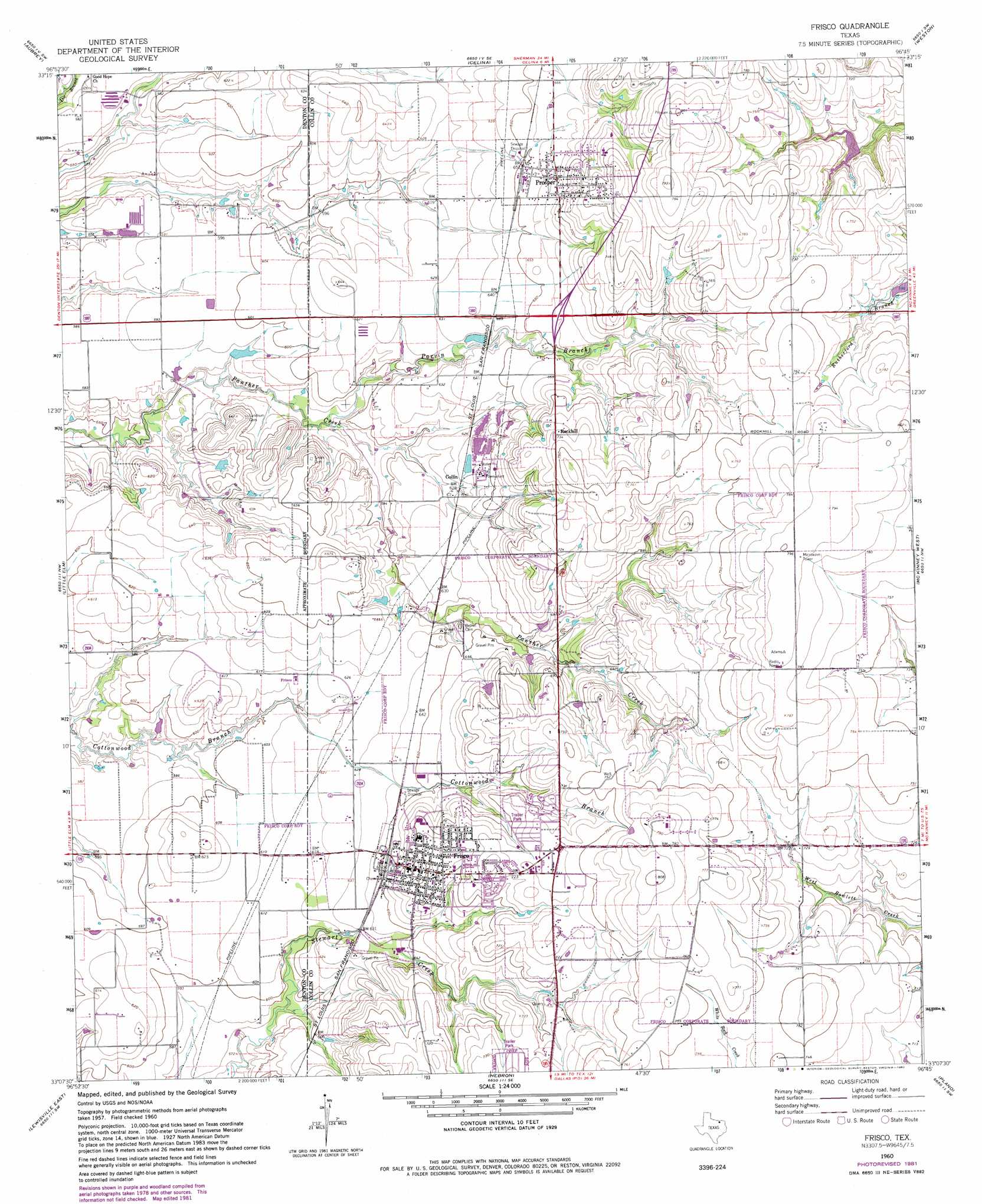
USGS Topo Quad 33096b7 - 1:24,000 scale
| Topo Map Name: | Frisco |
| USGS Topo Quad ID: | 33096b7 |
| Print Size: | ca. 21 1/4" wide x 27" high |
| Southeast Coordinates: | 33.125° N latitude / 96.75° W longitude |
| Map Center Coordinates: | 33.1875° N latitude / 96.8125° W longitude |
| U.S. State: | TX |
| Filename: | o33096b7.jpg |
| Download Map JPG Image: | Frisco topo map 1:24,000 scale |
| Map Type: | Topographic |
| Topo Series: | 7.5´ |
| Map Scale: | 1:24,000 |
| Source of Map Images: | United States Geological Survey (USGS) |
| Alternate Map Versions: |
Frisco TX 1960, updated 1961 Download PDF Buy paper map Frisco TX 1960, updated 1968 Download PDF Buy paper map Frisco TX 1960, updated 1973 Download PDF Buy paper map Frisco TX 1960, updated 1982 Download PDF Buy paper map Frisco TX 1960, updated 1982 Download PDF Buy paper map Frisco TX 1969, updated 1969 Download PDF Buy paper map Frisco TX 2010 Download PDF Buy paper map Frisco TX 2013 Download PDF Buy paper map Frisco TX 2016 Download PDF Buy paper map |
1:24,000 Topo Quads surrounding Frisco
Mountain Springs |
Pilot Point |
Marilee |
Gunter |
Van Alstyne |
Green Valley |
Aubrey |
Celina |
Weston |
Anna |
Denton East |
Little Elm |
Frisco |
Mckinney West |
Mckinney East |
Lewisville West |
Lewisville East |
Hebron |
Plano |
Wylie |
Grapevine |
Carrollton |
Addison |
Garland |
Rowlett |
> Back to 33096a1 at 1:100,000 scale
> Back to 33096a1 at 1:250,000 scale
> Back to U.S. Topo Maps home
Frisco topo map: Gazetteer
Frisco: Airports
Drewery Airport elevation 238m 780′Frisco: Dams
Anderson Lake Dam elevation 216m 708′Box Lake Dam elevation 229m 751′
Caldwell Dam elevation 190m 623′
Soil Conservation Service Site 1c Dam elevation 204m 669′
T P and L Dam elevation 192m 629′
Vial Lake Dam elevation 207m 679′
Frisco: Parks
EDS Superdrome elevation 232m 761′Frisco Independent School District Stadium elevation 207m 679′
Frisco: Populated Places
Collin elevation 192m 629′Frisco elevation 212m 695′
Prosper elevation 208m 682′
Rockhill elevation 224m 734′
Frisco: Reservoirs
Anderson Lake elevation 216m 708′Box Lake elevation 229m 751′
Caldwell Lake elevation 190m 623′
Soil Conservation Service Site 1c Reservoir elevation 204m 669′
T P and L Lake elevation 192m 629′
Vial Lake elevation 207m 679′
Frisco: Streams
Parvin Branch elevation 175m 574′Frisco digital topo map on disk
Buy this Frisco topo map showing relief, roads, GPS coordinates and other geographical features, as a high-resolution digital map file on DVD: