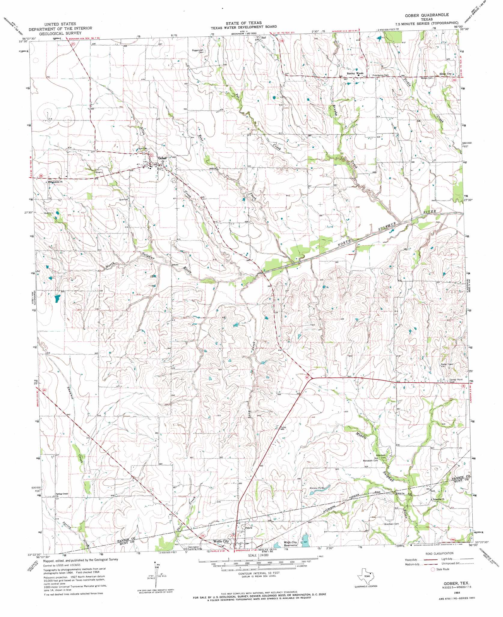
Gober Topo Map Texas
To zoom in, hover over the map of Gober
USGS Topo Quad 33096d1 - 1:24,000 scale
| Topo Map Name: | Gober |
| USGS Topo Quad ID: | 33096d1 |
| Print Size: | ca. 21 1/4" wide x 27" high |
| Southeast Coordinates: | 33.375° N latitude / 96° W longitude |
| Map Center Coordinates: | 33.4375° N latitude / 96.0625° W longitude |
| U.S. State: | TX |
| Filename: | o33096d1.jpg |
| Download Map JPG Image: | Gober topo map 1:24,000 scale |
| Map Type: | Topographic |
| Topo Series: | 7.5´ |
| Map Scale: | 1:24,000 |
| Source of Map Images: | United States Geological Survey (USGS) |
| Alternate Map Versions: |
Gober TX 1964, updated 1968 Download PDF Buy paper map Gober TX 2010 Download PDF Buy paper map Gober TX 2013 Download PDF Buy paper map Gober TX 2016 Download PDF Buy paper map |
| FStopo: | US Forest Service topo Gober is available: Download FStopo PDF Download FStopo TIF |
1:24,000 Topo Quads surrounding Gober
Mulberry |
Lake Bonham |
Lamasco |
Selfs |
Tigertown |
Ector |
Bonham |
Dodd City |
Honey Grove |
Petty |
Trenton |
Leonard |
Gober |
Ladonia |
Pecan Gap |
Pike |
Celeste |
Wolfe City |
Commerce North |
Klondike |
Farmersville |
Greenville Nw |
Greenville Ne |
Commerce South |
Cumby |
> Back to 33096a1 at 1:100,000 scale
> Back to 33096a1 at 1:250,000 scale
> Back to U.S. Topo Maps home
Gober topo map: Gazetteer
Gober: Lakes
Minnow Ponds elevation 201m 659′Gober: Populated Places
Bartley Woods elevation 193m 633′Gober elevation 198m 649′
Gober: Streams
Allen Creek elevation 169m 554′Bear Creek elevation 164m 538′
Brushy Creek elevation 164m 538′
Long Creek elevation 168m 551′
Pot Creek elevation 167m 547′
Shawnee Creek elevation 184m 603′
Gober digital topo map on disk
Buy this Gober topo map showing relief, roads, GPS coordinates and other geographical features, as a high-resolution digital map file on DVD: