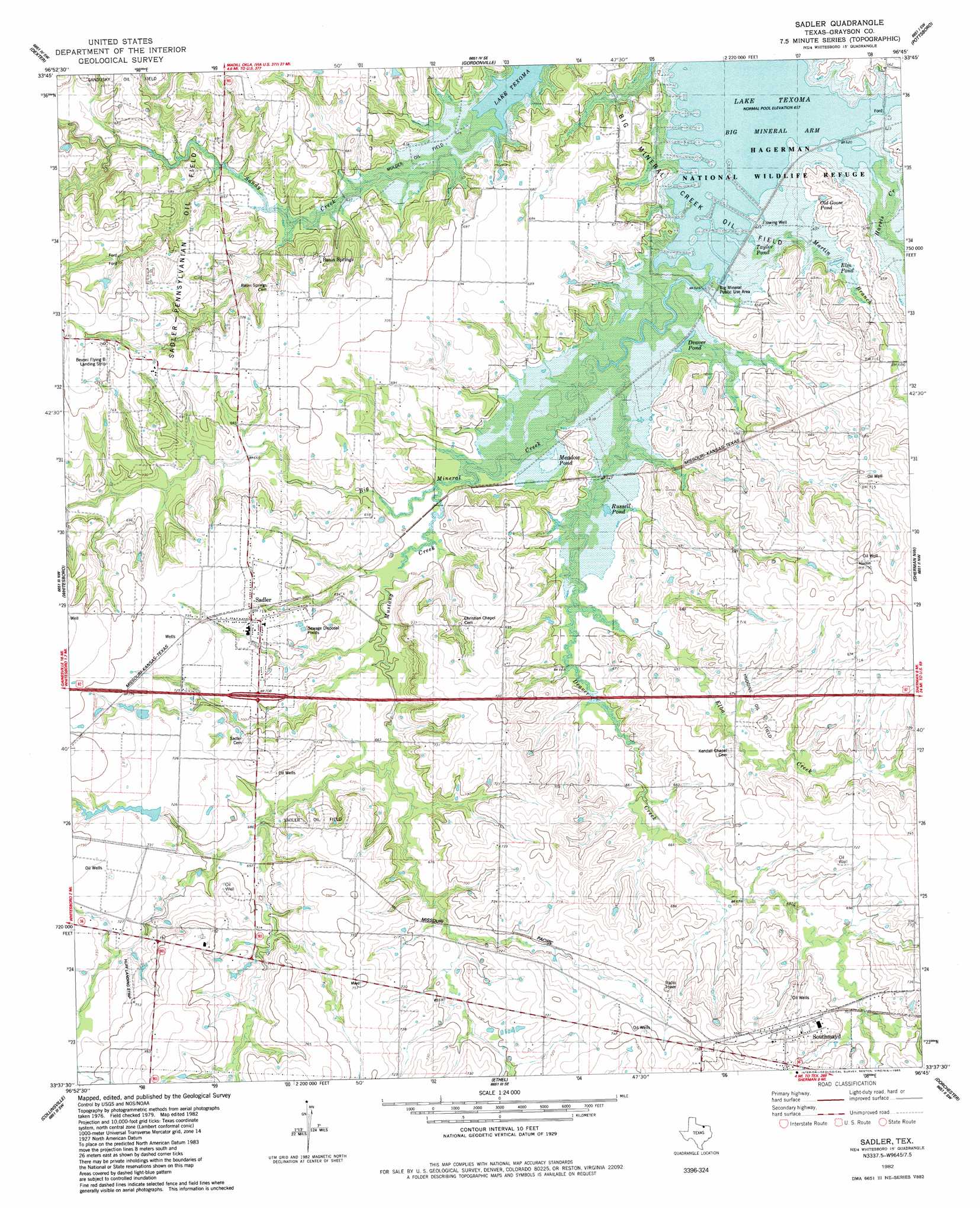
Sadler Topo Map Texas
To zoom in, hover over the map of Sadler
USGS Topo Quad 33096f7 - 1:24,000 scale
| Topo Map Name: | Sadler |
| USGS Topo Quad ID: | 33096f7 |
| Print Size: | ca. 21 1/4" wide x 27" high |
| Southeast Coordinates: | 33.625° N latitude / 96.75° W longitude |
| Map Center Coordinates: | 33.6875° N latitude / 96.8125° W longitude |
| U.S. State: | TX |
| Filename: | o33096f7.jpg |
| Download Map JPG Image: | Sadler topo map 1:24,000 scale |
| Map Type: | Topographic |
| Topo Series: | 7.5´ |
| Map Scale: | 1:24,000 |
| Source of Map Images: | United States Geological Survey (USGS) |
| Alternate Map Versions: |
Sadler TX 1982, updated 1983 Download PDF Buy paper map Sadler TX 2010 Download PDF Buy paper map Sadler TX 2013 Download PDF Buy paper map Sadler TX 2016 Download PDF Buy paper map |
1:24,000 Topo Quads surrounding Sadler
Marietta East |
Lebanon |
Shay |
Kingston South |
Platter |
Horseshoe Bend |
Dexter |
Gordonville |
Pottsboro |
Denison Dam |
Callisburg |
Whitesboro |
Sadler |
Sherman Nw |
Sherman |
Woodbine |
Collinsville |
Ethel |
Dorchester |
Howe |
Mountain Springs |
Pilot Point |
Marilee |
Gunter |
Van Alstyne |
> Back to 33096e1 at 1:100,000 scale
> Back to 33096a1 at 1:250,000 scale
> Back to U.S. Topo Maps home
Sadler topo map: Gazetteer
Sadler: Airports
Bevoni-Flying B Airport elevation 227m 744′Graham Field elevation 208m 682′
Sadler: Dams
J P Huff Dam elevation 220m 721′Sadler: Lakes
Deaver Pond elevation 192m 629′Elm Pond elevation 194m 636′
Meadow Pond elevation 194m 636′
Old Goose Pond elevation 197m 646′
Russell Pond elevation 193m 633′
Taylor Pond elevation 188m 616′
Sadler: Oilfields
Hudgins Oil Field elevation 209m 685′Mulder Oil Field elevation 192m 629′
Saddler Oil Field elevation 221m 725′
Sadler-Moulder Mineral Oil Field elevation 213m 698′
Sadler: Parks
Big Mineral Public Use Area elevation 195m 639′Hagerman National Wildlife Refuge elevation 190m 623′
Sadler: Populated Places
Basin Springs elevation 215m 705′Gage elevation 221m 725′
Hanger elevation 207m 679′
Mayd elevation 210m 688′
Sadler elevation 219m 718′
Southmayd elevation 224m 734′
Steedham elevation 211m 692′
Thorne elevation 226m 741′
Sadler: Reservoirs
Huff Lake elevation 220m 721′Sadler: Streams
Big Mineral Creek elevation 189m 620′Deaver Creek elevation 189m 620′
Elba Creek elevation 195m 639′
Harris Creek elevation 188m 616′
Martin Branch elevation 189m 620′
Mustang Creek elevation 195m 639′
Sadler digital topo map on disk
Buy this Sadler topo map showing relief, roads, GPS coordinates and other geographical features, as a high-resolution digital map file on DVD: