Whitesboro Topo Map Texas
To zoom in, hover over the map of Whitesboro
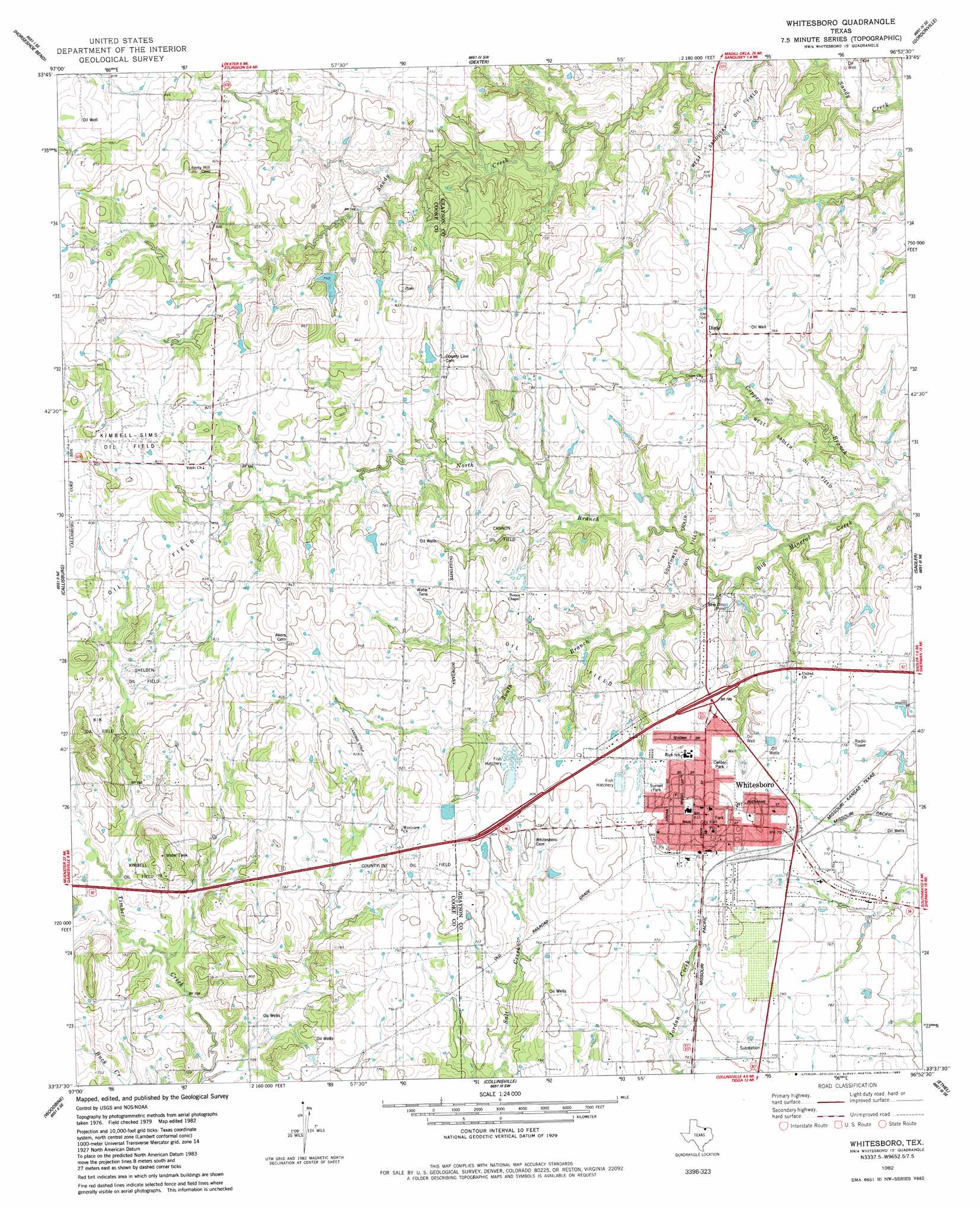
USGS Topo Quad 33096f8 - 1:24,000 scale
| Topo Map Name: | Whitesboro |
| USGS Topo Quad ID: | 33096f8 |
| Print Size: | ca. 21 1/4" wide x 27" high |
| Southeast Coordinates: | 33.625° N latitude / 96.875° W longitude |
| Map Center Coordinates: | 33.6875° N latitude / 96.9375° W longitude |
| U.S. State: | TX |
| Filename: | o33096f8.jpg |
| Download Map JPG Image: | Whitesboro topo map 1:24,000 scale |
| Map Type: | Topographic |
| Topo Series: | 7.5´ |
| Map Scale: | 1:24,000 |
| Source of Map Images: | United States Geological Survey (USGS) |
| Alternate Map Versions: |
Whitesboro TX 1982, updated 1983 Download PDF Buy paper map Whitesboro TX 2010 Download PDF Buy paper map Whitesboro TX 2013 Download PDF Buy paper map Whitesboro TX 2016 Download PDF Buy paper map |
1:24,000 Topo Quads surrounding Whitesboro
Marietta West |
Marietta East |
Lebanon |
Shay |
Kingston South |
Thackerville |
Horseshoe Bend |
Dexter |
Gordonville |
Pottsboro |
Gainesville North |
Callisburg |
Whitesboro |
Sadler |
Sherman Nw |
Gainesville South |
Woodbine |
Collinsville |
Ethel |
Dorchester |
Valley View |
Mountain Springs |
Pilot Point |
Marilee |
Gunter |
> Back to 33096e1 at 1:100,000 scale
> Back to 33096a1 at 1:250,000 scale
> Back to U.S. Topo Maps home
Whitesboro topo map: Gazetteer
Whitesboro: Dams
Bing Lake Dam elevation 248m 813′Harville Lake Dam elevation 233m 764′
Whitesboro: Oilfields
Cannon Oil Field elevation 234m 767′Kimbell - Sims Oil Field elevation 253m 830′
Kimbell Oil Field elevation 229m 751′
K-K Oil Field elevation 240m 787′
Shelden Oil Field elevation 236m 774′
Southwest Sadler Oil Field elevation 226m 741′
West Sadler Oil Field elevation 226m 741′
West Sandusky Oil Field elevation 225m 738′
Whitesboro Oil Field elevation 226m 741′
Whitesboro: Populated Places
Balm elevation 253m 830′Dixie elevation 232m 761′
Theodore elevation 230m 754′
Whitesboro elevation 250m 820′
Whitesboro: Reservoirs
Bing Lake elevation 248m 813′Harville Lake elevation 233m 764′
Whitesboro: Streams
Copper Branch elevation 207m 679′North Branch Big Mineral Creek elevation 210m 688′
South Branch Big Mineral Creek elevation 210m 688′
Whitesboro digital topo map on disk
Buy this Whitesboro topo map showing relief, roads, GPS coordinates and other geographical features, as a high-resolution digital map file on DVD: