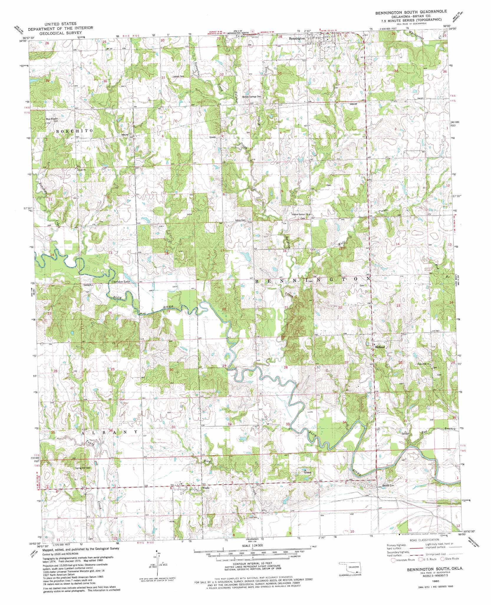
Bennington South Topo Map Oklahoma
To zoom in, hover over the map of Bennington South
USGS Topo Quad 33096h1 - 1:24,000 scale
| Topo Map Name: | Bennington South |
| USGS Topo Quad ID: | 33096h1 |
| Print Size: | ca. 21 1/4" wide x 27" high |
| Southeast Coordinates: | 33.875° N latitude / 96° W longitude |
| Map Center Coordinates: | 33.9375° N latitude / 96.0625° W longitude |
| U.S. State: | OK |
| Filename: | o33096h1.jpg |
| Download Map JPG Image: | Bennington South topo map 1:24,000 scale |
| Map Type: | Topographic |
| Topo Series: | 7.5´ |
| Map Scale: | 1:24,000 |
| Source of Map Images: | United States Geological Survey (USGS) |
| Alternate Map Versions: |
Bennington South OK 1980, updated 1981 Download PDF Buy paper map Bennington South OK 2009 Download PDF Buy paper map Bennington South OK 2012 Download PDF Buy paper map Bennington South OK 2016 Download PDF Buy paper map |
1:24,000 Topo Quads surrounding Bennington South
Caddo North |
Caney |
Bentley |
Boswell Nw |
Darwin |
Caddo South |
Bokchito |
Bennington North |
Boswell Sw |
Boswell |
Roberta |
Blue |
Bennington South |
Lake West |
New Oberlin |
Kemp |
Yuba |
Telephone |
Monkstown |
Direct |
Mulberry |
Lake Bonham |
Lamasco |
Selfs |
Tigertown |
> Back to 33096e1 at 1:100,000 scale
> Back to 33096a1 at 1:250,000 scale
> Back to U.S. Topo Maps home
Bennington South topo map: Gazetteer
Bennington South: Dams
Gregory Lake Dam elevation 170m 557′McIntire Lake Dam elevation 157m 515′
Page Lake Dam elevation 178m 583′
Bennington South: Lakes
Cherokee Lake elevation 146m 479′Bennington South: Populated Places
Smith-Lee elevation 151m 495′Wade elevation 161m 528′
Bennington South: Reservoirs
Gregory Lake elevation 170m 557′McIntire Lake elevation 157m 515′
Page Lake elevation 178m 583′
Bennington South: Streams
Bokchito Creek elevation 145m 475′McGee Creek elevation 156m 511′
Red Branch elevation 133m 436′
Sassafras Creek elevation 161m 528′
Sulphur Creek elevation 143m 469′
Wolf Creek elevation 146m 479′
Bennington South digital topo map on disk
Buy this Bennington South topo map showing relief, roads, GPS coordinates and other geographical features, as a high-resolution digital map file on DVD: