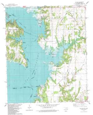
Platter Topo Map Oklahoma
To zoom in, hover over the map of Platter
USGS Topo Quad 33096h5 - 1:24,000 scale
| Topo Map Name: | Platter |
| USGS Topo Quad ID: | 33096h5 |
| Print Size: | ca. 21 1/4" wide x 27" high |
| Southeast Coordinates: | 33.875° N latitude / 96.5° W longitude |
| Map Center Coordinates: | 33.9375° N latitude / 96.5625° W longitude |
| U.S. States: | OK, TX |
| Filename: | o33096h5.jpg |
| Download Map JPG Image: | Platter topo map 1:24,000 scale |
| Map Type: | Topographic |
| Topo Series: | 7.5´ |
| Map Scale: | 1:24,000 |
| Source of Map Images: | United States Geological Survey (USGS) |
| Alternate Map Versions: |
Platter OK 1982, updated 1983 Download PDF Buy paper map Platter OK 2010 Download PDF Buy paper map Platter OK 2012 Download PDF Buy paper map Platter OK 2016 Download PDF Buy paper map |
1:24,000 Topo Quads surrounding Platter
> Back to 33096e1 at 1:100,000 scale
> Back to 33096a1 at 1:250,000 scale
> Back to U.S. Topo Maps home
Platter topo map: Gazetteer
Platter: Capes
Washita Point elevation 188m 616′Platter: Dams
Oknoname 013003 Dam elevation 216m 708′Oknoname 013012 Dam elevation 215m 705′
Platter: Parks
Alberta Creek Public Use Area elevation 197m 646′Johnson Creek Public Use Area elevation 198m 649′
Lakeside Public Use Area elevation 193m 633′
Platter Flats Public Use Area elevation 195m 639′
Sunset Camp Public Use Area elevation 193m 633′
Willafa Woods Public Use Area elevation 192m 629′
Willow Springs Public Use Area elevation 191m 626′
Platter: Populated Places
Lakeside elevation 201m 659′Mead elevation 234m 767′
Platter elevation 204m 669′
Sand Point elevation 199m 652′
Platter: Reservoirs
Oknoname 013003 Reservoir elevation 216m 708′Oknoname 013012 Reservoir elevation 215m 705′
Platter: Streams
Alberta Creek elevation 188m 616′Double Spring Branch elevation 198m 649′
Little Sand Creek elevation 179m 587′
Moore Creek elevation 197m 646′
Rock Creek elevation 190m 623′
Taylor Creek elevation 189m 620′
Teeter Creek elevation 191m 626′
Washita River elevation 188m 616′
Platter digital topo map on disk
Buy this Platter topo map showing relief, roads, GPS coordinates and other geographical features, as a high-resolution digital map file on DVD:


