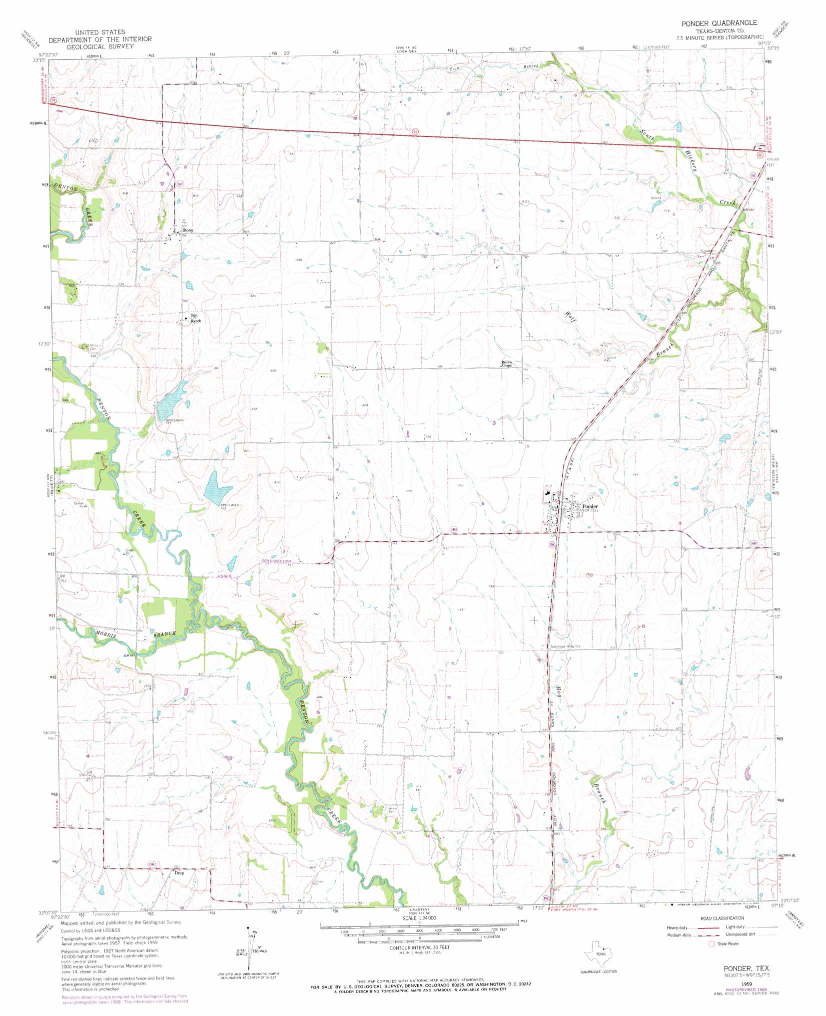
Ponder Topo Map Texas
To zoom in, hover over the map of Ponder
USGS Topo Quad 33097b3 - 1:24,000 scale
| Topo Map Name: | Ponder |
| USGS Topo Quad ID: | 33097b3 |
| Print Size: | ca. 21 1/4" wide x 27" high |
| Southeast Coordinates: | 33.125° N latitude / 97.25° W longitude |
| Map Center Coordinates: | 33.1875° N latitude / 97.3125° W longitude |
| U.S. State: | TX |
| Filename: | o33097b3.jpg |
| Download Map JPG Image: | Ponder topo map 1:24,000 scale |
| Map Type: | Topographic |
| Topo Series: | 7.5´ |
| Map Scale: | 1:24,000 |
| Source of Map Images: | United States Geological Survey (USGS) |
| Alternate Map Versions: |
Ponder TX 1959, updated 1961 Download PDF Buy paper map Ponder TX 1959, updated 1969 Download PDF Buy paper map Ponder TX 2010 Download PDF Buy paper map Ponder TX 2013 Download PDF Buy paper map Ponder TX 2016 Download PDF Buy paper map |
1:24,000 Topo Quads surrounding Ponder
New Harp |
Greenwood |
Era |
Valley View |
Mountain Springs |
Pecan Creek |
Slidell |
Era Se |
Sanger |
Green Valley |
Decatur |
Bluett |
Ponder |
Denton West |
Denton East |
Boyd |
Rhome |
Justin |
Argyle |
Lewisville West |
Azle |
Avondale |
Keller |
Colleyville |
Grapevine |
> Back to 33097a1 at 1:100,000 scale
> Back to 33096a1 at 1:250,000 scale
> Back to U.S. Topo Maps home
Ponder topo map: Gazetteer
Ponder: Airports
Clark Airport elevation 214m 702′Deussen Field elevation 237m 777′
Dew Drop Airport elevation 226m 741′
Drop Field elevation 224m 734′
Palmer Field elevation 240m 787′
Rodeo Airstrip elevation 239m 784′
Ponder: Dams
C Hobson Dunn Dam Number 1 elevation 221m 725′C Hobson Dunn Dam Number 2 elevation 215m 705′
Ponder: Populated Places
DISH elevation 211m 692′Drop elevation 231m 757′
Northlake elevation 210m 688′
Ponder elevation 223m 731′
Stony elevation 239m 784′
Ponder: Reservoirs
C Hobson Dunn Lake Number 1 elevation 221m 725′C Hobson Dunn Lake Number 2 elevation 215m 705′
Ponder: Streams
Crow Branch elevation 213m 698′Morris Branch elevation 200m 656′
Wolf Branch elevation 195m 639′
Ponder digital topo map on disk
Buy this Ponder topo map showing relief, roads, GPS coordinates and other geographical features, as a high-resolution digital map file on DVD: