Era Se Topo Map Texas
To zoom in, hover over the map of Era Se
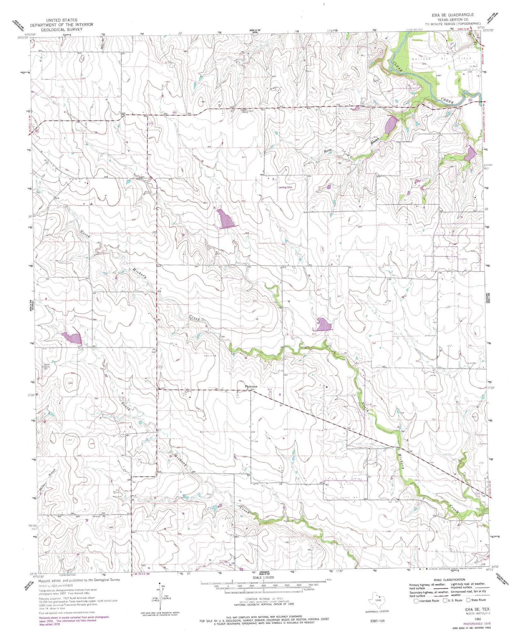
USGS Topo Quad 33097c3 - 1:24,000 scale
| Topo Map Name: | Era Se |
| USGS Topo Quad ID: | 33097c3 |
| Print Size: | ca. 21 1/4" wide x 27" high |
| Southeast Coordinates: | 33.25° N latitude / 97.25° W longitude |
| Map Center Coordinates: | 33.3125° N latitude / 97.3125° W longitude |
| U.S. State: | TX |
| Filename: | o33097c3.jpg |
| Download Map JPG Image: | Era Se topo map 1:24,000 scale |
| Map Type: | Topographic |
| Topo Series: | 7.5´ |
| Map Scale: | 1:24,000 |
| Source of Map Images: | United States Geological Survey (USGS) |
| Alternate Map Versions: |
Era SE TX 1961, updated 1963 Download PDF Buy paper map Era SE TX 1961, updated 1978 Download PDF Buy paper map Era SE TX 2010 Download PDF Buy paper map Era SE TX 2013 Download PDF Buy paper map Era SE TX 2016 Download PDF Buy paper map |
1:24,000 Topo Quads surrounding Era Se
Forestburg |
Freemound |
Hood |
Gainesville South |
Woodbine |
New Harp |
Greenwood |
Era |
Valley View |
Mountain Springs |
Pecan Creek |
Slidell |
Era Se |
Sanger |
Green Valley |
Decatur |
Bluett |
Ponder |
Denton West |
Denton East |
Boyd |
Rhome |
Justin |
Argyle |
Lewisville West |
> Back to 33097a1 at 1:100,000 scale
> Back to 33096a1 at 1:250,000 scale
> Back to U.S. Topo Maps home
Era Se topo map: Gazetteer
Era Se: Airports
Bird Dog Field elevation 273m 895′Glass Airport elevation 246m 807′
Haire Airport elevation 264m 866′
Era Se: Dams
Soil Conservation Service Site 2 Dam elevation 253m 830′Soil Conservation Service Site 4 Dam elevation 236m 774′
Soil Conservation Service Site 41 Dam elevation 223m 731′
Soil Conservation Service Site 42 Dam elevation 207m 679′
Soil Conservation Service Site 7 Dam elevation 268m 879′
Era Se: Populated Places
Plainview elevation 258m 846′Era Se: Reservoirs
Soil Conservation Service Site 2 Reservoir elevation 253m 830′Soil Conservation Service Site 4 Reservoir elevation 236m 774′
Soil Conservation Service Site 41 Reservoir elevation 223m 731′
Soil Conservation Service Site 42 Reservoir elevation 207m 679′
Soil Conservation Service Site 7 Reservoir elevation 268m 879′
Era Se: Streams
Boom Branch elevation 200m 656′Era Se digital topo map on disk
Buy this Era Se topo map showing relief, roads, GPS coordinates and other geographical features, as a high-resolution digital map file on DVD: